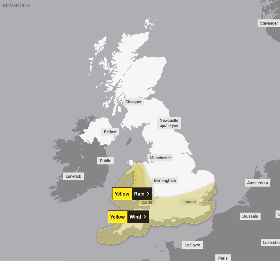
Yellow weather warnings for rain will continue into Tuesday after Storm Herminia caused disruption across large parts of England and Wales.
The Met Office predicted heavy blustery showers and thunderstorms as it issued three weather warnings across the south of England and Wales.
A rain warning covering southwest Wales and the West Midlands will continue until 9pm.
Follow our live blog for all the latest weather updates
These warnings were attributed to the latest low-pressure system - dubbed Storm Herminia by Spanish forecasters - which came hot on the heels of Storm Éowyn.
The Met Office said: “The system did not meet the criteria to be named by the Met Office’s storm naming group, which includes Met Eireann and KNMI.”
Nevertheless, Storm Herminia battered the UK. The forecaster recorded 84mph gusts of wind in the Isle of Wight, while 59.4mm of rainfall was recorded in Seathwaite, Cumbria.
Somerset declared a major incident on Monday morning after overnight flooding wreaked havoc in the region and more than 100 people were evacuated from their homes.
The yellow rain warning across Wales and the West Midlands predicts some places seeing as much as 40mm of rain on top of a widespread 20 to 30mm of rain expected, as well as isolated totals of 50 to 60mm through Tuesday before rain and showers begin to ease in the evening.
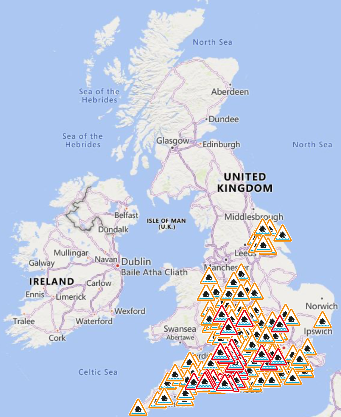
As of Tuesday morning, there were 37 flood warnings in place, mostly for the south-west of England, as well as 171 flood alerts.
Some places could see up to 80mm of rainfall over the period from two separate spells of heavy rain and thundery showers, while 10 to 20mm should fall quite widely and 30 to 50mm could fall over high ground, the Met Office said.
Flooding to homes and businesses could occur in the warning area, with power cuts and difficult driving conditions also possible. There is also a “small chance” of fast-flowing or deep floodwater causing danger to life, the Met Office said.
Meteorologist Marco Petagna said: “Things are going to stay unsettled in the next few days. We’re getting successive spells of wet and windy weather, which is obviously adding to impacts.
“While not as powerful as Storm Eowyn, a low-pressure system was named Storm Herminia by meteorologists in Spain which was expected to feel the strongest winds.”
Tuesday is forecast to see further heavy showers in the south with a risk of thunder. Longer spells of rain in the North West are expected to ease later.
The wet and windy weather will remain in the south on Wednesday, and more settled conditions will be present later in the week.