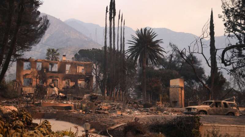
The disastrous fires in the Los Angeles area have now claimed at least 10 lives and damaged or destroyed 9,000 structures, according to local officials. With insured losses expected to exceed $20 billion, the wildfires are on track to be the most expensive on record.
Though many factors contributed to the devastation (such as fire hydrants without water, too few controlled burns, and insurance price controls), it was also exacerbated by land-use policies that pushed homes and residents away from the city center and closer to the wildland-urban interface (WUI). The U.S. Fire Administration defines the WUI as "the zone of transition between unoccupied land and human development…where structures…intermingle with undeveloped wildland or vegetative fuels."
The U.S. Forest Service's 2020 national assessment includes the Pacific Palisades, Altadena, and most of L.A. County abutting the surrounding hills in the WUI. In 2005, the Forest Service reported that California had 5.1 million housing units in the WUI—the most in the nation. The number of housing units in the WUI has only increased since, including 140,000 subsidized by the state.
State policymakers have been aware of the risk to these homes for decades. The University of California system received a grant from the Office of the State Fire Marshal in 1997 to "develop standard test protocols to evaluate the relative performance of exterior construction materials and assemblies" in the hopes of making homes fire-resistant. These standards have not prevented the incineration of buildings in the Palisades, Altadena, and other neighborhoods impacted by the inferno—with better land-use planning, they might not have been built in the first place.
The American Planning Association identifies these neighborhoods—the origin points of the present firestorm—as "Very High Fire Hazard" zones. The California Department of Forestry and Fire Protection's active fire map includes a five-year fire history, which identifies the 2020 Bobcat fire that scorched 115,997 acres of land northeast of the Eaton fire, which destroyed 169 structures and caused $100 million in damage. The 2018 Woolsey fire—which torched nearly 100,000 acres, caused $6 billion in damage and took three lives—burned just west of the Palisades.
Despite the recurring devastation of wildfires, the University of California, Berkeley's College of Natural Resources reports that "humans have developed into fire-prone wildland areas." The passive voice avoids assigning responsibility for this development to single-family zoning, city planners, and NIMBY lobbyists that have pushed people into these areas and made L.A. one of the least densely populated, most expensive, and most expansive cities in America.
Michael Manville, a professor of urban planning at the UCLA School of Public Affairs, tells Reason the sprawl of L.A. is in part a function of land use regulations and "the desire to have…the most in-demand kind of housing, which is a nice little family home with a backyard [and] you can't do that without expanding outward." Nearly 78 percent of residential land in L.A. is reserved for single-family housing, according to a study published by the Othering & Belonging Institute in 2022.
"Not in my backyard" (NIMBY) proponents have made it nearly impossible for L.A. residents to relocate from the flammable city outskirts toward the city center. Although it's possible to build a lot of houses on paper, "in practice, it's extremely difficult because the zoning capacity that we have is on land that's already developed," Manville explains. The solution is to "take these areas that are zoned for very low density and allow them to build four or five units." Unfortunately, single-family zoning makes doing so illegal, hampering L.A.'s ability to recover from the Palisades and Eaton fires.
The post Los Angeles Zoning Laws Pushed People and Homes Toward Fire-Prone Areas appeared first on Reason.com.


