Residents along the West Coast were left shaken when a 7.0 magnitude earthquake rattled the region last week, resulting in a tsunami warning and a scary couple of hours for more than 5 million people.
While the tsunami warning was canceled shortly after evacuations and transportation shut down, San Francisco forecasters said a small wave had been seen off the California coastline.
“A non-destructive tsunami wave was observed earlier today near Point Arena,” the Bay Area’s National Weather Service office wrote on social media. “This serves as a reminder that we do indeed have a fault capable of producing tsunamis in our vicinity. We don’t deal with this often, but when we do it pays to know your zones!”
The wave was just nine centimeters high and was measured around Arena Cove at 11:46 a.m. PST last Thursday. The cove is located in Mendocino County on the state’s northern shores. It’s a three-hour drive north to the Humboldt County city of Ferndale, which was closer to the earthquake’s center.
While the wave generated by this earthquake did not result in catastrophe, officials have warned people not to assume the next event will play out the same way.
“If you evacuated, you did the right thing. Tsunamis are rare, but can be extremely deadly,” the National Weather Service’s Bay Area office said in a post on social media. “For perspective, roughly 230,000 people lost their lives in the 2004 Indian Ocean Tsunami, the deadliest natural disaster of the 21st century.”
The earthquake was what’s known as a strike-slip, geologists said, meaning two of the Earth’s tectonic plates slid past each other. The Earth is made of these plates, and they’re in constant motion.
“These types of earthquakes are less likely to cause tsunami because their movement is primarily horizontal with minimal vertical movement of the ocean floor,” the US Geological Survey explained.
However, recent research from academics at the California Institute of Technology says strike-slip faults can generate large tsunamis.
“Strike slip faults are capable of generating powerful tsunamis, as we have seen only six years ago,” Dr. Ahmed Elbanna, associate professor of civil and environmental engineering at The University of Illinois Urbana Champaign and the work’s lead author, told The Independent.
“When earthquake faults slip, the surrounding Earth moves and deforms like the elastic in a waistband. This movement can cause the stress on nearby faults to either increase or decrease, making additional earthquakes more likely in some areas and less likely in others,” Dr. Jason R. Patton and Dr. Wendy Bohon, scientists at the California Geological Survey, told The Independent in an email. “If stresses on a nearby fault increase enough, it could trigger an earthquake. However, we cannot tell if this is going to happen until it does.”
In this case, an aftershock forecast indicates that there is a less than one percent chance of another magnitude 7.0 earthquake in the coming year. Scientists say that the likelihood of smaller events near the site of the 7.0 can be expected in the near term, but that experts do not indicate an expected increase in strike-slip activity elsewhere.
If large enough and close enough to the ocean floor, the energy from such an earthquake can cause the ocean floor to suddenly rise or fall, according to the US Geological Survey. As the ocean floor rises and falls, so does the ocean water above it. While earthquakes as large as 6.5 or below are very unlikely to trigger a tsunami and those between 6.5 and 7.5 do not usually produce destructive tsunamis, larger earthquakes could result in much worse outcomes.
Large tsunamis have occurred in the US and will again. A magnitude 9.2 earthquake in the Gulf of Alaska caused damage and loss of life along the West Coast in 1964. More than 150 tsunamis have slammed California’s shore since 1800. The 2011 tsunami that hit Japan also caused $100m in damage to the state’s ports and harbors.
The best way to be prepared is to be aware of the risk a tsunami might pose to the immediate environment. Interactive hazard maps made using computer modeling can show which areas are in critical zones.
In the future, there could still be improvements. The modeling that is the basis for tsunami alerts is determined using observations from floating buoys in the deep ocean. The California Geological Survey says putting more of these buoys in key locations could help.
“These buoys are exposed to rough conditions at sea, so having additional buoys in the ocean will help when some buoys are malfunctioning,” Patton and Bohon said.
Furthermore, research focused on using GPS to help with modeling the earthquakes that generate tsunamis could improve initial tsunami size estimates from the National Tsunami Warning Center, they said.
But, guidance on what to do during a tsunami threat has remained largely unchanged.
When the tsunami is about to strike, there are several signs to look out for. For example, the ocean could look like a wall of water or a rising flood. It could also suddenly drain, exposing fish and the ocean floor. A loud roaring sound may be emitted by the ocean. However, people may not see natural tsunami warnings and should be on the lookout for official tsunami warnings, like broadcasts, wireless emergency alerts, and messages from officials. Sirens may go off, indicating that an area is at risk, in those that have them.
For people in tsunami hazard and evacuation zones or low-lying coastal areas who feel a strong or long earthquake or see any natural warnings, a tsunami could arrive within just minutes. Weather officials recommend heading as high or as far inland as possible. Those who can should move to a safe place and not wait for official warnings or instructions. And, they should do it on foot because traveling by car could cause traffic that may prevent people from evacuating.
They should also avoid damage from earthquakes like fallen power lines and stay away from buildings, bridges, and piers. Heavy objects may fall from them during an aftershock. Residents should remain outside the tsunami hazard or evacuation zone until officials say it is safe to do so. The first wave may not be the last or the largest and the danger may last for hours or days.
Planning for an evacuation now could be life-saving in the future. Emergency plans should include evacuation routes and tsunami hazard zones. Plans should also include several identified places that are safe for people to get to, in case of logistical complications like road closures and damage. Those with children should find out their school’s evacuation plans. The National Weather Service advises people to practice walking evacuation routes, including at night and in bad weather.
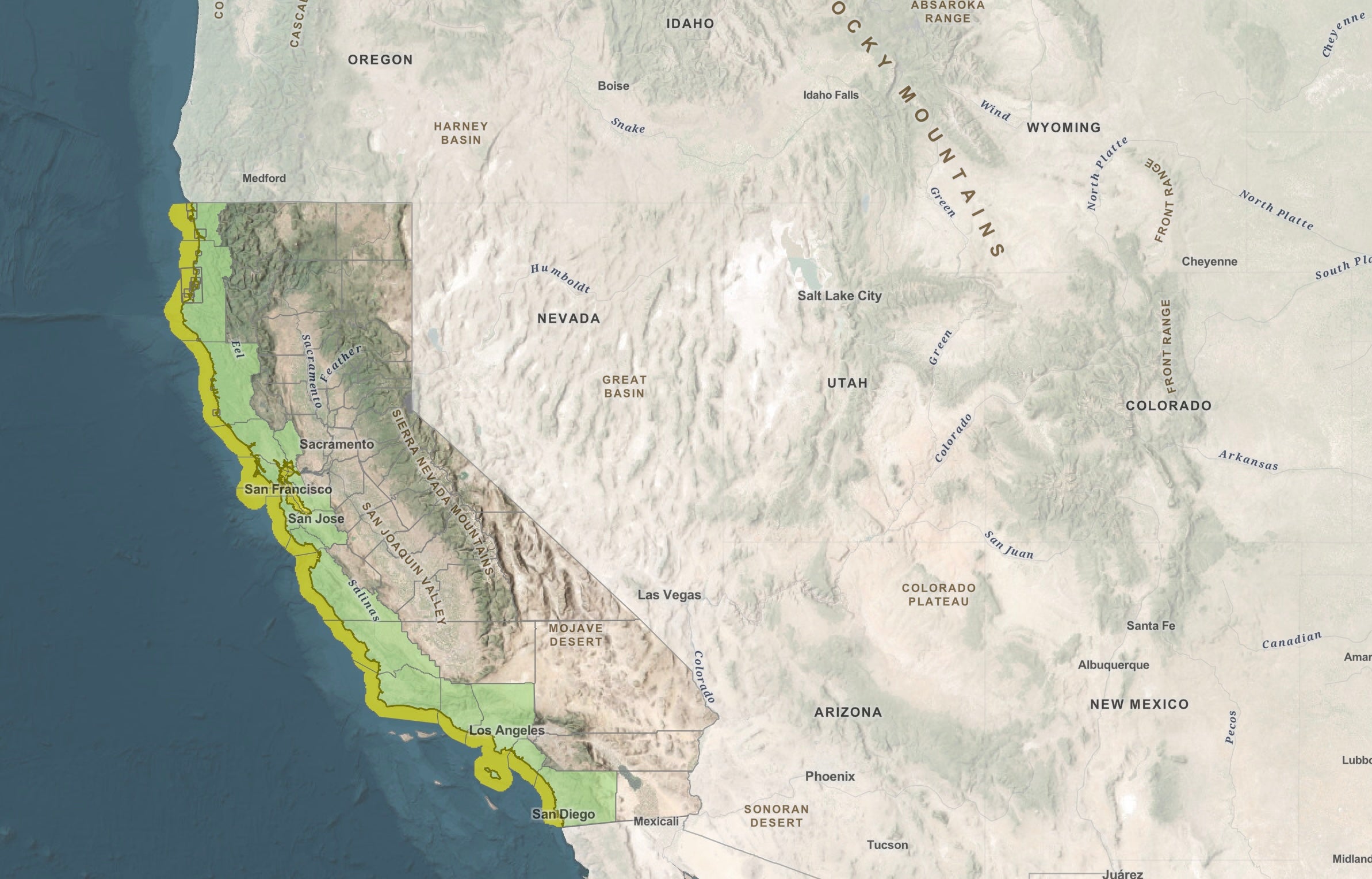
In California, tsunami hazard areas stretch from Crescent City to San Diego. The current maps are drawn with boundaries from the California Geological Survey. The hazard zones are highlighted in yellow. Recent changes have shown increases in central California’s Monterey and the state said sizeable areas of northern California’s Alameda County could be flooded up to an 18-foot elevation.
In San Francisco, a tsunami triggered by a large earthquake in Alaska would take approximately five hours to reach the city of over 800,000 residents, the 2021 maps showed.
“Where the coast is surrounded by steep cliffs, the inundation won’t extend as far inland as places that are more flat and low lying (like bays or river mouths). Also, places like the entrance to the San Francisco Bay can constrict tsunami flow, causing the tsunami to be smaller (in height and in the amount of land inundation),” Patton and Bohon said.
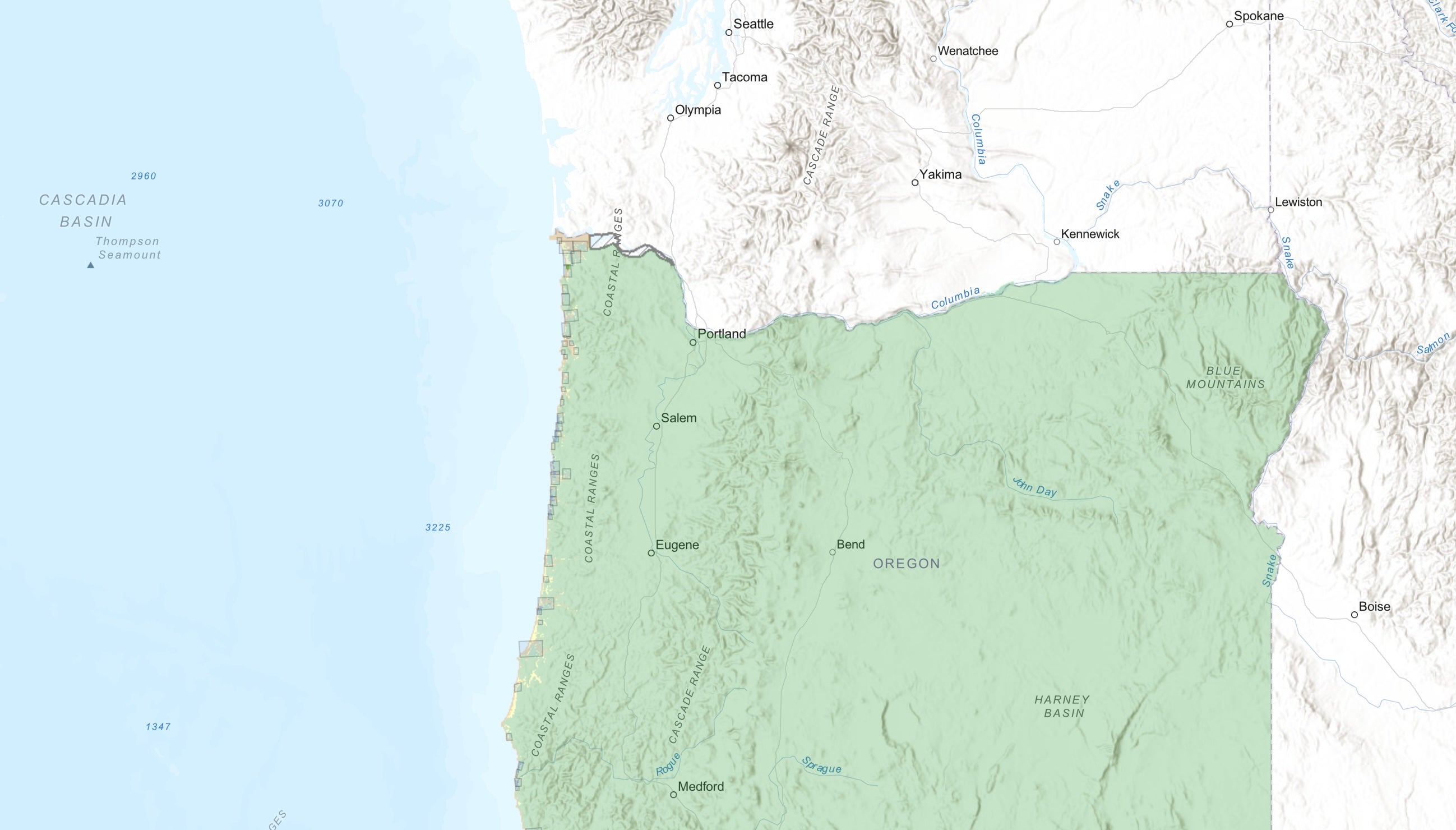
In neighboring Oregon, the map colors are different, demarcating distant tsunami evacuation zones from local zones. What’s shown in green is outside a hazard area.
Up the coast, Washington has hazard maps made for multiple tsunami scenarios. The metropolitan city of Seattle — home to more than 730,000 — is at risk in both a Seattle Fault earthquake scenario and a Cascadia magnitude 9.0 scenario. Simulations of that scenario show its destructive power throughout the Pacific and along the coast.
Most inland areas are safe, but just how safe depends on the magnitude of the earthquake and its results.
“Washington ranks as having the second highest earthquake risk in the US and correspondingly a significant tsunami risk as well,” Daniel Eungard, a tsunami hazards geologist with the Washington Geological Survey, said.
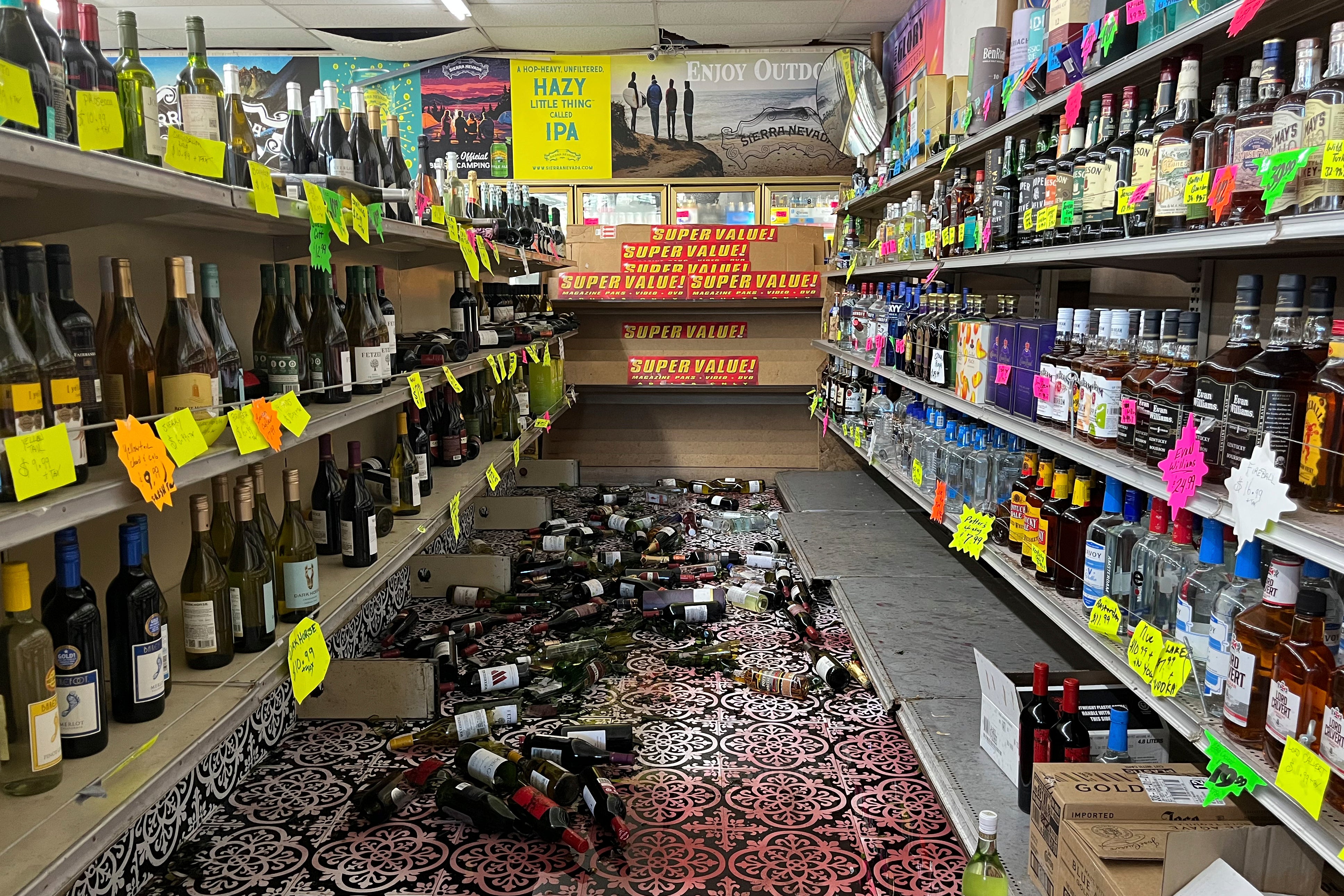
Thursday’s shaker occurred in what’s known as “earthquake country,” because three tectonic plates meet there. There have been just under 40 earthquakes of magnitude 6.0 or larger in the past century within 150 miles of Thursday’s earthquake, which was the most powerful to rattle the state since a 7.1-magnitude quake hit Ridgecrest in 2019.
With reporting from The Associated Press


