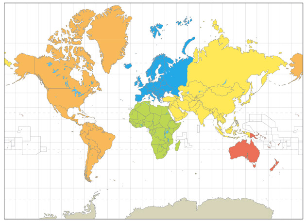
Mercator is used for navigation or maps of equatorial regions.
Any straight line between two points is a true line of constant direction, but not usually the shortest distance between the two points.
Distances are true only along the equator, but are reasonably correct within 15° either side.
Areas and shapes of large areas are distorted. Distortion increases away from the equator and is extreme in polar regions (Greenland appears larger than Africa but is actually 14 times smaller).
Parallels and meridians are straight lines which meet at right angles. Meridians are equally spaced but parallels are stretched towards the poles. Poles are not shown. Photograph: Graphic

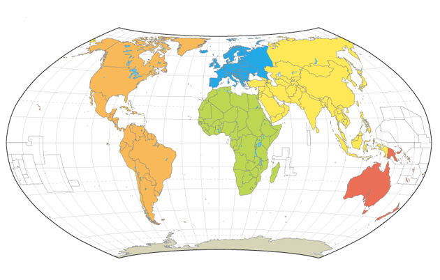
Hammer is an equal-area projection. The only point free of distortion is the centre point, though distortion of shape is moderate throughout.
Central meridian (pole-to-pole) is a straight line half the length of the equator. Other meridians are complex curves, equally spaced along the equator.
The equator is straight. Other parallels are complex curves, equally spaced along the central meridian, curving towards the poles which are normally shown as points but are missing in our version of the map. Photograph: Graphic

Goode is an interrupted, equal-area, composite projection composed of 12 regions that form six lobes, each the top section of a Mollweide projection, carefully grafted on to six interior regions along the equator.
Provides an effective alternative to portraying global area relationships on the Mercator map.
This projection was quite common in the 1960's, when it gained the nickname “the orange-peel map". Photograph: Graphic

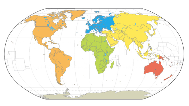
Robinson makes the world “look right”. Better balance of size and shape of high-latitude lands than in Mercator. Russia, Canada, and Greenland truer to size, but Greenland compressed.
Directions true along all parallels and along central meridian. Distances constant along the equator and other parallels, but scales vary. All points have some distortion but it is very low along the equator and within 45° of centre. Distortion greatest near the poles.
Not an equal-area projection.
Used in Goode's Atlas, adopted for National Geographic's world maps in 1988, appears in growing number of other publications, may replace Mercator in many classrooms. Photograph: Graphic

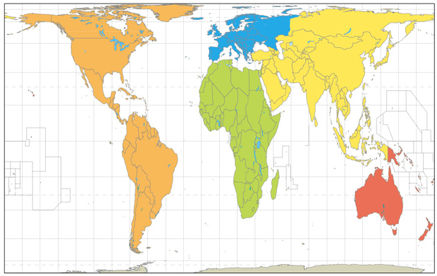
Peters is an equal-area projection which became the centrepiece of a controversy surrounding the political implications of map design. The argument goes something like this:
Mercator inflates the sizes of regions as they gain distance from the equator. Since much of the developing world lies near the equator, these countries appear smaller and less significant.
On Peters's projection, by contrast, areas of equal size on the globe are also equally sized on the map so poorer, less powerful nations could be restored to their rightful proportions. Photograph: Graphic


