The UK is set to be hit by a “weather bomb” later this week, bringing with it strong winds, heavy rain, and even some snow.
The Met Office has issued a yellow wind warning, cautioning that gusts could exceed 80mph, potentially leading to power cuts, travel disruption, and damage to buildings. Flying debris could also pose a danger to life.
The first half of the week will be relatively calm, with cloudy skies and occasional rain showers across much of the country. However, this calm is expected to be shattered by Thursday, as the “weather bomb” makes its presence felt.
A “weather bomb,” meteorologically known as explosive cyclogenesis, occurs when the central pressure within a low-pressure system drops rapidly over a 24-hour period. This rapid pressure drop creates a surge of violent winds, often strong enough to cause significant damage, including bringing down trees and causing structural damage.
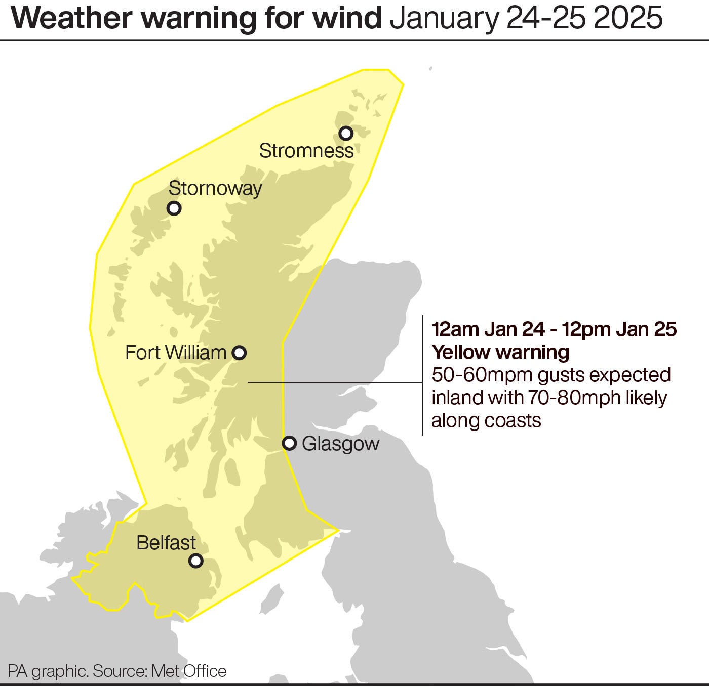
A yellow wind warning is in place from midnight on Friday to midday on Saturday and covers the whole of Northern Ireland and the western half of Scotland, including Glasgow.

Very strong south-easterly to south-westerly winds will see gusts reach 50 to 60mph inland and 70 to 80 mph along coastal areas.
Met Office deputy chief meteorologist Chris Almond said: “A very deep area of low pressure will bring a very unsettled, potentially disruptive, spell of weather to the UK through Friday and into Saturday.
“Winds will begin to strengthen on Thursday night with the peak gusts forecast through Friday in Northern Ireland and western Scotland. The wind will also be accompanied by heavy rain bringing some unpleasant conditions to end the week.
The weather looks set to turn more unsettled later this week 🌧️ 🌬️
— Met Office (@metoffice) January 20, 2025
Find out the details here ⬇️ pic.twitter.com/hVV2OS4NIf
“We have issued a yellow weather warning for wind, and with several days before the impactful weather, the forecast details are likely to be fine-tuned during the week, so stay tuned to your local forecast and keep up to date with Met Office warnings.”
The change to conditions is being caused by a powerful jet stream pushing the low pressure across the Atlantic and towards the UK, following a recent cold spell over North America, the Met Office said.
An initial front will bring heavy rain eastwards on Thursday, with 20 to 30mm of rainfall likely across North Wales and north-west England, while some hill snow is possible over the Scottish mountains.
The “weather bomb” will develop while still out over the Atlantic on Thursday and will be “a mature feature” when it arrives in over the UK on Friday, Mr Almond said.
The Met Office advised securing loose items outside the home, including bins, garden furniture, trampolines and sheds, and gathering torches and batteries in case of any potential power cut.
Another area of low pressure could bring further wet and windy conditions once the previous system has weakened on Sunday.
There is the potential for a named storm or further weather warnings over the weekend and throughout next week, the forecaster added.


