Firefighters battled to contain an out-of-control bushfire in Victoria’s west on Sunday before temperatures spike in the region on Boxing Day as rain continued to soak parts of Queensland.
The fire in Grampians national park, about three hours west of Melbourne, grew to 34,000 hectares on Sunday after it was ignited by a series of lightning strikes almost a week ago.
Residents were warned to leave immediately in Halls Gap, Bellfield, Flat Rock Crossing, Grampians Junction and Fyans Creek. The warning was downgraded to watch and act late on Sunday morning, but it remained unsafe for residents to return.
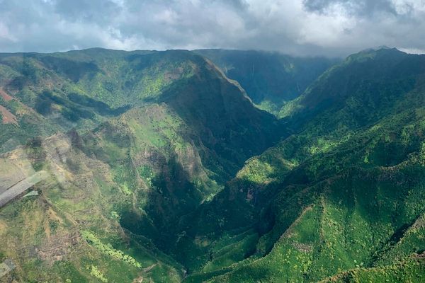
Emergency services said the fire could burn for weeks due to the dry terrain, which caused the fire to spread quickly, and the very little rain forecast for the Grampians national park – which was closed due to the blaze on Friday.
Victoria’s state response controller, Garry Cook, said on Saturday that firefighters were working to contain the fire ahead of increased fire risk on Boxing Day when a maximum of 39C is expected for the region.
“The terrain is also inaccessible to many of our crews on the ground so we’re doing our best to attack the fire from the air where safe to do so.
“We understand the disappointment for many with the closure of the Grampians national park but our number one priority is the protection of life.
“People in surrounding areas to the fire need to remain alert and ready to take action.”
Robyn Murphy, a Halls Gap resident who fled her home told ABC radio how the bushfire had interrupted her plans: “All the presents, all the yummy food in the fridge. All prepared to have a nice Christmas and now we’re out of home, so it’s sad.”
In Queensland, severe flooding continued to impact parts of the state’s north and far north with flood warnings remaining in place as a major highway began to reopen.
More than 340mm of flooding rain fell in six hours in some areas amid widespread falls of up to 100mm.
Flood waters trapped two people in their car in the Whitsundays, prompting a rescue operation south of Airlie Beach on the Bruce Highway late on Friday.
Critical sections of the major arterial road were closed throughout Saturday with the highway reopening around 10am on Sunday.
The deluge triggered a string of flood warnings that remained in place on Sunday morning, including for the Herbert River, the Haughton River catchment and the Don and Bohle rivers.
A flood warning was issued for the north tropical coast and parts of the central coast, which includes the Daintree, Mossman and Barron rivers.
The wet weather system began to make its way across the tropical coast offshore of the Whitsunday Islands on Saturday.
The Bureau of Meteorology said the trough would continue to move eastwards and further offshore over coming days but catchments across the flood watch area are wet from recent heavy rainfall and saturated in parts.
Sunday was forecast to bring isolated to scattered showers and the chance of a thunderstorm in northern and far northern Queensland, north of about Mackay to Hughenden.
Possible severe thunderstorms with a risk of heavy rainfall were forecast north of Ingham, while heavy rainfall with storms were also predicted north of Townsville and south of Weipa.
Thunderstorms were possible north of Ayr and in western and far southern Queensland.
The wet-weather system would not be as heavy as recent days, the BoM said.
On Sunday, a gale warning was in place for Great Barrier Reef offshore and a strong wind warning had been issued for the Townsville and Mackay coasts.


