The UK may have been basking in some lovely sunny spells over the weekend, but don’t get too comfortable—it looks like winter isn’t done with us just yet.
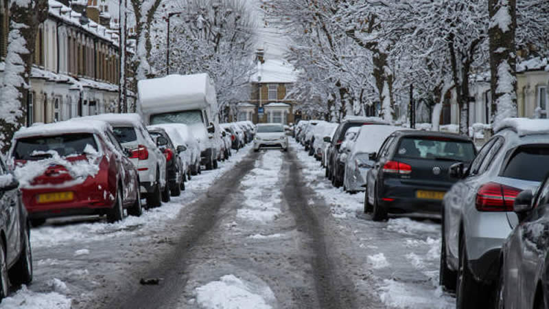
Fresh weather maps suggest that a significant snowfall is heading our way, with parts of the country bracing for freezing conditions in the coming weeks. According to WXCharts, the wintry blast is set to arrive around March 11, covering a huge stretch from Brighton on the south coast all the way up to Newcastle. Cities including London, Cambridge, Nottingham, and York are all in for a snowy surprise.
The charts indicate snowfall rates of up to 1cm per hour in these areas, while Scotland and Wales might see a dusting too—though not quite as heavy as in parts of England. And it won’t just be snow—expect rain to be in the mix as well, with places like Kent, Norfolk, and Newcastle seeing downpours of up to 1mm per hour, according to the Express. With temperatures set to drop below zero in many areas, it’s shaping up to be a bitterly cold spell.
The unsettled conditions are expected to drag on until at least March 13. By then, most of the country will be dealing with either snow, rain, or a miserable combination of both. Data from WXCharts suggests snow will be falling at around 1cm per hour across the Yorkshire Dales from midnight, while lighter flurries will be seen in the Scottish Highlands and the Cairngorms between Inverness and Edinburgh, as reported by the Mirror. If you’re in the northeast, you might just escape the worst of it—this seems to be the only region that could stay relatively dry.
So, what’s next? Well, according to the Met Office, the period from March 7 to March 16 is expected to start on a milder note, with some sunshine making things feel a bit warmer. However, it won’t last, with showers and longer spells of rain likely to sweep across the country, particularly in western areas. Looking beyond that, forecasters suggest high pressure might take hold briefly from the north, bringing drier weather but also a noticeable drop in temperatures—so don’t be surprised if there’s another cold snap.
Further into March, it’s all a bit uncertain, but the outlook points towards a mix of unsettled and settled weather, with temperatures leaning above average. That said, there’s still a chance of some colder spells before the month is out.
As for the immediate forecast, expect rain to hit northwest Scotland this evening, moving south towards Northern Ireland and northern England overnight. Elsewhere, clear skies will bring fog patches and widespread frost. Monday looks mixed—cloud and light rain for western Scotland, Northern Ireland, and northwest England, while the rest of the UK should enjoy a dry and bright day once the freezing fog lifts.
Looking ahead to midweek, it’s a tale of two halves—southern areas will stay mostly dry with sunshine by day and frost and fog at night, while the north will see more cloud, spells of rain, and strong winds. On the plus side, temperatures are expected to get a little milder.
So, keep those winter coats handy—you’re going to need them a bit longer!