Topline
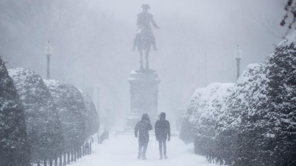
A powerful winter storm swept up the East Coast on Saturday, bringing snow from North Carolina to Maine—with a potentially record-breaking amount forecast for Massachusetts and Rhode Island—and snarling travel in the region, where about 55 million people were under winter weather alerts.
Key Facts
The storm left 7.5 inches of snow in New York City’s Central Park in the morning and early afternoon, and portions of the Jersey shore and Long Island were hit with 12 to 18 inches of snow, while in some areas of Massachusetts and Connecticut, a foot of snow had accumulated Saturday afternoon, with hours more snowfall expected, according to the National Weather Service.
Areas of Rhode Island, Massachusetts and Maine were forecast to receive up to 2 feet of snow overnight, according to the NWS, adding to blizzard warnings issued in the morning for the three states, along with Connecticut, New York and New Hampshire, which could lead to whiteout conditions.
The NWS forecasts areas of Massachusetts, including Boston, will receive 24 to 30 inches of snow, which could break the city’s 2003 record of 27.6 inches; Rhode Island is predicted to get 18 to 24 inches of snow, which could break Providence’s snowfall record of 18.3 inches; and Connecticut is forecast to get anywhere between 8 and 24 inches.
Boston Mayor Michelle Wu said on a local television interview Saturday morning the storm is “going to get quite ugly out there, because it’s coming down fast.”
Conditions have slowed or halted travel in many of the affected states: The Massachusetts Department of Transportation issued a highway ban for tractor-trailers, Amtrak canceled all trains between Washington, D.C., and New York and New York to Boston, and officials urged people to stay at home and avoid driving.
Around 104,000 power outages had been reported in Massachusetts, and over 10,000 were reported in New York on Saturday afternoon, in addition to hundreds of outages reported in Maine, New Jersey, Pennsylvania, Delaware, Virginia and North Carolina.
The NWS said the storm had become a bomb cyclone after it had strengthened rapidly in the early morning hours, which could lead to snow falling at a rate of 3 to 4 inches per hour.
Big Number
3,569. That’s how many flights within, into or out of the U.S. were cancelled Saturday as of 5:20 p.m., according to FlightAware. New York’s LaGuardia Airport was at a virtual standstill, with 97% of flights cancelled, while 91% of flights were cancelled at Boston Logan, 89% at Newark Liberty and 80% at New York’s John F. Kennedy International.
Crucial Quote
Rhode Island Gov. Dan McKee said the storm could lead to the most significant snowfall ever seen in the state. “As we expected, the storm started accumulating overnight and the winds have picked up; we are now seeing significant snowfall and rapid accumulation,” McKee said during a press conference. “This is one of the top snowfalls in the 24-hour period in the history of the state of Rhode Island at this point in time.”
Surprising Fact
The NWS issued wind chill advisories for nearly all of Florida. Northern portions of the state could get temperatures in the teens, and Miami is expected to reach near freezing temperatures overnight. The NWS also warned of iguanas falling from trees in the state due to “subfreezing temperatures that may temporarily paralyze them.”
Further Reading
Winter Storm Set To Hit The Northeast — Here's What To Expect (Forbes)