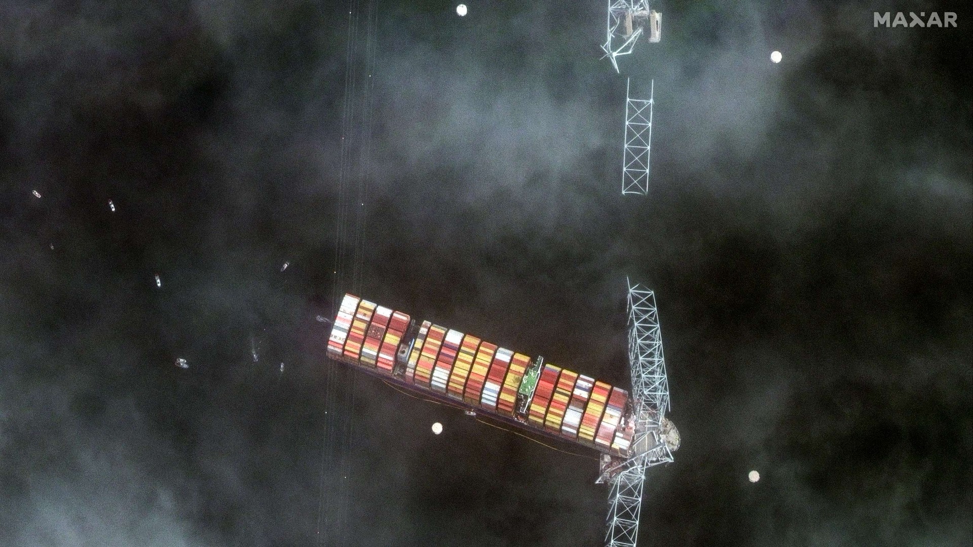
Maxar Technologies captured satellite images of the collapsed Francis Scott Key Bridge in Baltimore, which was struck by a giant cargo ship early on Tuesday (March 26). Most of the 1.6-mile (2.57 km) long bridge crumbled within minutes, sending people and vehicles into the icy waters of the Patapsco River.
The 984-foot-long cargo ship, named Dali, was just 30 minutes into its 27-day journey to Colombo, Sri Lanka when it lost all power and rammed into one of the bridge's critical pillars. Two of the eight workers who were fixing potholes on the bridge at the time of its collapse were rescued on Tuesday, after which rescue efforts were halted due to dangerous river conditions.
Search resumed early Wednesday morning for the remaining six people, who are presumed dead. They were citizens from several countries, including Honduras, Mexico and Guatemala, according to the Associated Press.
Related: Wow! Maxar satellite captures up-close look at NASA's Landsat 8 spacecraft in orbit
The #FrancisScottKeyBridge collapsed in #Baltimore, Maryland, around 1:30 a.m. ET today after being hit by a cargo ship. About an hour ago, two Maxar satellites collected imagery of the collapsed bridge and ship. A May 2023 image is also in the gallery. #viewfromspace pic.twitter.com/UyUuxzDo9pMarch 26, 2024
Colorado-based Maxar Technologies posted their satellite images to X (formerly Twitter), which show large chunks of the bridge in the river while search and rescue efforts can be seen underway around the crash site.
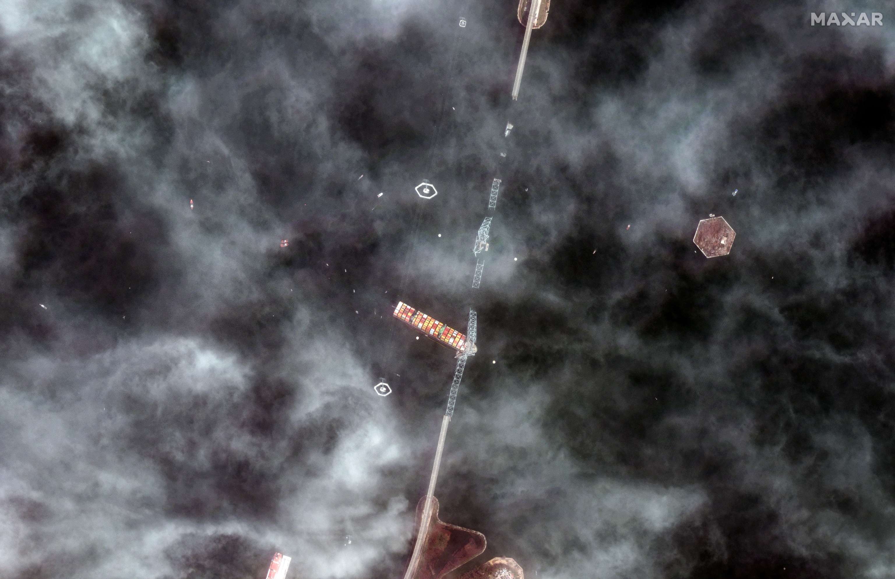
Maxar satellite images taken after the collapse on Tuesday show Dali still wedged under portions of the crumbled bridge.
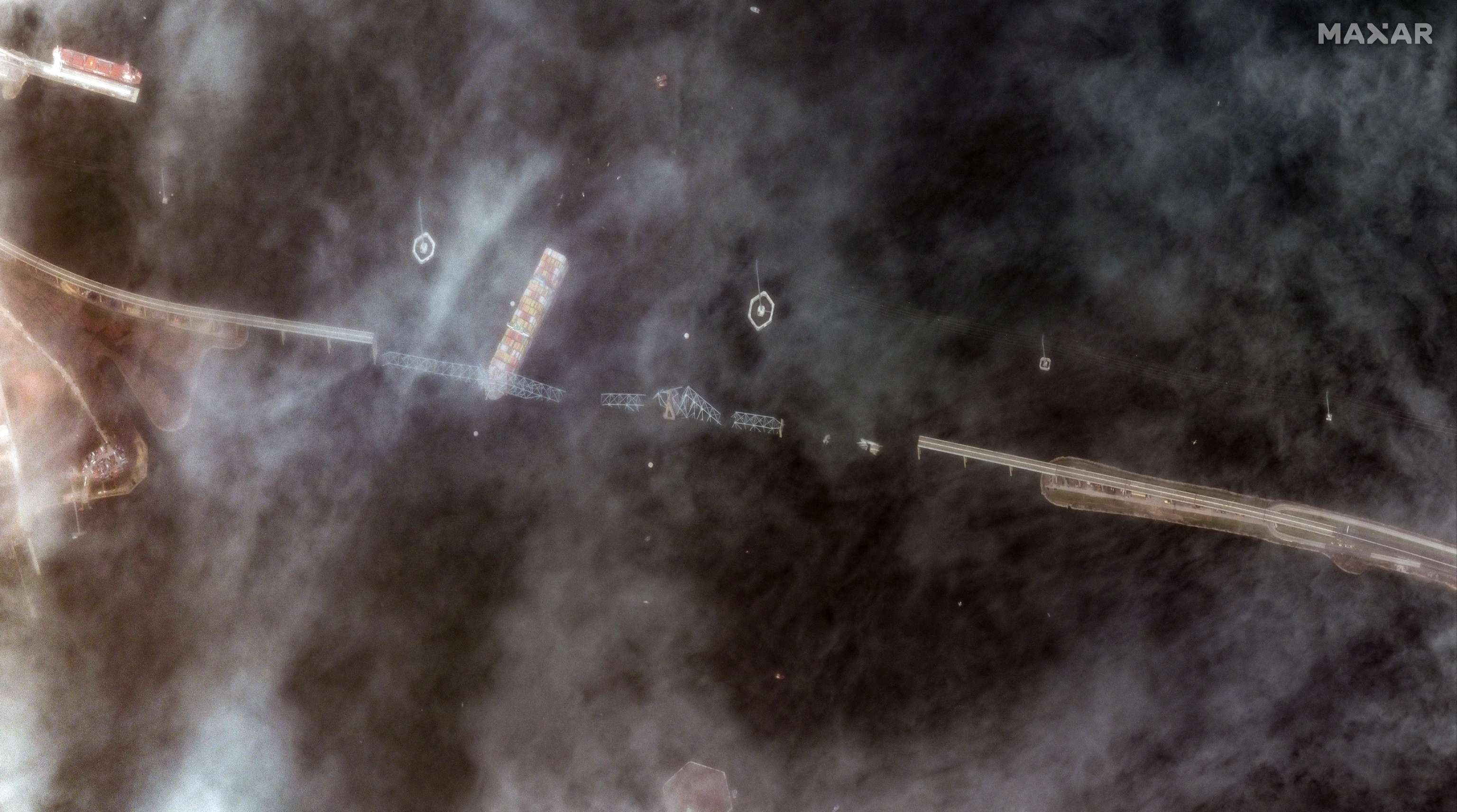
Another Maxar satellite photo taken in 2023 reveals how the bridge looked before the collision.
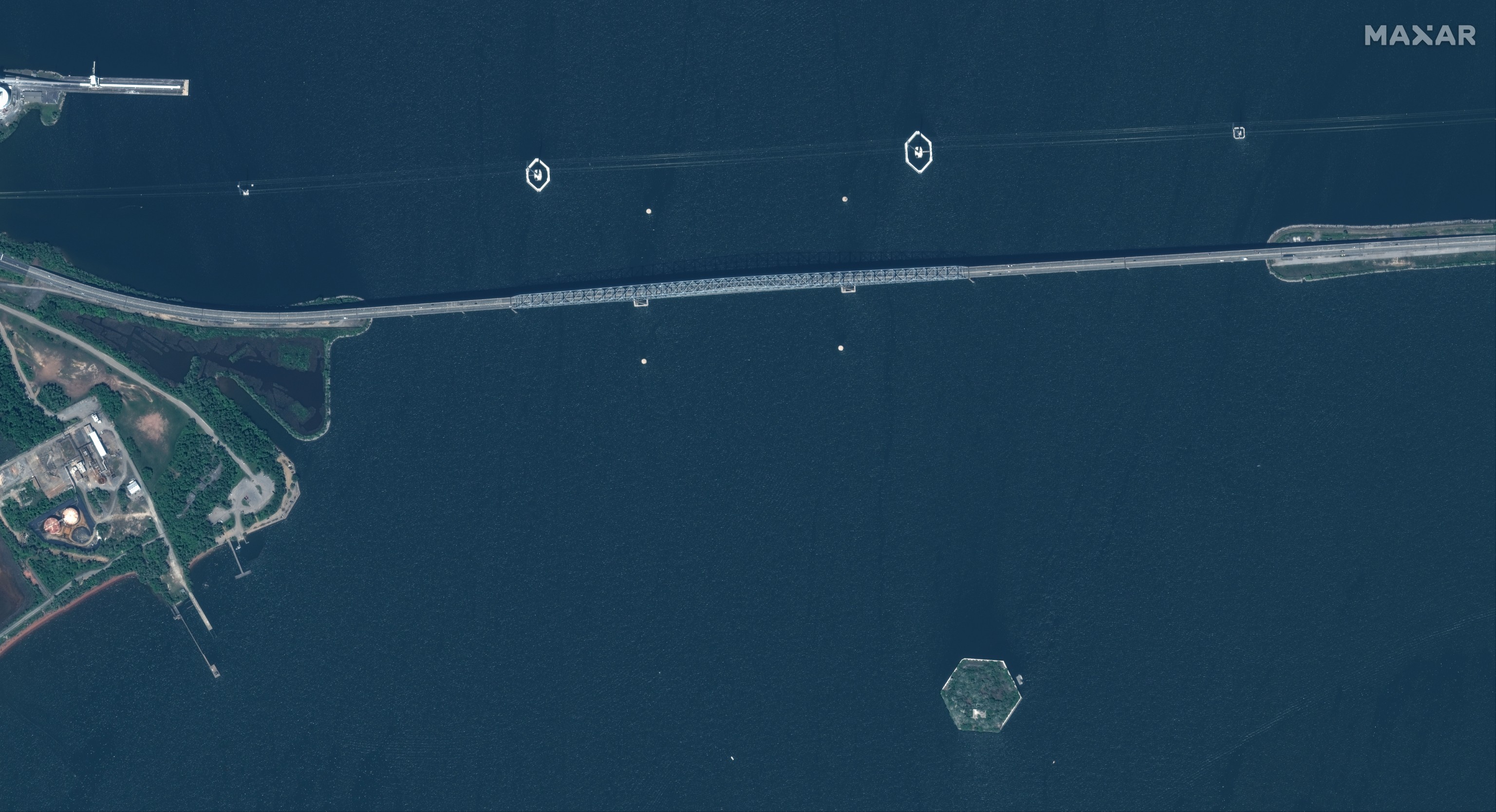
Prior to the crash, a mayday call from the ship signaling an imminent collision helped officials stop traffic from both sides of the four-lane bridge. The cause of the vessel's complete blackout minutes before it struck the bridge remains unclear.
Officials with the National Transportation Safety Board (NTSB) boarded the ship to collect the vessel's data recorder, also known as the black box, which would help them develop a timeline of events leading up to the crash, CNN reported.
Vessel traffic is halted indefinitely in and out of Baltimore's port, which is the 11th largest in the U.S. Officials have said the incident would impact the local economy in Baltimore, which remains in a state of emergency.

