This year’s hurricane season was shaping up to be a slow one — that was good news for people living in the tropics, though it left hurricane scientists with less data to examine.
So when a low-pressure wave began to form in the atmosphere over the central Atlantic in mid-September, some researchers weren’t expecting a major storm.
“It didn’t look like much,” says Greg Foltz, an oceanographer at the National Oceanographic and Atmospheric Association (NOAA).
But when the winds picked up and Tropical Storm Fiona began its transformation into Hurricane Fiona, Foltz’s team stirred into action.
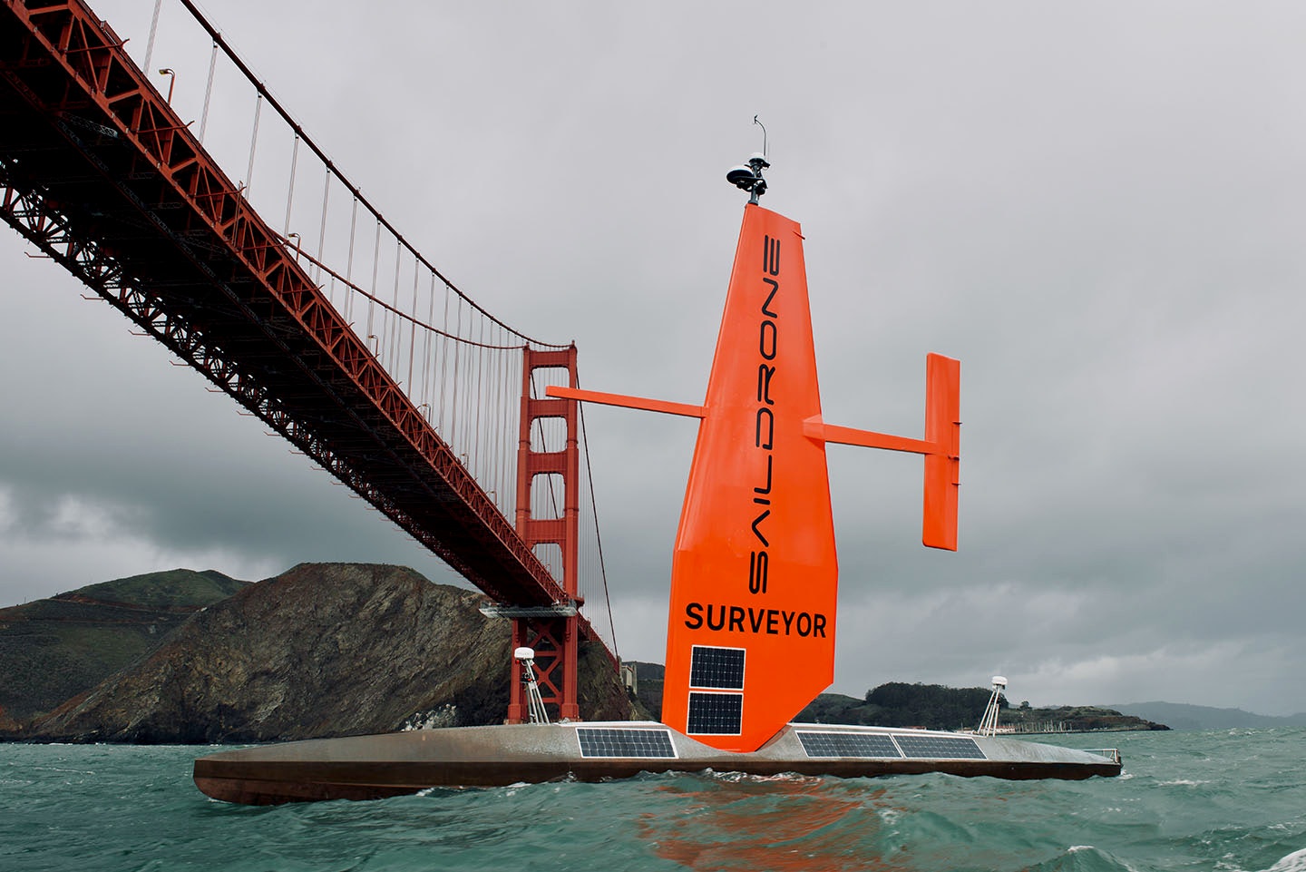
Since the start of hurricane season in July, the team has placed floating, wind-powered devices called saildrones in strategic locations in the western Atlantic. The Explorer model is bright orange, roughly 23 feet long, and looks a bit like a racing dinghy. Its massive companion, the Surveyor, measures 72 feet long.
As the storm made its way toward Puerto Rico and the Dominican Republic, the sea drones launched on a course to intercept it.
The mission was a success: Four drones caught up to their windy target. “We got a saildrone into the middle of the eye, just as it had become a hurricane,” says Foltz. “That was pretty exciting.”
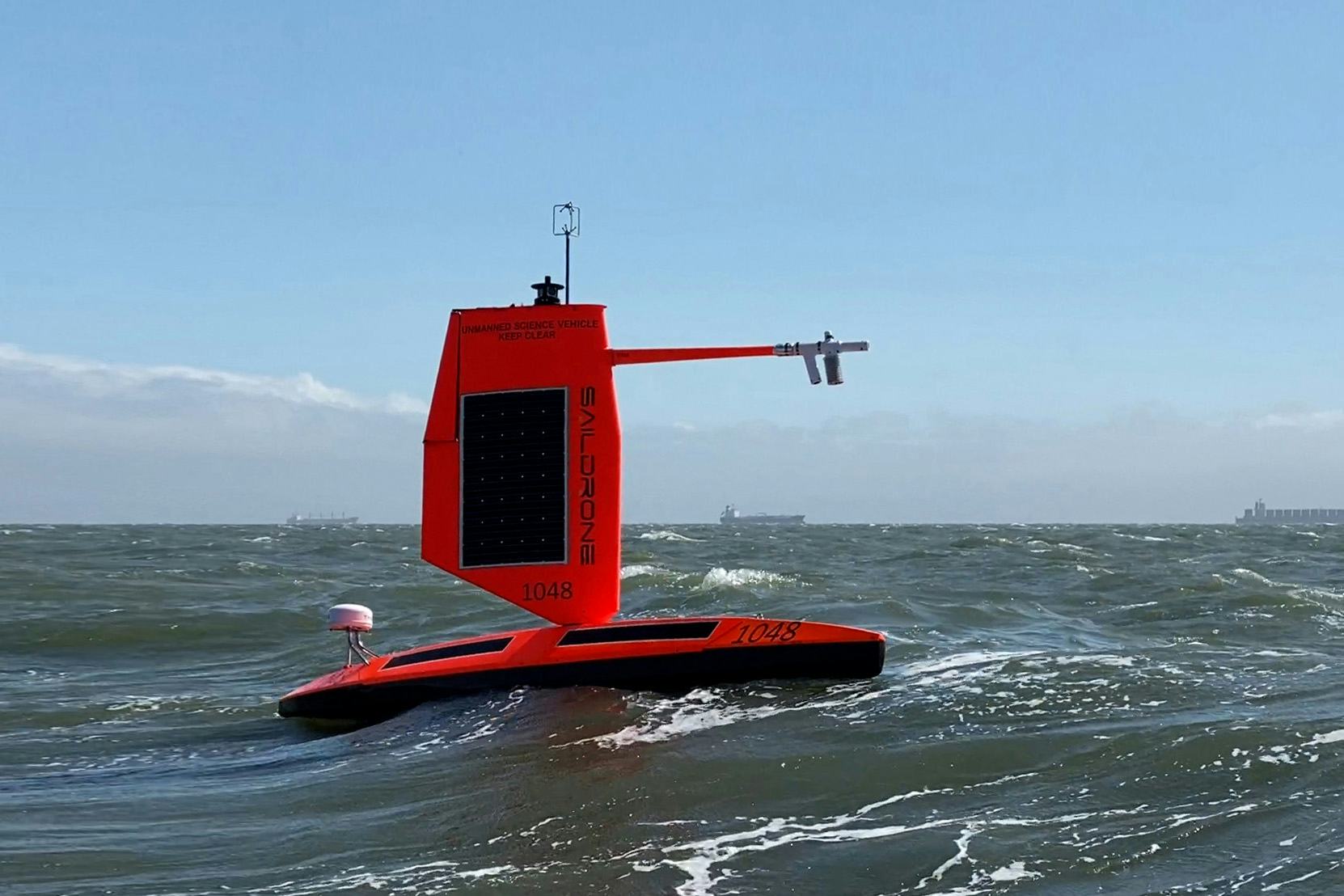
As the storm raged, the drones’ sensors collected data like temperature and pressure, and onboard cameras captured dramatic footage of towering waves and heavy winds.
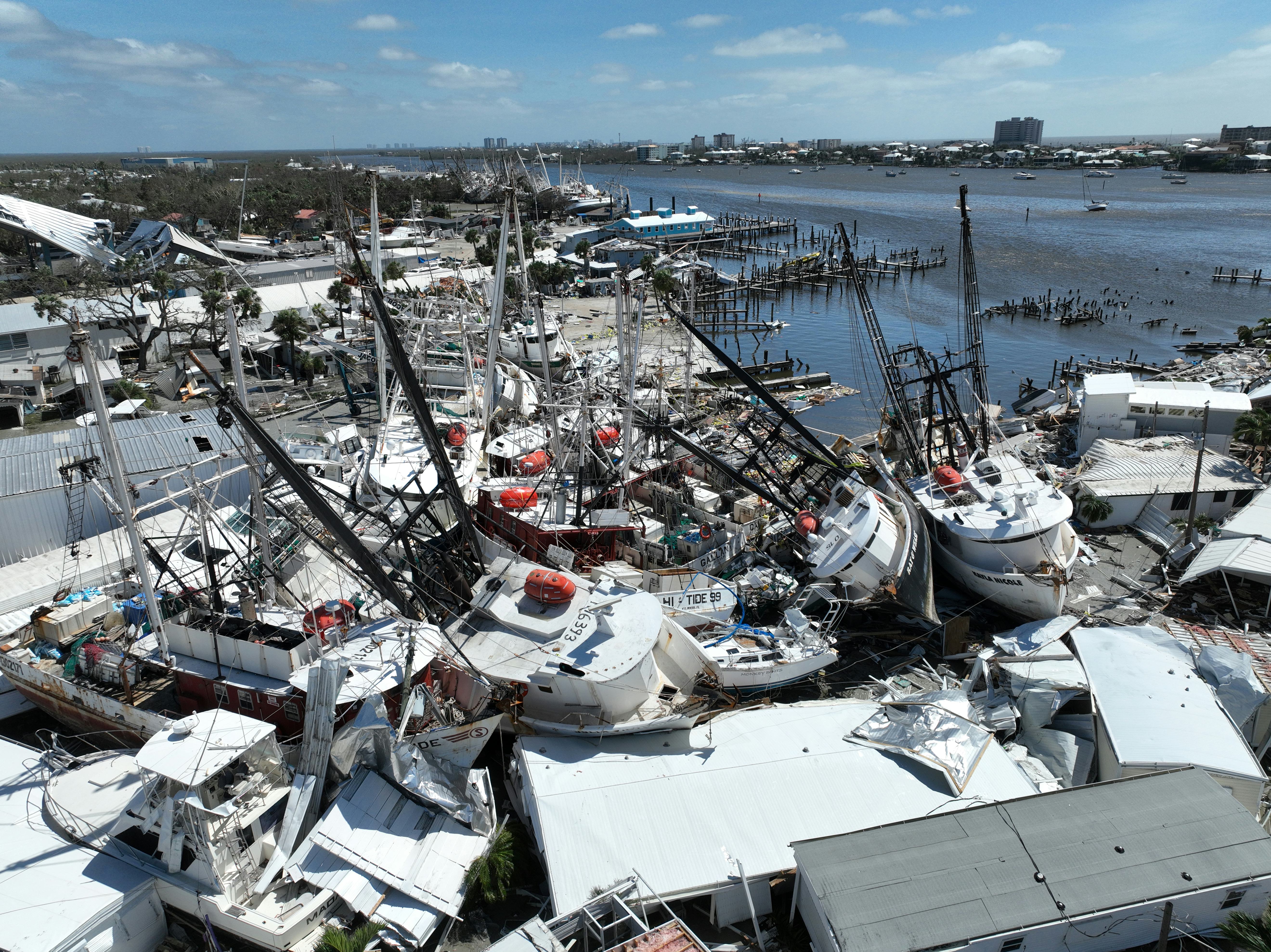
Roughly as strong as last year’s Hurricane Larry, Fiona has left many in the Caribbean without electricity and caused hundreds of millions of dollars in damage in Canada’s eastern provinces, according to Reuters.
In their initial results, saildrones showed that Fiona brought waves as high as 50 feet and average wind speeds of around 78 miles per hour, topping out at roughly 107 miles per hour.
The saildrone joins a growing lineup of high-tech tools that scientists use to gather data on storms: Along with other new-and-improved tracking technologies, these flocks of drones are helping scientists get closer than ever to the action, and they could even help predict which will turn especially devastating.
A need for speed tracking
While hurricane location tracking has quickly improved over the past few decades, forecasters’ ability to predict the intensity of hurricanes hasn’t matched its pace. According to a study from 2014, the error rate of intensity forecasts one to three days before a storm decreased by only 1 to 2 percent per year from 1989 to 2012.
Meanwhile, tracking forecast errors shrank at about double that rate over the same period. The stakes are especially high when it comes to predicting rare instances in which hurricanes intensify extremely quickly. This was the case for the recent Hurricane Ian, which doubled in wind speeds over 48 hours.
The team wants to make sure the drones are prepared to stalk the next big one.
This year, NOAA put two additional saildrones in the Gulf of Mexico, which might give them a chance to get good data on hurricane intensification. The Gulf is smaller and shallower than the Atlantic and has unique movement patterns, including the massive Gulf Stream current.
Storms that begin in the Atlantic can suddenly speed up and morph into hurricanes once they cross into the gulf’s relatively warm waters, as Hurricane Laura did in 2020 and Hurricane Ian last month. Now, the team wants to make sure the drones are prepared to stalk the next big one.
Game of drones
NOAA maps the drone’s path, but the device is helmed remotely by a team of saildrone pilots in California. This team chases the storm alongside a fleet of planes and other technologies like submarine drones called hurricane gliders, which travel up to half a mile below the ocean’s surface. But the gliders move too slowly to keep up with the storm, so once things get going, the saildrone has to brave it alone, Foltz says.
Hurricanes also require some major team effort (in this case, between the forces of nature): Low-pressure systems in the atmosphere suck up warm water from the tropical ocean, creating a storm fueled by the energy released from evaporating seawater.
When this happens, sensors aboard the saildrone measure variables like wave height, temperature, and wind speed, which allows scientists to calculate how much momentum is transferred between the wind and the waves.
This information is crucial for understanding phenomena like storm surges, when stormwinds push water against a shoreline and cause flooding, says Foltz. When the mission’s over, like the sailors of old, the drones make their way to tropical islands (usually the Virgin Islands or Puerto Rico) for a well-deserved break.
Researchers want to learn why some storms grow from ordinary tropical cyclones into raging behemoths
To get hurricane forecasting right, you have to manage multiple moving pieces. “It’s really kind of a three-legged stool,” says Jim Yoe, a physical scientist at NOAA.
The legs in question are the basic science — how well the equations and models match up with reality — and the observations from technology like satellites, along with the computing power needed to put it all together. NOAA is trying to improve on all fronts simultaneously, Yoe explains.
With these approaches, Foltz and other researchers want to learn why some storms grow from ordinary tropical cyclones into raging behemoths.
The National Hurricane Center rates hurricanes from Category 1 to 5 based on the strength of their winds. The highest rating is reserved for giants like Hurricane Katrina, which devastated New Orleans in 2005.
Studies have found that most Category 4 and 5 hurricanes in the Atlantic undergo a process called rapid intensification — when a hurricane’s wind speed increases by 25 knots or more in the span of 24 hours.
Part of the saildrone’s mission is pinpointing the conditions that make this phenomenon more likely.
Because hurricanes are powered by heat, a warming atmosphere increases the amount of energy available. That’s why particularly brutal storms have become more common.
How to measure a hurricane
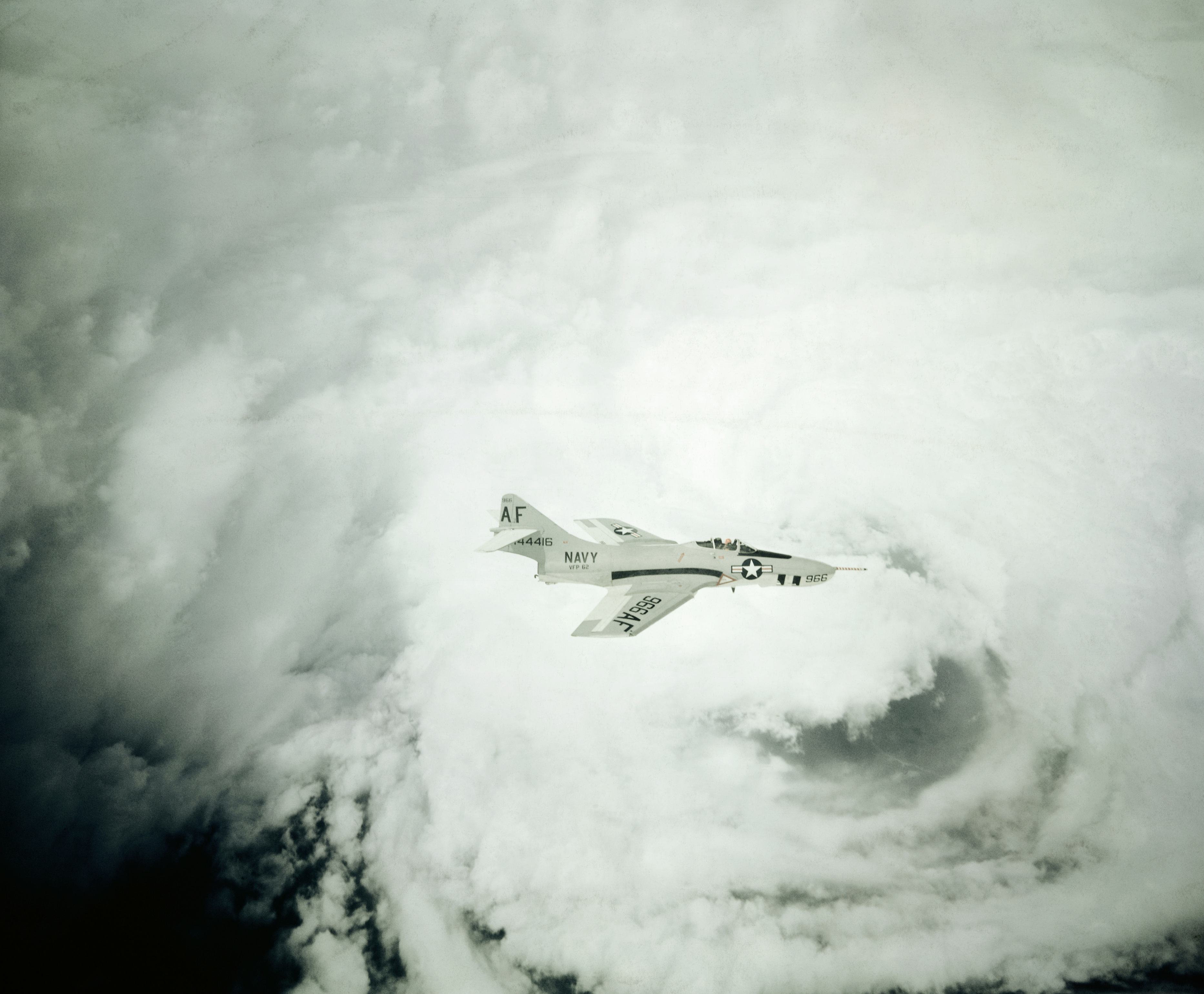
Even before saildrones, hurricane researchers had a flair for adventure. For instance, during the 1943 hurricane season, a tropical storm brewed in the Gulf of Mexico and headed toward Galveston, Texas. Col. Joseph Duckworth and Lt. Ralph O’Hair of the U.S. Air Force volunteered to fly a plane straight into the storm — not for science but to settle a bet, according to NOAA.
Since then, it has grown common to steer planes into tropical storms, which provides valuable prediction data. NOAA maintains its own small fleet of aircraft in Florida, known as the Hurricane Hunters, which fly out every hurricane season to plunge sensors called dropsondes into the howling winds.
Aerial reconnaissance might be the most perilous way to gather data on hurricanes, but scientists now have safer tools including satellites, buoys, and newer inventions like the saildrone. “We use everything we can get,” Yoe says.
“We use everything we can get.”
Buoys measure parameters like wave height and the time that passes between waves. Fixed to the ocean floor with mileslong nylon cords, they must endure the wind, sun, and the full might of the ocean. So they must be maintained by a roving fleet of technicians, who go to sea eight months a year to replace parts and scoop up any buoys that have gone adrift.
To get a read on the hurricane as it barrels across the ocean, satellites photograph the storm from orbit. “The better you do with that initial condition — Where is it? What direction? Is it moving? How strong is it? — the better the forecast will be later on,” says Dan Lindsey, a research meteorologist at NOAA.
NOAA’s GOES-18 satellite, which launched this year, can capture a wider range of light wavelengths and take images at a higher resolution (and more often). But most satellites don’t measure wind speed near the surface, buoys are stuck in place, and dropsondes only provide a snapshot of a particular moment in time. That’s where the saildrone comes in.
The saildrone sets off
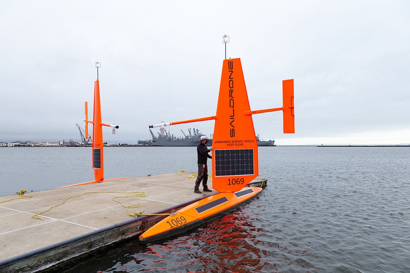
Saildrones are designed to ride the storm, following it as long as possible and capturing crucial information along the way.
It all began when Saildrone Inc. partnered with NOAA in 2014 to use its proprietary vessels to gather data on the ocean. But the first generation, which included longer sails than the current models, had trouble handling the rough seas.
“When it got into a typhoon in the Western Pacific accidentally, with the large waves crashing on it, the sail completely broke off,” Greg Foltz says.
The latest version has a shorter sail called a hurricane wing that lowers the center of gravity, so the vessel is less likely to capsize. A future version might include a small motor, which could be useful for days when the winds aren’t right and the drone needs an extra burst of speed, says Foltz.
Previous seasons of saildrone data have already provided some insight. For example, the drones help researchers assess how the ocean drags on hurricane winds and slows them down, which will make for better hurricane models, says Foltz. The team also found a surprising relationship between a rapidly intensifying hurricane and the salt content of the water.
“It’s still Mother Nature.”
In the Western Atlantic near the coast of Brazil, the Amazon and Orinoco rivers dump huge amounts of freshwater into the ocean, keeping the cooler, deeper layers from rising to the top — creating ideal conditions for intensification.
More closely packed lightning strikes are another sign that a storm might be worsening, so some satellites are also carrying lightning mappers onboard.
Today, communities along tropical coastlines in the path of these storms rely heavily on the data collected and relayed by NOAA’s array of monitors.
“Once a storm emerges, we are in close contact — literally constantly — with the National Weather Service,” says Rick Adams, emergency management coordinator for the city of Port Aransas, Texas. He has held the position for more than a decade and witnessed large storms like 2017’s Hurricane Harvey, a Category 4 hurricane.
During his time in office, Adams says he has seen significant progress in NOAA’s technology and data, especially the tracking forecasts — which are invaluable even if they’ll never be perfectly accurate.
After all, we can’t yet completely decipher what the weather has in store for us. “It’s still Mother Nature,” he says.


