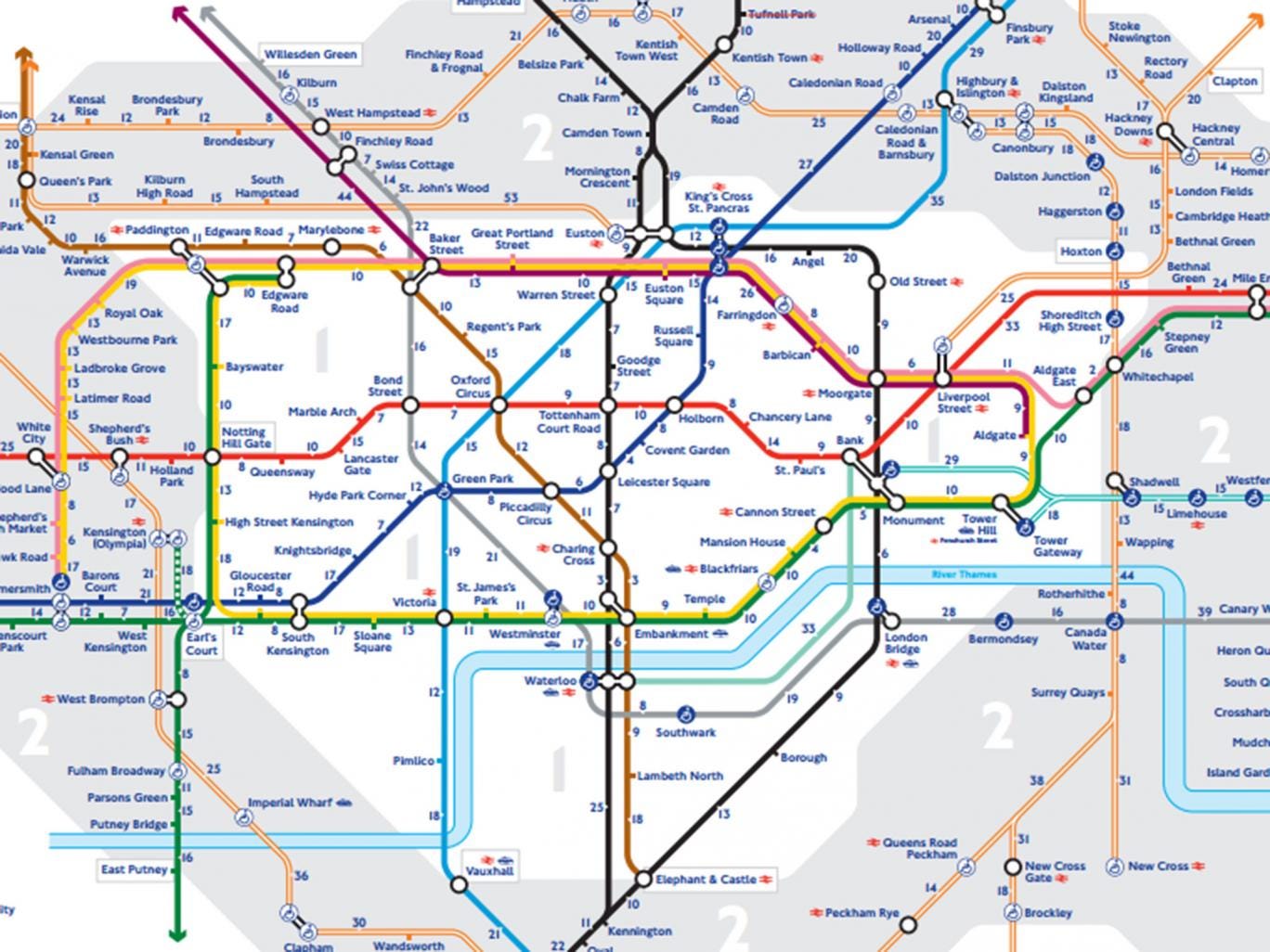
Transport for London (TfL) has unveiled its first official map showing how long it would take to walk between London's Tube stations.
The map shows Leicester Square and Covent Garden are less than five minutes walk apart, while walking between Kings Cross St. Pancras and Euston would take 12 minutes.
TfL said the map was released following the popularity of other unofficial versions, such as one showing the rent prices at London's Underground stations and another showing a geographically accurate London Tube and rail map.
A TfL spokesperson told the Evening Standard: “What we have seen is that people are desperate for this sort of thing, so we have created it.
"We focused on central London, zones 1 and 2, and based the times of our journey planner.
“It’s often quite a difficult message for us because people think we just do the Tube and buses, but we’re also responsible for roads, walking and cycling.
“We’re investing heavily in improving walking and cycling routes across London, with all the health benefits they bring.
She added: “This is going to be great for people to see how quick and easy it is to so many stations.”
You can view the map in full here.