Terra Incognita: maps that shaped the world – in pictures
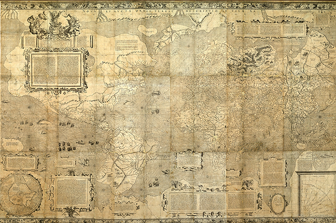
Andrew Walsperger was a Benedictine monk from Salzburg, Austria. His 1448 portrayal of the world known to Europeans includes spheres around the edges to represent the heavens, while the signs of the zodiac and names of the winds are written between themPhotograph: Vatican LibraryFra Mauro's map of the world, 1448-1453. On loan from Venice – where it has never before left its library home – this beautiful work is the centrepiece of the National Gallery's show for many visitorsPhotograph: National Library of St Mark's'A new and augmented representation of the world amended for the use of navigation', by Mercator in 1569. A groundbreaking map but, alas, still missing AustraliaPhotograph: National Library of France
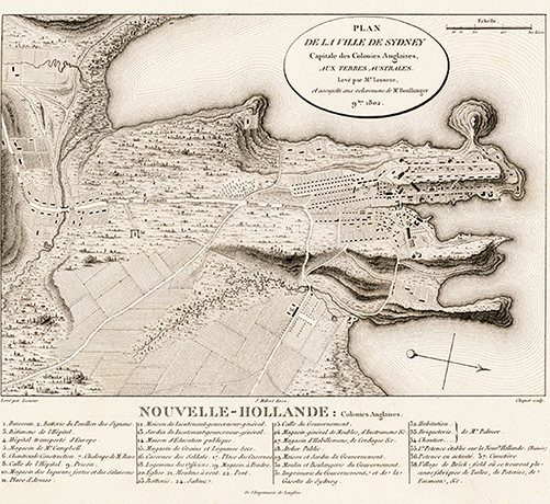
In 1622, Dutch cartographer and self-publisher Hessel Gerritsz produced this map of the Pacific Ocean. Gerritsz is considered the master Dutch cartographer of the 17th century. A few years earlier, he portrayed the top of what we know as Western Australia while surveying modern-day IndonesiaPhotograph: National Library of FranceThere she blows: in 1657, Dutchman Jan Jansson created this guide to getting the most from the fuel that powered exploration of the globe – wind Photograph: National Library of AustraliaIn 1769, James Cook as surveyor and Isaac Smith as chartmaker came up with this representation of Tahiti Photograph: British LibraryIt's Sydney, but not as we know it. This French map of the nascent British colonial town appears in the book Voyage of Discoveries to Southern Lands, produced between 1807 and 1817 by Francois Peron. Is that a river passing underneath Broadway? Photograph: National Library of AustraliaCreated between 1814 and 1822 and held by the National Library, this map by the explorer Matthew Flinders was published in A Voyage to Terra Australis, one day before he died Photograph: National Library of Australia
Sign up to read this article
Read news from 100’s of titles, curated specifically for you.