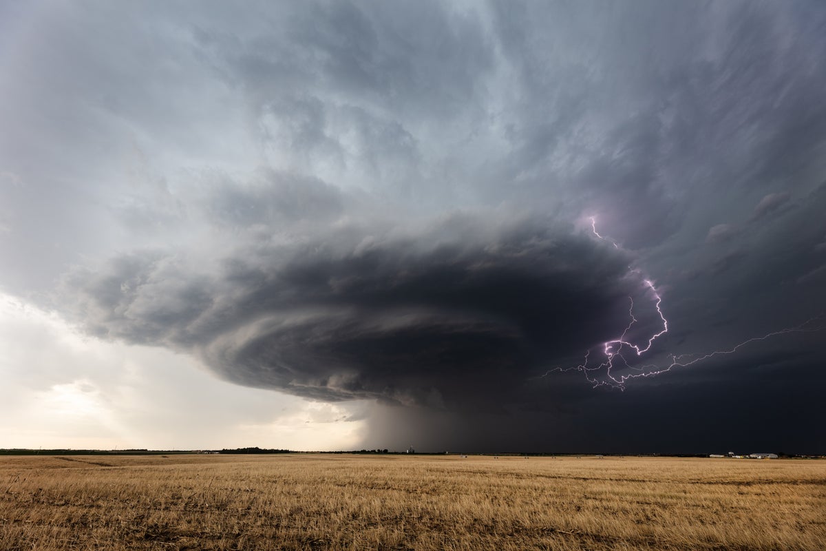
A major incident has been declared and around 100 properties damaged after a suspected tornado struck Greater Manchester, with a second “supercell thunderstorm“ hitting Lancashire hours later.
The Met Office confirmed that a rare supercell thunderstorm – storms defined by the deep and persistently rotating current of rising air at their centre – hit the borough of Tameside on Wednesday night, causing chaos as it pulled roofs and chimneys from houses and broke windows.
A second supercell thunderstorm also struck Lancashire’s Morecambe Bay on Thursday morning, with the Met Office warning of hail, frequent lightning and strong and gusty winds as it moved inland.
Supercell thunderstorms are most common in the United States’ Tornado Alley— (Getty Images)
These storms are the type responsible for spawning tornadoes, and around 30 per cent of supercells or less will do so, according to the US National Weather Service.
Storms become supercells as their powerful upward winds begin to rotate, which occurs because their “strong wind shear creates a horizontal spin in the atmosphere”, according to the Met Office.
Tornadoes are then formed when downdraughts within the supercell storm help to concentrate the rotation and to bring it down to lower levels, the national forecaster explains.
“Eventually the rotation may become so strongly-focused that a narrow column of violently rotating air forms. If this violently-rotating column of air reaches the ground a tornado is born,” the Met Office website states.
“The tornado is often visible because of the presence of a condensation funnel – a funnel-shaped cloud which forms due to the much-reduced pressure within the tornado vortex. Dust and other debris lofted by the intense winds can also help to make the tornado visible.”
Scores of homes were damaged in Tameside on Wednesday night— (AP)
Experts suspect this may have occurred in Tameside on Wednesday night, as much of the UK reeled from the impacts of Storm Gerrit – which caused widespread flooding, halting trains across most of Scotland, and causing disruption to ferries and air travel to the Hebrides, the Isle of Wight, France, and at London Heathrow.
Residents in Tameside described the intense noise of the storm, likening it to “a plane coming down [on] the house”.
Julie Ann Fielding from Stalybridge said the suspected tornado lasted around 10 minutes and she watched emergency services attend the scene, adding: “Hail, rain. Never experienced anything like it.
Debris from a wall damaged by the suspected tornado in Stalybridge— (Getty Images)
“I thought the windows were coming through. Fence panels ripped right up and out. Roof opposite has been ripped off and severely damaged a lot of the cars.”
Another man shared shocking footage of the destruction of his conservatory, writing on Twitter/X: “My ears are still ringing like I’ve been to a gig! The funnel moved down our street and it was so loud that it went silent for a moment, it was weird as hell.”
While most common in the Great Plains of the United States, known as Tornado Alley, there have been several supercell thunderstorms in England in recent years.
In June 2012, multiple supercells hit – two of which formed over the Midlands causing severe hail, while a Tornado was formed at Sleaford. In Tyneside, the sky was described as turning “pitch black” during evening rush hour, causing people to abandon their cars and major roads, homes and shopping centres were flooded.
There were further notable supercell thunderstorms in 2019 and 2020.


