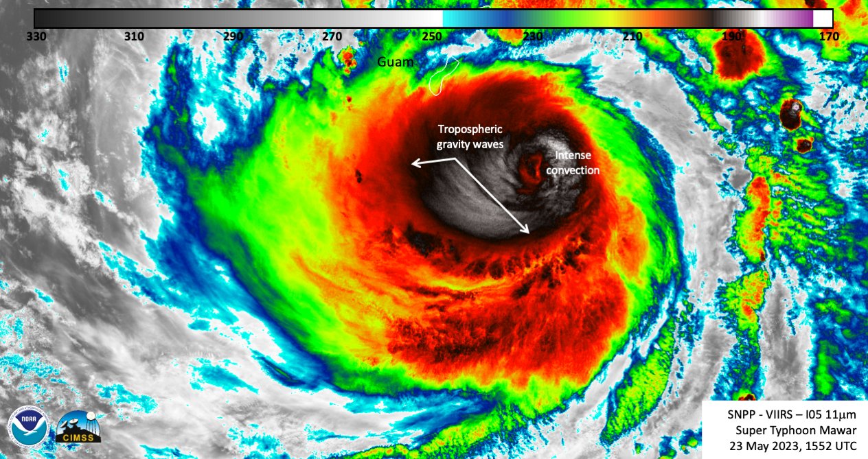
Satellites watched as the powerful Super Typhoon Mawar made its way toward the U.S. island territory of Guam on Wednesday (May 24).
Weather satellites tracked the Category 4 storm as it produced winds of up to 140 mph (225 kph) while moving northwest past Guam on Wednesday, knocking out power for large portions of the island and prompting the White House to declare a state of emergency for the territory in order to provide disaster relief. The National Oceanic and Atmospheric Administration (NOAA) stated on Twitter that it was the most powerful storm to hit the island in six decades.
Satellites watched as the storm bore down on Guam this week, swirling and churning over the open waters of the Pacific Ocean. In the satellite images, the super typhoon dwarfs the island as it travels northwest toward the Philippine Sea.

NOAA shared a time-lapse of four days' worth of infrared imagery captured by Japan's Himawari 9 weather satellite. In the animation, which NOAA shared on Twitter, the violent swirling of the storm can be seen as it roils above the Pacific Ocean.
Infrared imagery from the @NOAA/NASA #SuomiNPP satellite shows the intensity of Super Typhoon #Mawar as it approached Guam. The storm's eyewall clipped the northern tip of the island early this morning, bringing destructive winds, a life-threatening storm surge, and torrential… pic.twitter.com/2bCpqB8fkTMay 24, 2023
Meanwhile, the European Space Agency's Sentinel-3 satellite that makes up part of the European Union's Copernicus Program watched Super Typhoon Mawar in visible light, revealing the massive size of the storm as it hit Guam.
#ImageOfTheDay#Maware 🌀 is ➡️a super typhoon, equivalent to a category four hurricane➡️ one of the most powerful typhoons in recent years in the Pacific Ocean➡️ currently lashing the island of Guam, before heading towards the Philippines⬇️Yesterday's #Sentinel3🇪🇺🛰️ image pic.twitter.com/EwDetKgZdtMay 24, 2023
Super Typhoon Mawar is expected to intensify through Thursday (May 25), as it moves west-northwest at 6 mph (9.6 kph), according to the National Weather Service.
Guam is located roughly 1,500 miles (2,400 km) east of the Philippines and is home to around 150,000 residents. The island also houses two major U.S. military installations, Naval Base Guam and Andersen Air Force Base.


