If you were hoping for a cosy, romantic Valentine’s weekend, you might just get your wish—alongside a fresh blanket of snow! A cold snap is reportedly heading for the UK, with snow expected to stretch from Aberdeen to Sheffield starting on Friday, February 16.
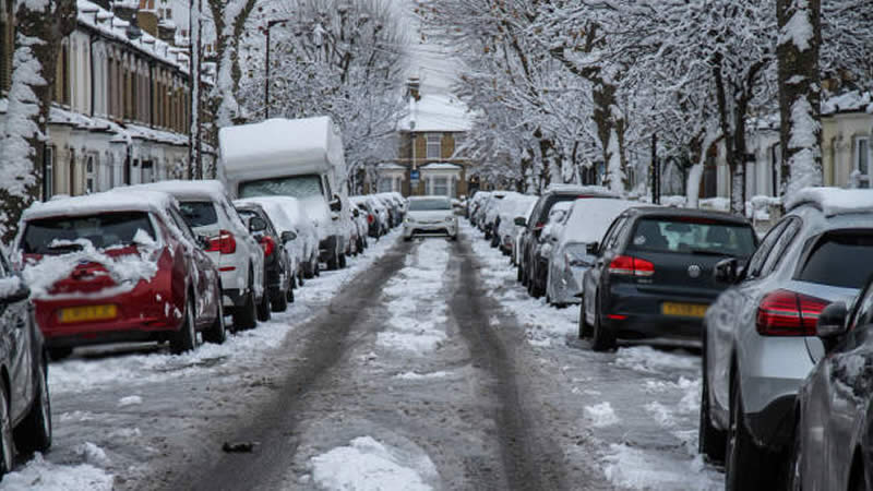
Latest weather maps from WXCHARTS show that by midnight on February 16, most of Scotland and northern England will be seeing snowfall. The white stuff is set to fall at a steady 0.5cm per hour, accumulating up to 2.5cm in some places, making for a wintry scene in many parts of the country.
Meanwhile, those in southern England can breathe easy, as most areas down south will dodge both rain and snow, with dry conditions expected. Over in Wales, only the north is likely to see a dusting, while the rest of the country will escape the wintery blast, enjoying a calmer weekend.
By 6 am on February 16, residents in Manchester and Cumbria will wake up to the thickest snow, with maps predicting depths of around 4cm. If you’re in these areas, it might be time to dig out your snow boots and prepare for a crisp, chilly morning as winter makes another appearance.

The Met Office has weighed in on the forecast, saying: “Southeasterly winds are likely at the start of this period. This will maintain below-average temperatures and often cloudy conditions.” With temperatures set to drop, many could be in for a particularly frosty start to the weekend.
And while things are already looking cold, there’s a chance it could get even colder, bringing more wintry showers, particularly in eastern regions. The potential for icy roads and frosty mornings means extra caution may be needed for those travelling over the weekend.
The forecast continues: “Meanwhile, Atlantic frontal zones, bringing milder conditions and rain, will attempt to move in from the west or southwest. Early in this period, these look likely to have limited influence over the UK, though should they push further northeastwards, this would increase the chance of snow for some areas.”
Looking ahead, mid-February is shaping up to be unpredictable, with the potential for more snowy surprises before things eventually shift to milder, wetter conditions towards the end of the month. While some may enjoy the wintery scenery, others will be hoping for an early taste of spring.

This latest cold spell follows a snowy start to 2025 when heavy snowfall in January forced hundreds of schools to close due to icy conditions. Could we be in for another round of winter disruption? Only time will tell, but the forecast suggests anything is possible.
For now, if you’re up north, wrap up warm—it looks like winter isn’t done with us just yet! Those venturing out should prepare for a frosty weekend, while the rest of the country waits to see if more snow is on the way.