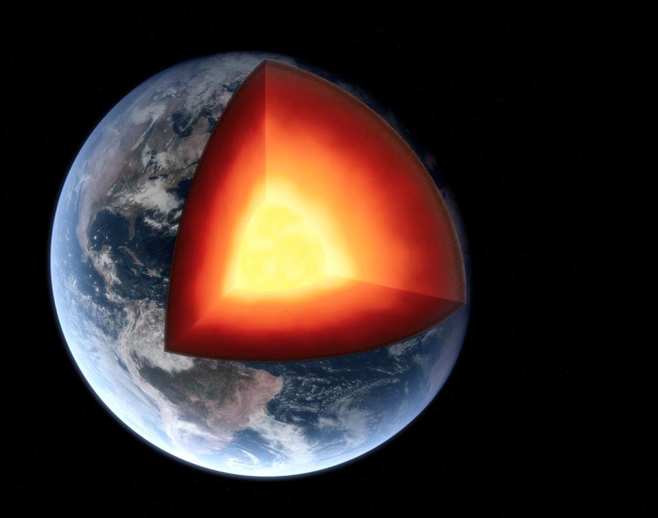
Combining gravity data, chemistry and how seismic waves are reflected and scattered deep within Earth, an international group of scientists affiliated with the European Space Agency (ESA) created a model of Earth's lithosphere, showing how plumes of cold and hot rocks slowly move around there.
The model combines different satellite data, such as gravity data from ESA's GOCE mission, with seismic tomography, a technique using arrays of seismograph stations on Earth's surface to map the behavior of seismic waves within Earth, and chemical properties of rocks to create a virtual Earth. As a result, the model shows differences in rock temperature down to 400 kilometers depth. This zone, called the lithosphere, includes Earth's outer shell and parts of the upper mantle and plays an essential role in driving plate tectonics.
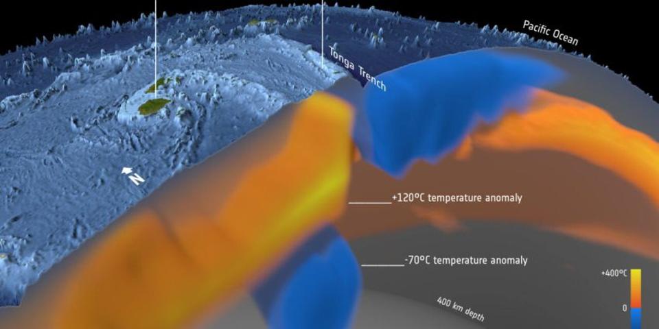
Earth's outer shell or crust comprises seven major tectonic plates and several smaller ones. The rigid tectonic plates are sliding on a ductile layer, the astenosphere, pushed and pulled around by convection currents in the mantle. As parts of the tectonic plates are pulled into the mantle, they release water and melt, feeding explosive volcanism along the plate's border. One such example is the Hunga Tonga-Hunga Ha'apai volcano.
Sergei Lebedev, from the University of Cambridge in the UK, coauthor of the model: “It is a part of the Tonga–Kermadec arc, where the edge of the Pacific tectonic plate dives beneath the Australian Plate. Here, our imaging shows the layer of hydrated, partially molten rock above the plunging Pacific Plate, which feeds the volcanoes of the arc.” The model shows the cold crust fragments sinking down in blue, and the hot, less dense rocks rising up in red.
In other regions of the mantle the model shows how large plumes of hot and cold material rise up or sink down, driven by temperature differences. The Cumbre Vieja volcano on the Spanish Canary Island of La Palma is fed by the Azores plume, a large thermal anomaly in the upper mantle.
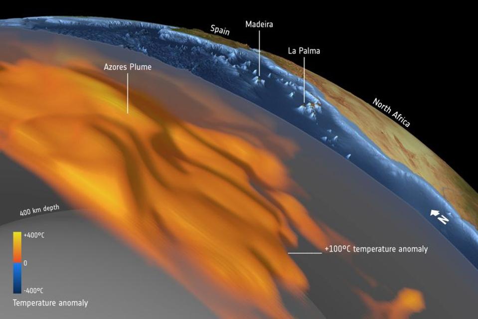
Scientists are still not sure what causes those thermal anomalies. Based on seismic data, large structures found along the core-mantle boundary at a depth of around 2,800 kilometers likely play a role. Here convection currents push mantle material together, forming plumes of less dense rock that eventually will start rising and heating up regions of the mantle.