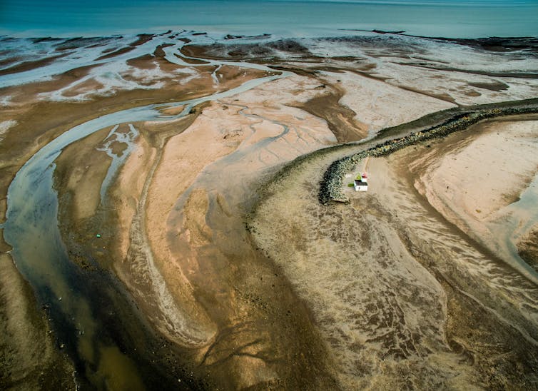
Earth’s surface is the “living skin” of our planet – it connects the physical, chemical, and biological systems. Over geological time, landscapes change as this surface evolves, regulating the carbon cycle and nutrient circulation as rivers carry sediment into the oceans.
All these interactions have far-reaching effects on ecosystems and biodiversity – the many living things inhabiting our planet.
As such, reconstructing how Earth’s landscapes have evolved over millions of years is a fundamental step towards understanding the changing shape of our planet, and the interaction of things like the climate and tectonics. It can also give us clues on the evolution of biodiversity.
Working with scientists in France (French National Centre for Scientific Research, ENS Paris university, University of Grenoble and University of Lyon), our team at the University of Sydney has now published a detailed geological model of Earth’s surface changes in the prestigious journal Science.
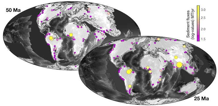
Ours is the first dynamic model – a computer simulation – of the past 100 million years at a high resolution down to ten kilometres. In unprecedented detail, it reveals how Earth’s surface has changed over time, and how that has affected the way sediment moves around and settles.
Broken into frames of a million years, our model is based on a framework that incorporates plate tectonic and climatic forces with surface processes such as earthquakes, weathering, changing rivers and more.
Three years in the making
The project started about three years ago when we began the development of a new global-scale landscape evolution model, capable of simulating millions of years of change. We also found ways to automatically add other information into our framework, such as palaeogeography – the history of Earth’s landscapes.
For this new study, our framework used state-of-the-art plate tectonic reconstructions and simulations of past climates on a global scale.
Our advanced computer simulations used Australia’s National Computational Infrastructure, running on hundreds of computer processors. Each simulation took several days, building a complete picture to reconstruct the past 100 million years of Earth’s surface evolution.
All this computing power has resulted in global high-resolution maps that show the highs and lows of Earth’s landscapes (elevation), as well as the flows of water and sediment.
All of these fit well with existing geological observations. For instance, we combined data from present-day river sediment and water flows, drainage basin areas, seismic surveys, and long-term local and global erosion trends.
Our main outputs are available as time-based global maps at five-million-year intervals from the Open Science Framework.
Water and sediment flux through space and time
One of Earth’s fundamental surface processes is erosion, a slow process in which materials like soil and rock are worn and carried away by wind or water. This results in sediment flows.
Erosion plays an important role in Earth’s carbon cycle – the never-ending global circulation of one of life’s essential building blocks, carbon. Investigating the way sediment flows have changed through space and time is crucial for our understanding of how Earth’s climates have varied in the past.
We found that our model reproduces the key elements of Earth’s sediment transport, from catchment dynamics depicting river networks over time to the slow changes of large-scale sedimentary basins.

From our results, we also found several inconsistencies between existing observations of rock layers (strata), and predictions of such layers. This shows our model could be useful for testing and refining reconstructions of past landscapes.
Our simulated past landscapes are fully integrated with the various processes at play, especially the hydrological system – the movement of water – providing a more robust and detailed view of Earth’s surface.

Our study reveals more detail on the role that the constantly evolving Earth’s surface has played in the movement of sediments from mountaintops to ocean basins, ultimately regulating the carbon cycle and Earth’s climate fluctuations through deep time.
As we explore these results in tandem with the geological record, we will be able to answer long-standing questions about various crucial features of the Earth system – including the way our planet cycles nutrients, and has given rise to life as we know it.
This research was undertaken with resources from the National Computational Infrastructure supported by the Australian Government and from Artemis HPC supported by the University of Sydney. This work was supported by the following: Australian Research Council grant IC190100031 and Australian Research Council grant DE210100084.
This article was originally published on The Conversation. Read the original article.


