There’s a saying that ‘sometimes you need to distance yourself from everything to see things clearly’. NOAA’S geostationary satellites will do it orbiting 22,300 miles above the equator at speeds equal to Earth’s rotation.
Collaborative efforts between NOAA and NASA are promising that the new GeoXO satellite system will advance observations of Earth that the GOES-R Series currently provides.
NOAA’s GeoXO satellite system will expand observations of Earth that the GOES-R Series currently provides from geostationary orbit
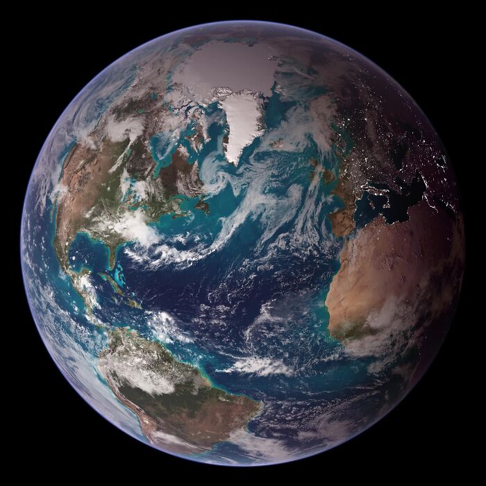
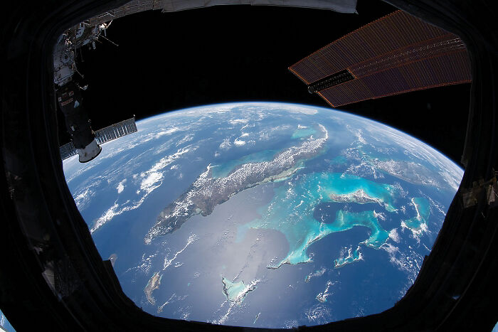
Thanks to NOAA’s next-generation satellite systems, like the GOES-R series, scientists are able to get high-definition images of Earth faster than ever before. Such data helps to paint a full picture of our planet by taking observations that would nearly impossible to perform from the ground directly.
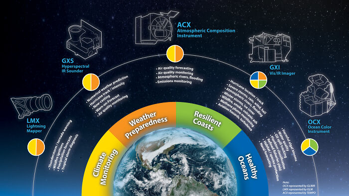
Since our climate continues to change rapidly due to human activities, technology needs to be updated as well. NOAA’s GeoXO satellite system will expand observations of Earth that the GOES-R Series currently provides from geostationary orbit. It will address emerging environmental issues and challenges regarding weather, the ocean, and the climate that threaten the security and well-being of everyone in the Western Hemisphere.
Data from GeoXO will contribute to weather forecast models and drive short-term weather forecasts and severe weather warnings as well as will detect and monitor environmental hazards like wildfires, smoke, dust, volcanic ash, drought, and flooding, and provide advanced warning to decision makers.
NOAA plans to improve visible/infrared imagery and lightning mapping capabilities and also expects to include hyperspectral sounding, atmospheric composition, and ocean color observations.
The new generation satellites allow scientists to make observations that would otherwise be nearly impossible to perform from the ground directly
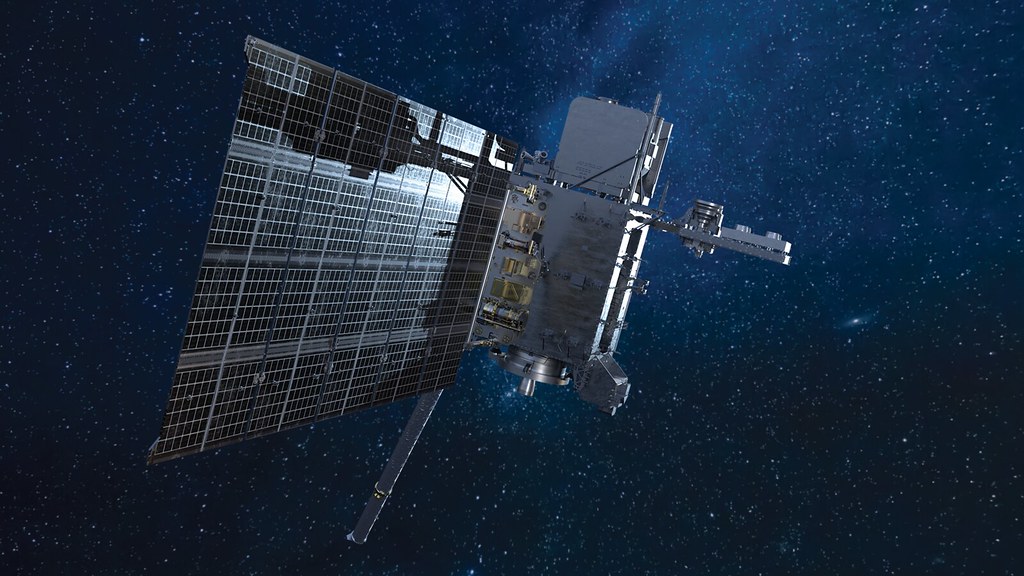
Image credits: NOAA
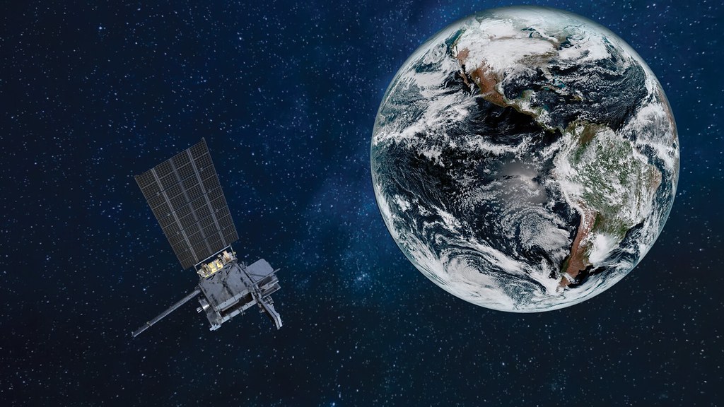
Image credits: NOAA
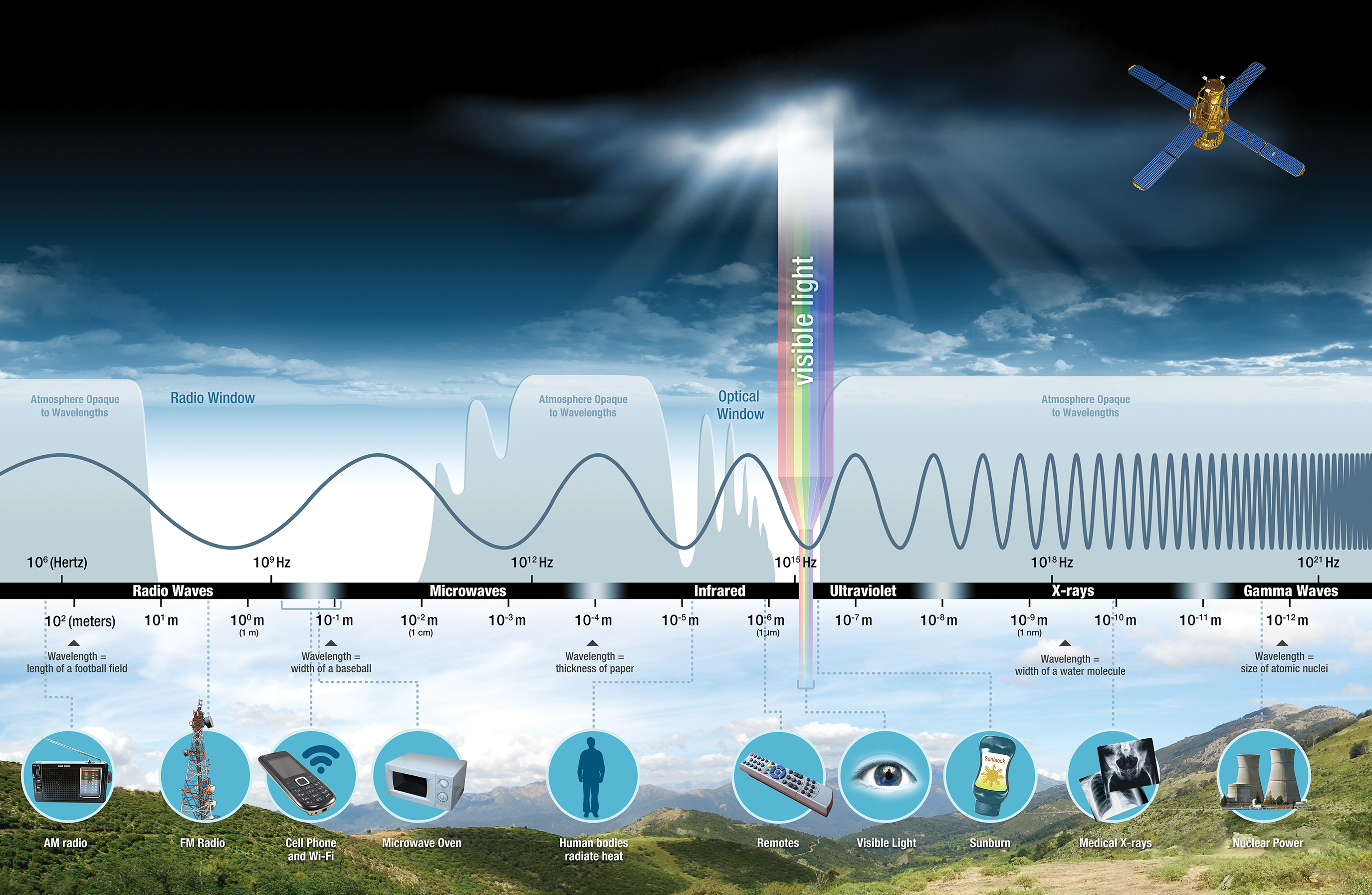
Image credits: NOAA
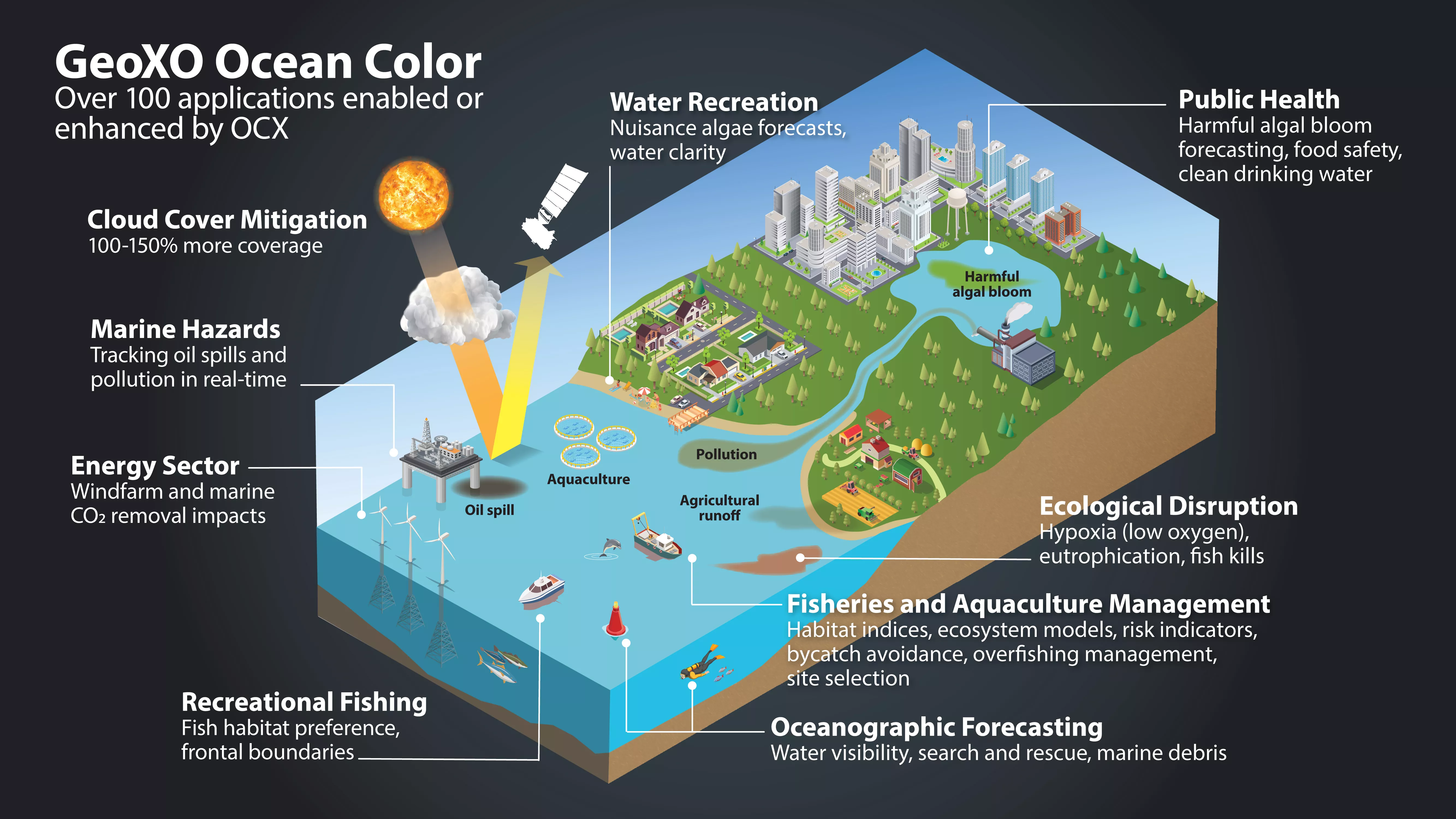
Image credits: NOAA
The GeoXO Ocean Color (OCX) instrument is planned to achieve 390-meter spatial resolution. It will observe ocean biology, chemistry, and ecology to assess ocean productivity, ecosystem change, coastal and inland water quality, seafood safety, and hazards like harmful algal blooms (HABs).
“We know GOES-R is mostly focused on what we think of as the weather mission. So we plan to add a new instrument called the Ocean Color (OCX) instrument, and it’s going to be scanning the coastal areas around the US as well as some of the major lakes like the Great Lakes. It will be able to detect things like if there’s runoff or pollution there, or an oil spill … it’ll be able to tell how clear the water is,” explained Pam Sullivan, the NOAA’s GOES-R and GeoXO program director.
“Satellite remote-sensing of ocean color gives us this really synoptic vantage point of living and nonliving microscopic materials in the aquatic environment. This gives us really critical insights into ecosystem variability, function health and vulnerability. We get down to the smaller level and see how local stressors are also impacting our communities,” added Ryan Vandermeulen, the NOAA’s National Marine Fisheries Service Satellite Coordinator.
Integrated GeoXO observations will allow scientists to have a deeper understanding of the environmental conditions and will complement observations from other satellites from NOAA, NASA, and international partners. This way the scientists will be able to address emerging environmental challenges, respond to the effects of Earth’s changing climate, and improve forecasting and warning of severe weather and environmental hazards.
New instruments will take measurements in the ocean and the atmosphere and that will help to predict what trends are going to happen before they’ve even started
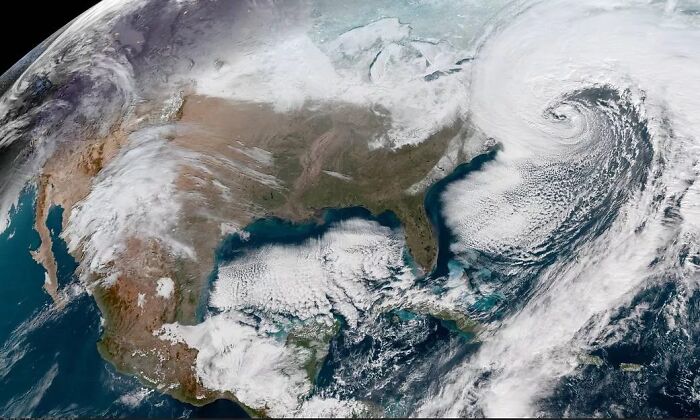
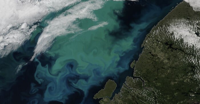
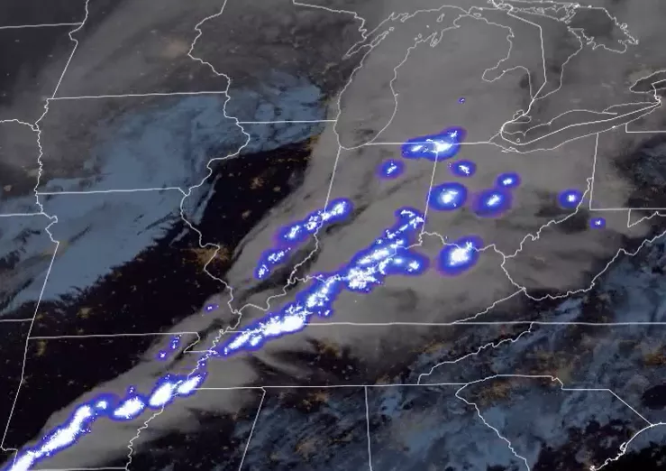
Image credits: NOAA
From the oldest civilian science organization, the Survey of the Coast, established by Thomas Jefferson in 1807 to NOAA’s recognition in 1970, NOAA’s heritage is rooted in 200 years of science, service, and stewardship: much of America’s scientific heritage resides here.
NOAA has a very rich history of successfully operating geostationary operational satellites (GOES) and polar-orbiting environmental satellites (POES). The organization’s satellite program has been indispensable for life-saving weather and climate forecasts for the United States and their partners around the world for more than 50 years.
The scientific and regulatory agency owns or operates a total of 17 satellites, which includes polar-orbiting satellites, geostationary satellites, and deep space satellites.
GeoXO is a constellation of three satellites (one perched over the Eastern United States, another over the West and a third in the middle) that will succeed NOAA’s current GEO Operational Environmental Satellites-R series (GOES-R). GeoXO is set to launch in the early 2030s and operate into the 2050s.
In contrast to low Earth orbit, where it makes sense to separate instruments on smaller spacecraft and spread out the constellation, an approach known as disaggregation, the GeoXO program will continue to group multiple instruments together. “Because you’re staring from geostationary orbit, there’s no point in having 10 satellites in the same spot staring,” explained Steve Volz, NOAA assistant administrator for satellite and information services.
GeoXO will begin operating in the early 2030s as the GOES-R Series nears the end of its operational lifetime
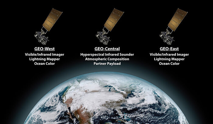
Image credits: NOAA
Image credits: NOAA
Meteorologist Dr. Harry Wexler, long before the days of weather satellites, expressed the thought that satellites would be a great instrument for both warning people about approaching severe weather and gathering information about the atmosphere.
He was the one who, in 1954, commissioned an unknown artist to draw what a satellite might ‘see’ from orbit. That happened approximately 4 years before the launch of the first US satellite, Explorer-1.
Thanks to such inspiring visionaries who brought us the very best in cutting-edge science and technology, we don’t have to imagine what our Earth looks like from above anymore; furthermore, we can predict what will happen next!
People on the internet shared their excitement about NOAA’s satellite systems


.jpg?w=600)