Satellite images of three Turkish towns reveal the extent of the devastation caused by the worst earthquakes to hit the country in decades.
The region was hit by two major quakes measuring 7.8 and 7.5 on the Richter scale at 4.17 am and 1.24pm local time on 6 February.
Extensive rescue operations are underway as emergency workers race against time to find survivors in affected areas of Turkey and Syria.
The death toll has already topped 7,300 but experts fear that the final number could be as high as 20,000.
Up 23 million people across both countries may be directly affected, including 1.4 million children, according to estimates by the World Health Organisation (WHO). Thousands of children are feared dead by Unicef.
“It’s now a race against time. Every minute, every hour that passes, the chances of finding survivors alive diminishes,” said Tedros Adhanom Ghebreyesus, the WHO’s director general, speaking in Geneva.
The earthquakes are the worst to hit Turkey since 1939 when one of the same magnitude killed around 30,000 people.
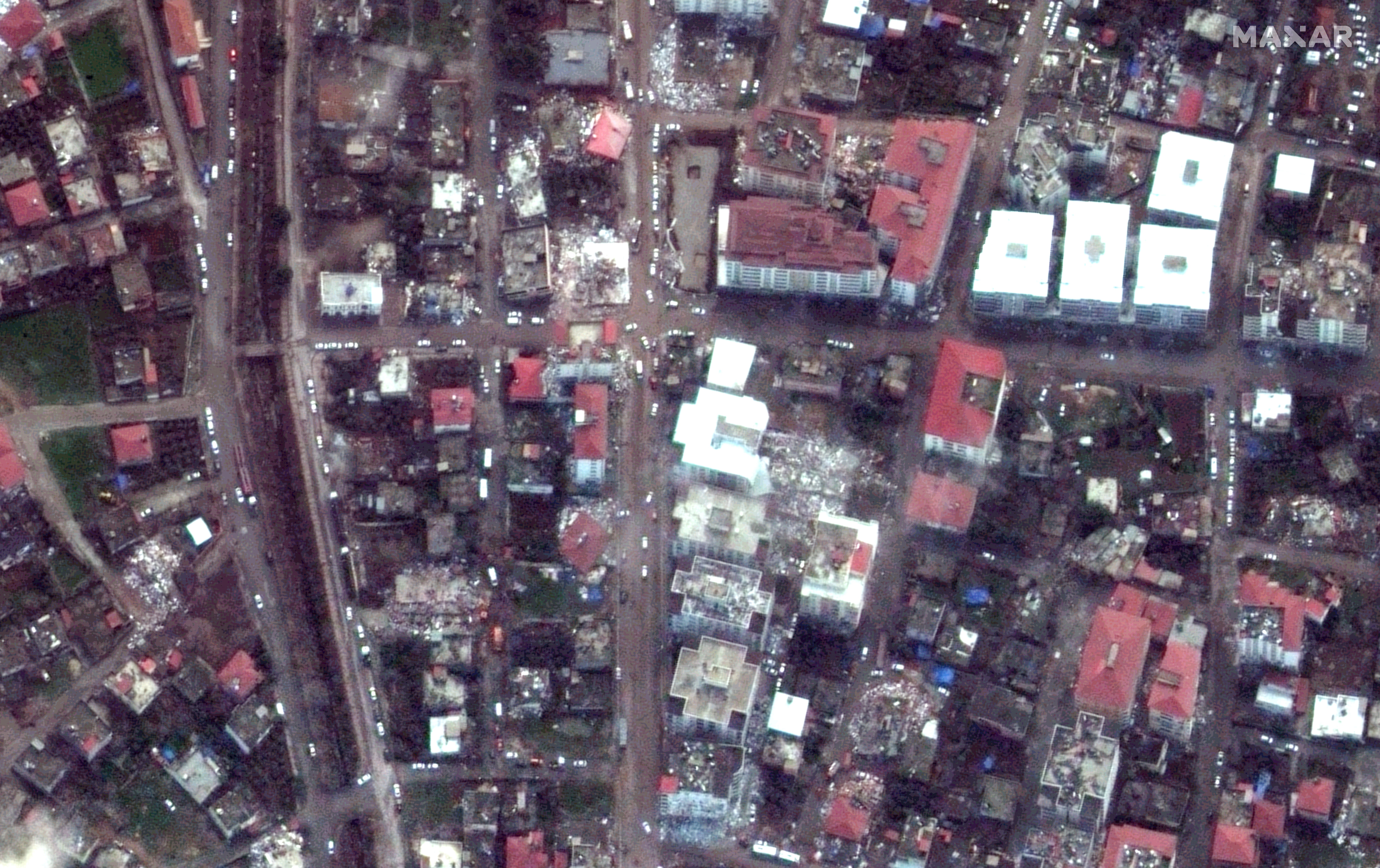
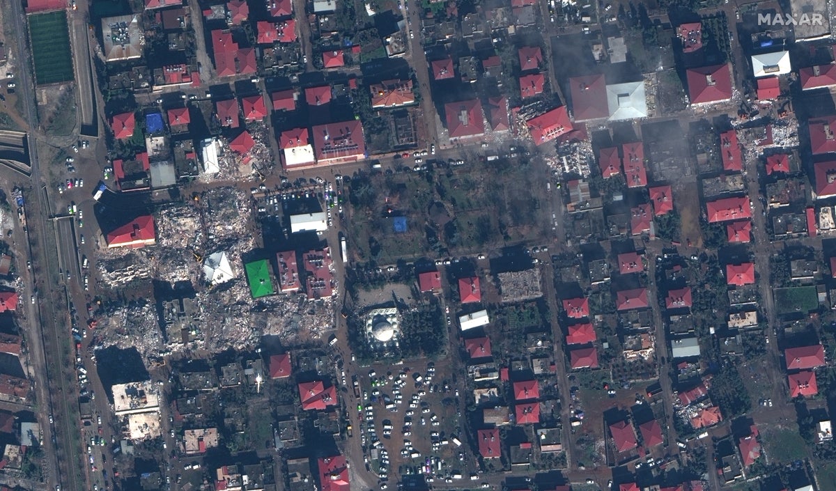
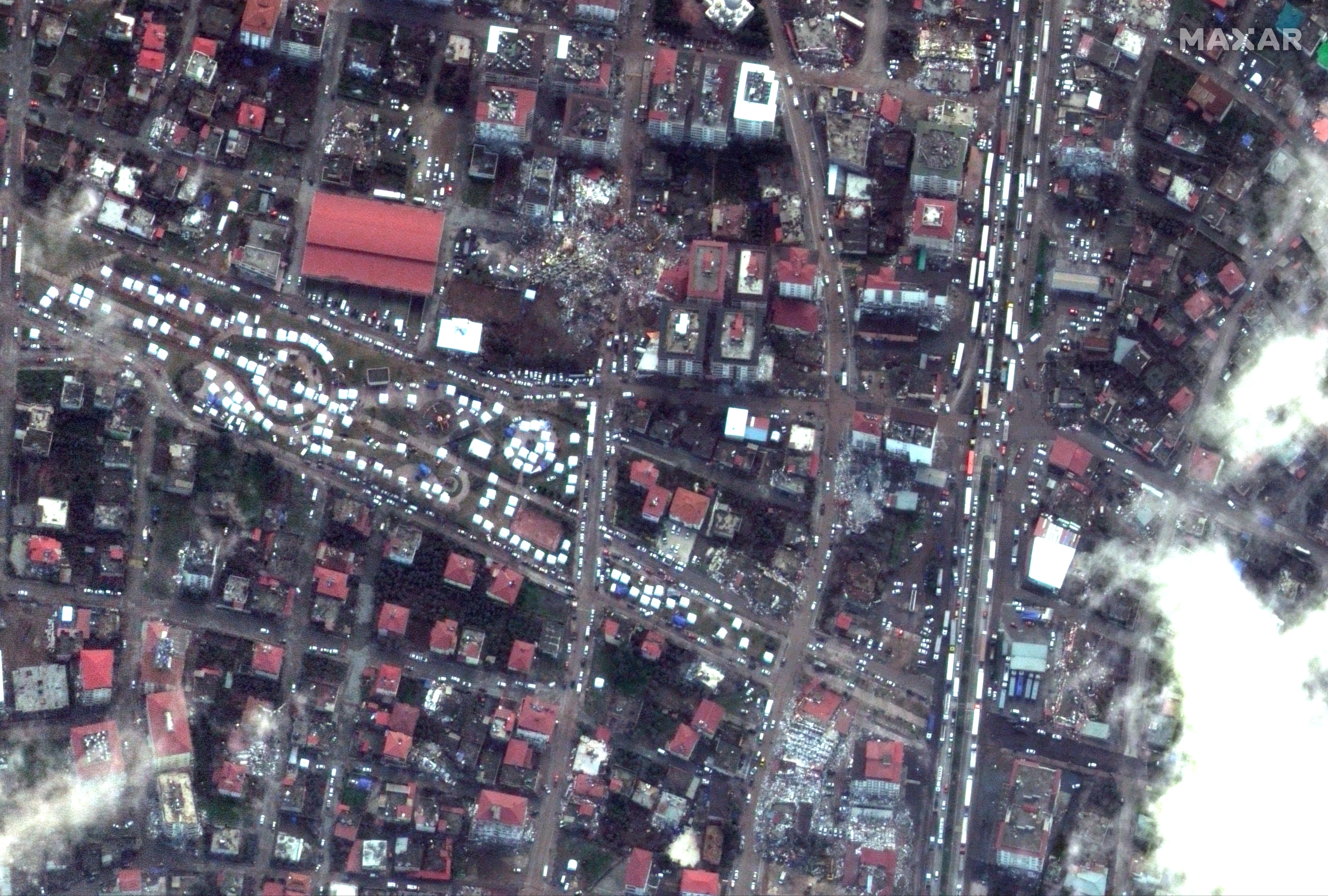
New satellite images show the extent of the destruction.
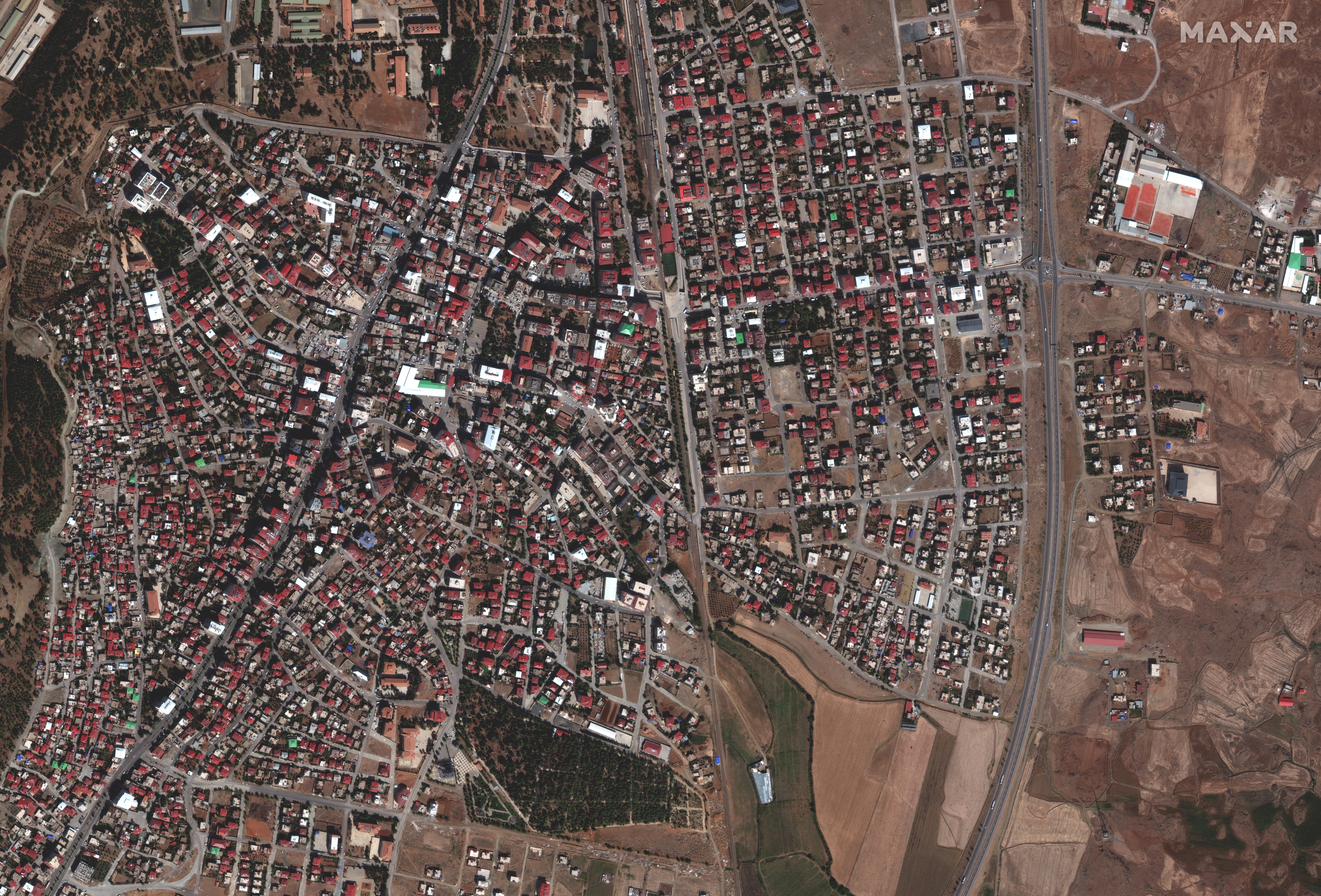
The images show detailed bird’s-eye views of three Turkish towns, Islahiye, Nurdağı and Düziçi after the earthquake struck.
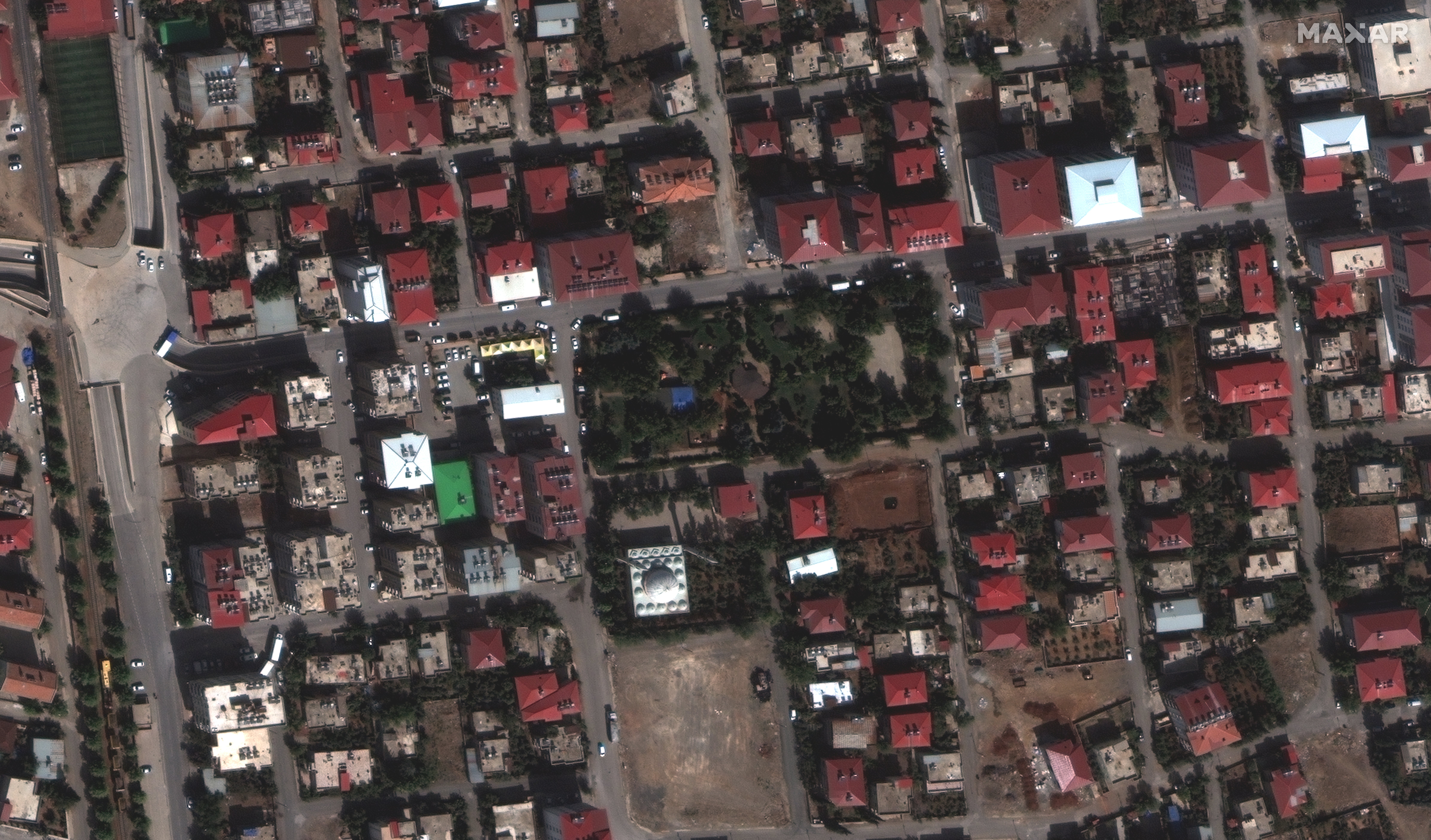
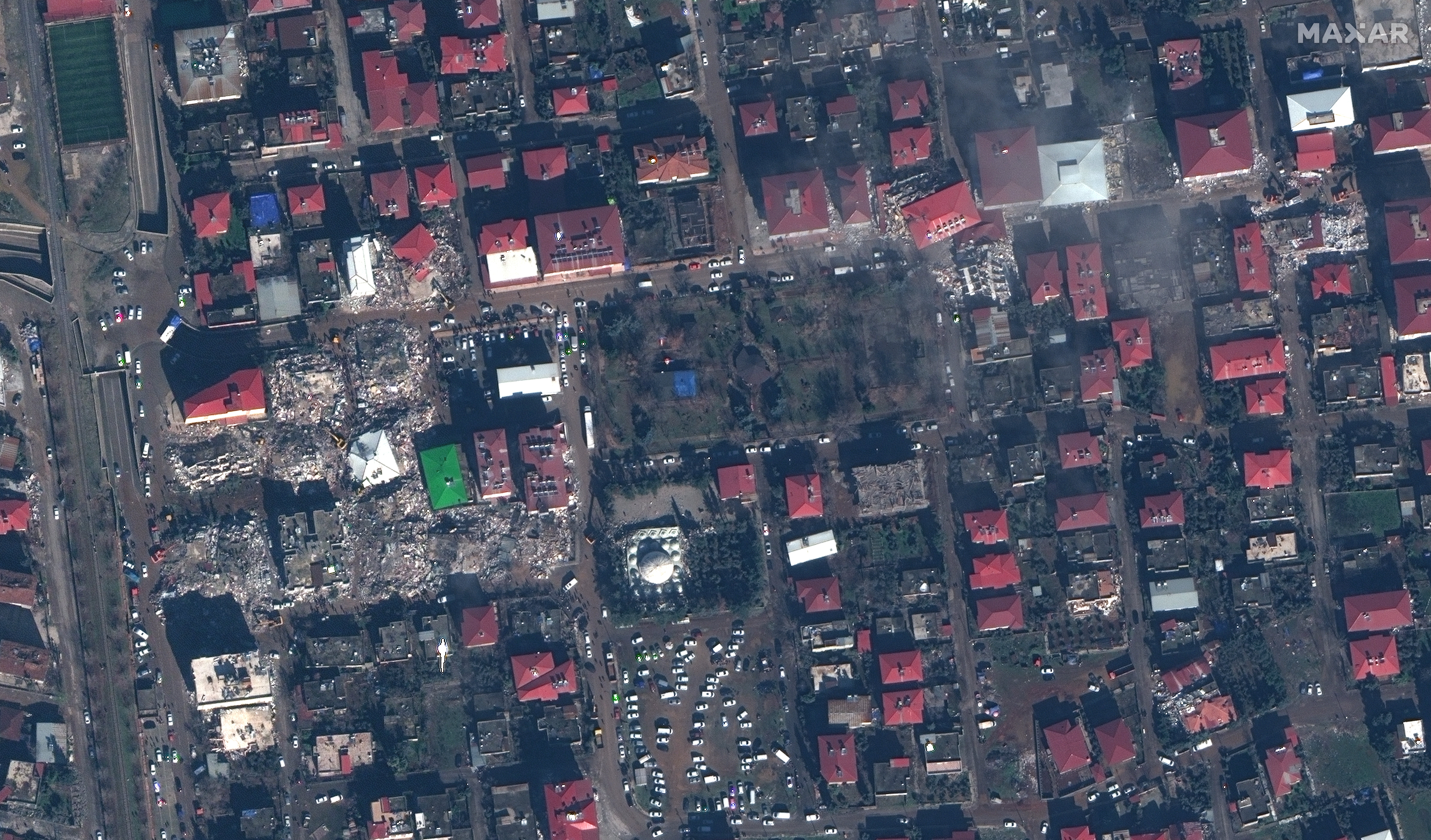
Images of the first two towns before the earthquakes struck allow for side-by-side comparisons of the towns before and after, emphasising the scale of the destruction. White emergency tents can be seen clustered along the roads and the few areas clear of debris.
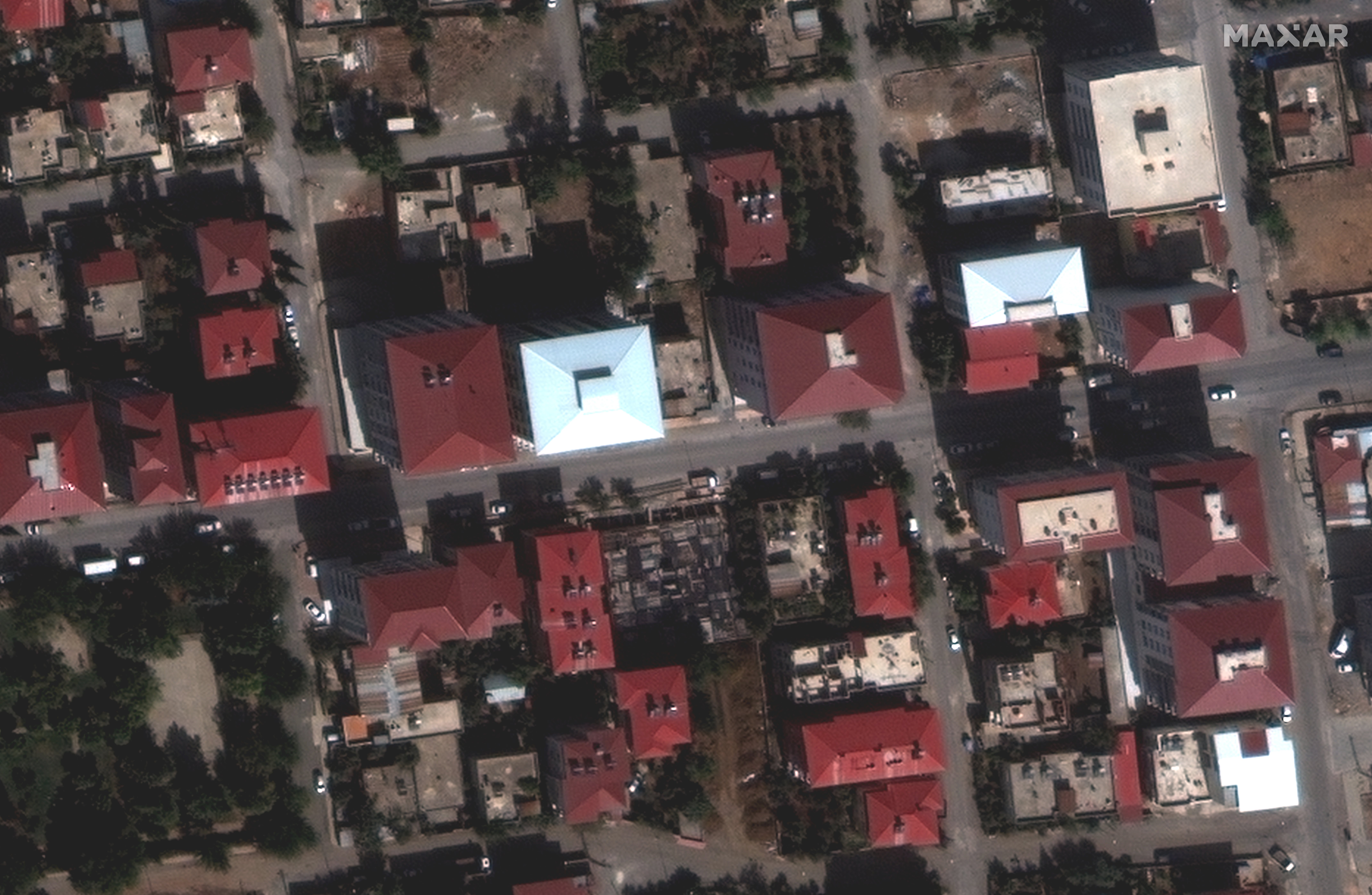
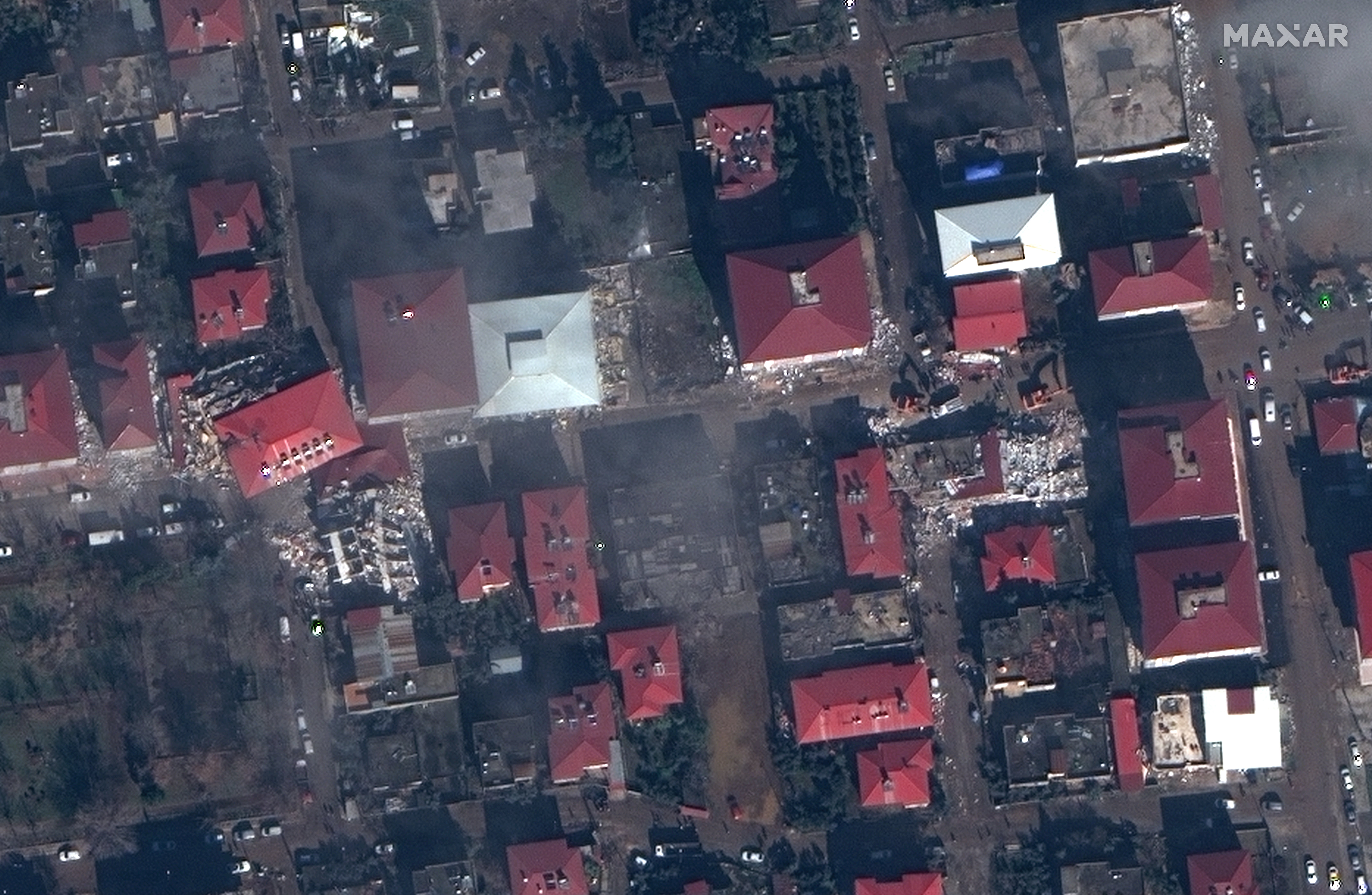
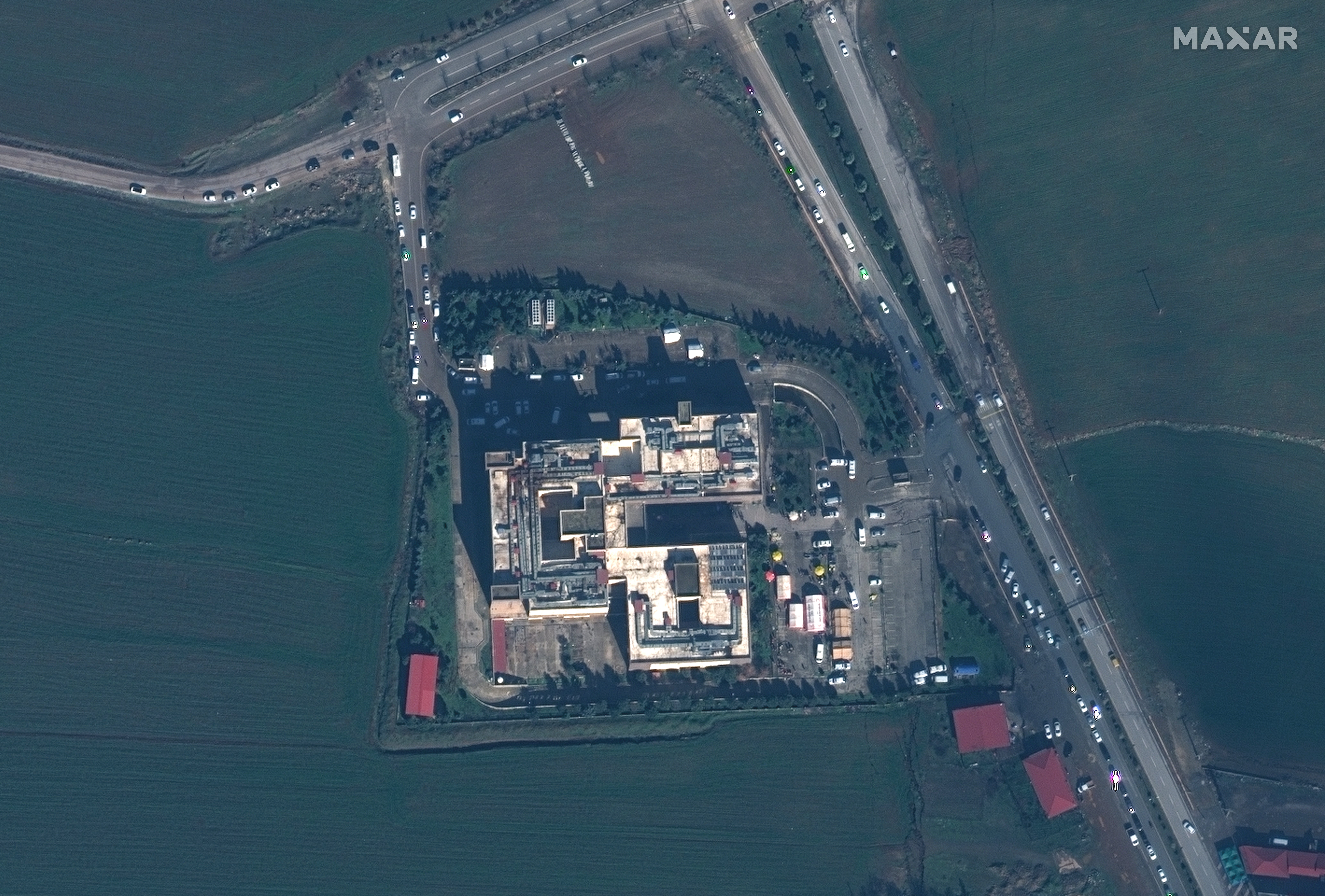
In another image, emergency tents can be seen set up outside the local hospital in Islahiye. However, reports on the ground say that hospitals are being overwhelmed as casualties come in faster than aid.
In the town of Nurdagi, what appears to be a residential area looks to have been hit. Houses and whole blocks of flats have either collapsed or been seriously damaged.
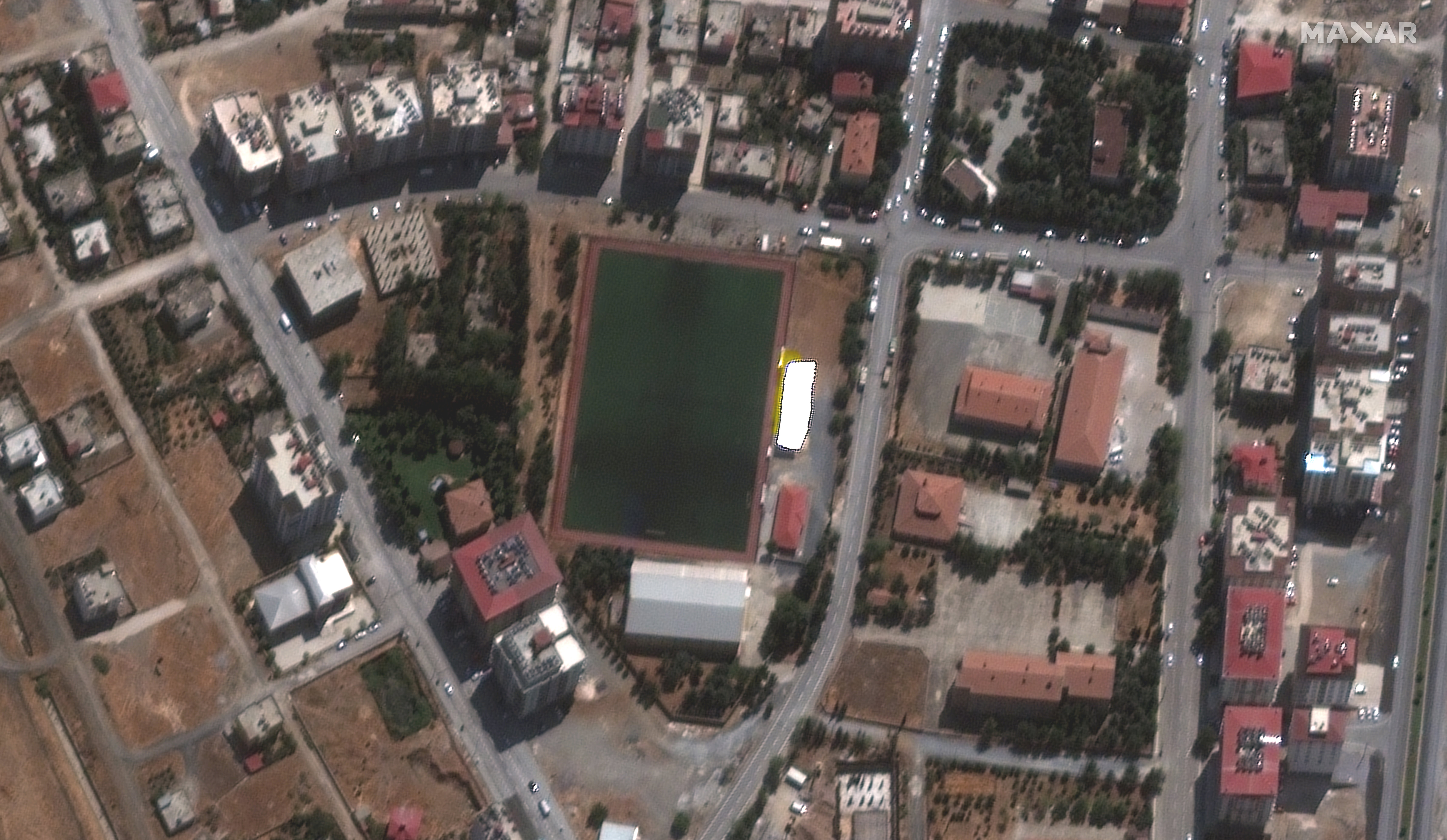
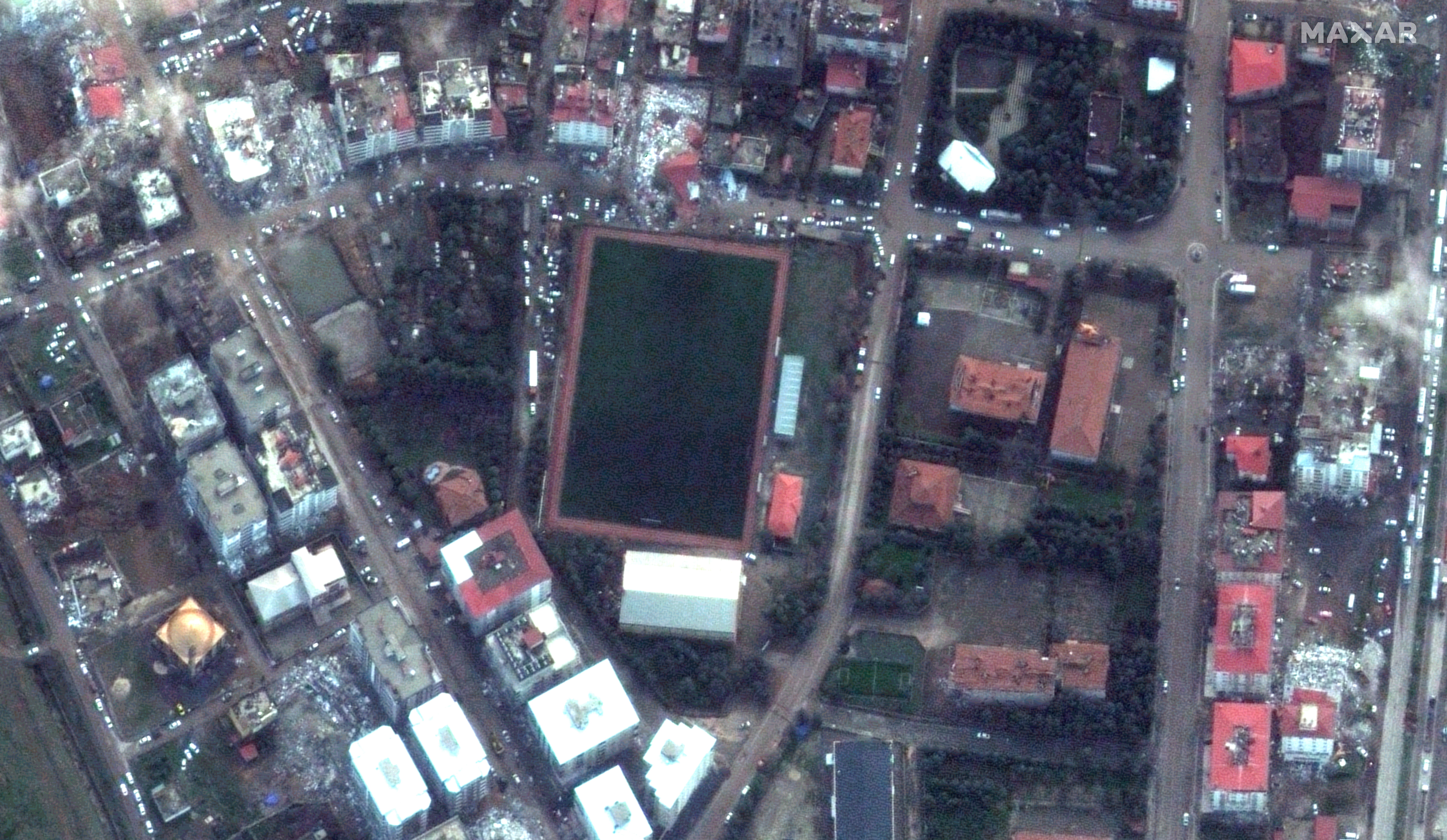
Debris from buildings is scattered across downtown Nurdagi.
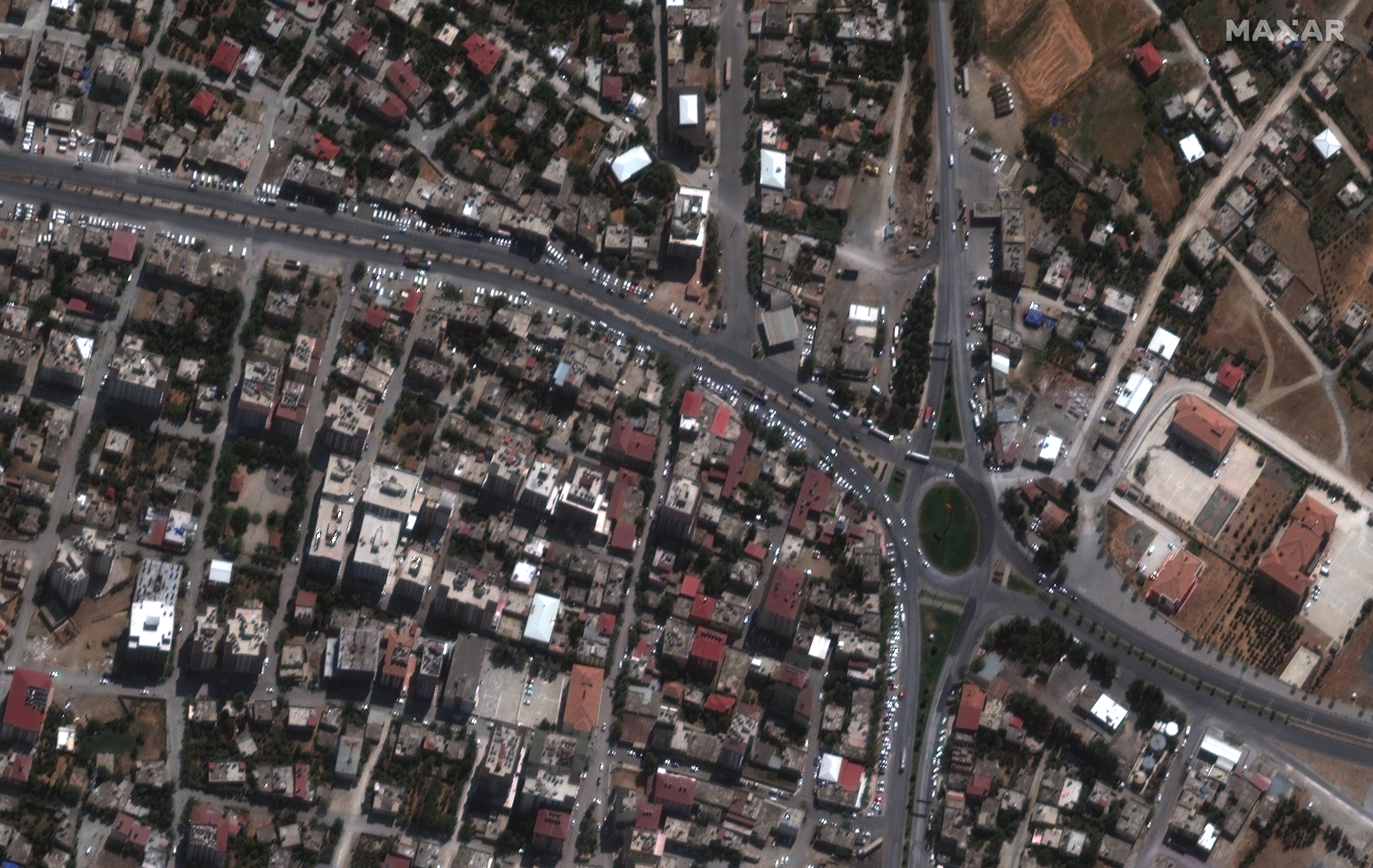
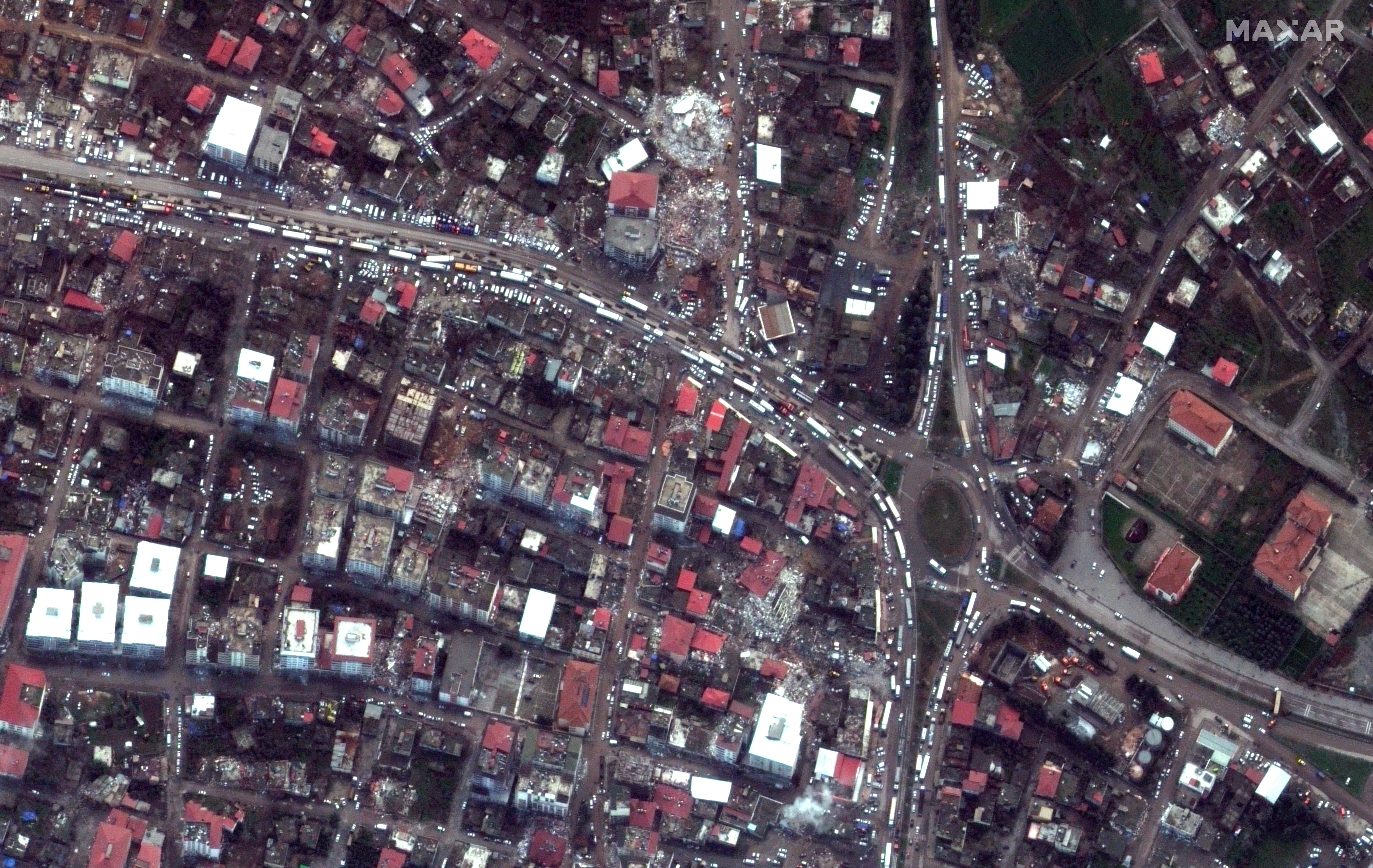
The images were taken by satellites owned by Maxar Technologies, a space technology company headquartered in Colorado, USA. While clouds and poor weather continue to affect the area, Maxar was able to capture these images that shed light on what’s happening on the ground.
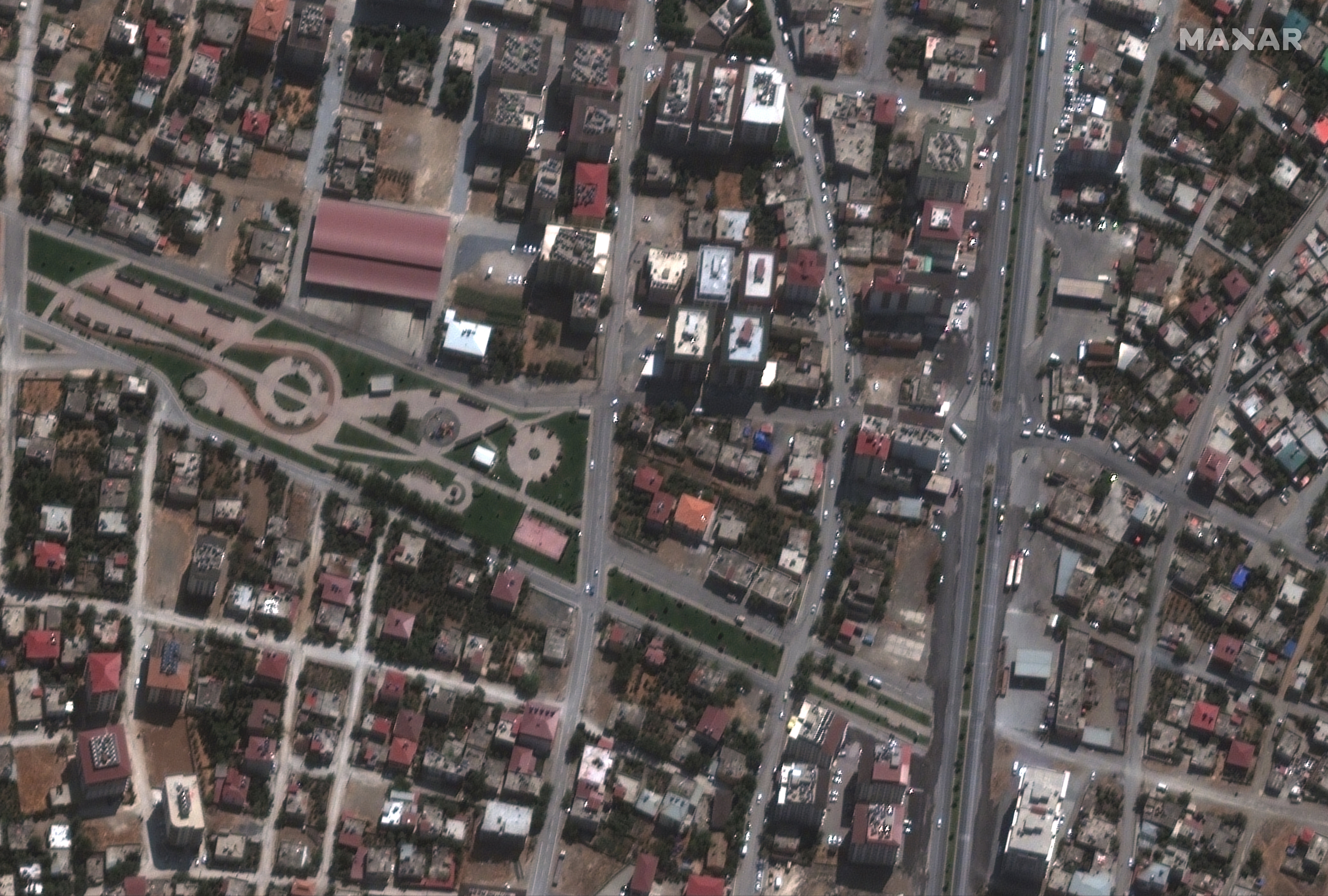
Maxar is continuing to monitor the region and will provide new updates as soon as they have additional imagery and information.

