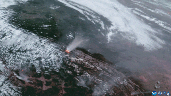
Quick-moving wildfires continue to burn across Western Canada, keeping the National Oceanic and Atmospheric Administration (NOAA)'s GOES-R series satellites busy as they monitor hotspots and smoke plumes around the clock.
On Wednesday evening (July 24) in Jasper National Park, the largest national park in the Canadian Rockies, thousands of residents and tourists had to be evacuated as powerful fires scorched through the southern part of the community. According to the Associated Press, there were "significant losses" across the area as structures were burned to the ground and other nearby towns were also forced to flee. These fires began on Monday (July 22) following a significant fire that also occurred in Western Canada on May 10; that fire, in British Columbia, expanded and burned more than 13,000 acres of land in just three days.
Firefighters, weather forecasters and community leaders rely on satellites to provide a wider scope of fire and smoke movement; they use images taken by the Advanced Baseline Imager (ABI) instrument aboard each of the GOES-R satellites to aid with such monitoring needs. Using different spectral bands, the wavelengths from each of these instruments' channels can pick up smoke signals and identify hotspots during a wildfire, pinpoint the locations of those signals, and produce powerful images to paint a picture in near real-time of the growth and/or demise of each event.
By combining these snapshots with ground observations from officials and firefighters, even wildfire and smoke forecasts can be significantly improved. This benefits firefighting efforts because it helps teams better understand each particular fire and also can help communities have more lead time to evacuate if a fast-moving blaze takes a quick turn when the winds shift or if new fires ignite from another's embers.
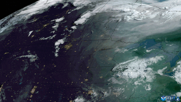
Wildfire smoke forecasts are also important for other parts of North America downwind of the plumes. By detecting the intensity and movement of the smoke, air quality alerts can be issued to help communities, especially in major cities, prepare for the incoming impacts that at times can last for days and cause health issues — particularly for those with respiratory issues.