LOS ANGELES — Heavy rain and damaging winds will gradually subside Wednesday as one of the wildest storms of the season makes its exit from the Golden State.
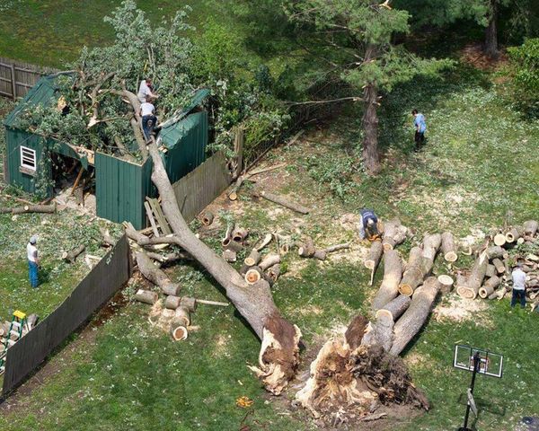
The remarkable “bomb cyclone” rocked the San Francisco Bay Area and Central Coast, killing at least one person and critically injuring several others as it felled trees and knocked out power to hundreds of thousands. The storm brought hurricane-force winds as it developed two “eyes,” or areas of low pressure, that swirled around each other in what is known as the Fujiwhara effect, meteorologists said.
“Wow. Even by the standards of what has turned out to be one of our most extraordinary winter seasons in a very long time, yesterday (Tuesday) stands out,” the National Weather Service said.
The strength of the storm, which brought wind gusts of up to 70 mph on the Monterey County coast and 80 mph in the mountains, caught even some meteorologists by surprise.
“From a large-scale picture, there was just a lot of potential energy to be converted over to energy and motion — or kinetic energy — and it just equated to a lot of wind and a fair amount of rain,” said Rick Canepa, a meteorologist with the National Weather Service in the Bay Area. “It just fully spun up and strengthened over our forecast area.”
As many as 244,000 customers were without power in the region Tuesday evening, according to Pacific Gas & Electric Co. Initial assessments found 42 damaged poles and 23 damaged transformers from the storm.
About 121,000 people remained without power statewide Wednesday morning, according to outage trackers.
The California Department of Transportation responded to “dozens and dozens” of reports of flooding, downed trees and power lines that snarled traffic, sometimes for hours as cars were stuck between two energized wires on the road, spokesman Kevin Drabinski said.
“We have five counties in our district,” he said of the area from Monterey to Santa Barbara. “There’s not one that wasn’t affected by flooding and downed trees — it’s just everywhere.”
Long stretches of Highways 9 and 236 in Santa Cruz County remained closed Wednesday as crews worked to clear the roads, he said.
The storm’s last gasp is expected to deliver more rain to the region through Wednesday night, but only about half an inch along the coast and valleys and an inch in the Santa Lucia and Santa Cruz mountains, Canepa said.
The chance of rain will diminish through the day as the storm loses energy and moves southeast.
But while stormy conditions are dissipating in the Bay Area, the Central Valley is bracing for more rain and potential flooding as the system tracks in its direction. A flood watch is in effect for a large swath of the region spanning from Merced to Bakersfield and San Luis Obispo.
The weakened system could still deliver strong thunderstorms south of Fresno County, along with an additional half-inch of rain in the San Joaquin Valley and an inch in the Sierra Nevada foothills, said Bill South, a meteorologist with the weather service in Hanford. Two additional feet of snow are possible at elevations above 6,000 feet.
The flood watch has less to do with precipitation totals than with “what happened leading up to this event,” South said, including heavy rainfall and low-elevation snowmelt.
“Many of the rivers, streams and creeks are running at capacity right now, or just below capacity, so any additional rainfall today is going to cause additional flooding, or worsen ongoing flooding,” he said.
Tulare County officials estimate about 10,000 acres of the county are underwater due to the recent snowmelt and storms, he added.
Videos shared by San Joaquin Valley news outlet SJV Water show the low-lying area of Corcoran in nearby Kings County transformed into a “sea.”
Thousands of people remain under evacuation orders in Tulare County, where officials continue to monitor high levels on the Tule River and release water from Lake Success. Nearly 24,000 structures in the area are threatened, said Daniel Potter, spokesman for the California Department of Forestry and Fire Protection, which is assisting with emergency response in the area.
Potter said crews have been able to patch most of the levee breaks that sent floodwaters rushing into the area, and will be patrolling Wednesday as the storm brings more rain before gradually drying out overnight.
Southern California is also bracing for more rainfall after a wet and stormy day Tuesday set daily rainfall records in the area, including 1.53 inches at Long Beach Airport, which surpassed the previous record of 0.82 inches set in 1983.
Downtown Los Angeles received 1.43 inches, breaking its 130-year record of 1.34 inches set in 1893.
The region largely fared better than the Bay Area, although roadway flooding, debris flows and strong winds were reported.
However, flood watches will remain in effect through Wednesday afternoon in areas ranging from Oxnard to San Diego, including much of the L.A. Basin. Isolated showers and a brief chance of thunderstorms are expected to wane as the day goes on.
High temperatures in Los Angeles are expected to stay in the 50s — about 12 to 18 degrees below normal.
A winter storm warning is also in effect in the San Bernardino mountains until 5 a.m. Thursday, where 60 mph wind gusts and up to 14 inches of fresh snow are possible. Blizzard conditions there earlier this month trapped scores of residents and resulted in more than a dozen deaths.
The rest of the week should be chilly and dry, forecasters said, but there is a chance for more rain to develop across the state as early as Monday.


