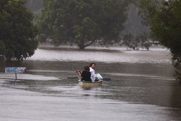
Supplied: Australian Defence Force
)It's been called many things. A "once-in-100-year flood", "unprecedented" and "chaotic".
Thousands of people were ordered to evacuate, a home floated down the Manning River on the Mid-North Coast and one person died after becoming trapped in their car in Sydney's north-west.
So how do NSW's most recent floods stack up against others in the state?
Experts say what makes this flood event a stand-out is the vast area affected.
"Its just the sheer scale of having it from the border all the way down south of Sydney and now heading west as well," said Fiona Johnson, a hydrologist from the water research centre at UNSW.
This map from the Bureau of Meteorology (BOM) of rainfall over the last week tells the story.
ABC News: Bureau of Meteorology
)The entire NSW coast has been drowned by at least 200 millimetres, and in some places, more than 400mm of rain.
To put that in context, Sydney averages 132mm of rain for the whole month of March.
Flooding stretches 600 kilometres from Sydney to the Northern Rivers.
Supplied: UNSW
)The BOM's Victoria Dodd said the state had experienced "the most significant floods … in decades".
"We've seen exceptionally high flood levels, high-velocity flows, lots of dangerous debris in these floodwaters."
NSW has 40 river catchments, half of which flow east to the coast.
On Wednesday, the BOM had issued flood warnings on 33 rivers.
The three largest coastal catchments, the Hawkesbury-Nepean, Clarence and Hunter rivers, are all flooded.
Tens of thousands of people were ordered to evacuate from the Hawkesbury-Nepean River area in Sydney.
The valley, which has a catchment of 21,400 square kilometres, has experienced 130 moderate to major floods since records began in the 1790s.
AAP: Dean Lewins
)On Wednesday, the Hawkesbury River at Windsor peaked at 12.9m above sea level.
While some have labelled it a one-in-100-year flood, Dr Johnson said that does not mean the next one will be in 100 years.
"What we're actually looking at is what is the probability this flood will occur in any particular year? That's 1 per cent, so that's one in 100."
ABC News: Tim Swanston
)Supplied: Hawkesbury Library Service
)This year's peak on the Hawkesbury River corresponds to a flood risk of a 1 in 10 chance per year.
It is not as high as the 14.5m peak in 1961 (1 in 50 chance) — the highest in living memory — which was eclipsed by the 19m peak in 1867 (1 in 200 chance).
Back in 1986, the Hawkesbury River topped the major flood mark of 12.2m. Six people died and the flood caused $35 million worth of damage (in 1986 dollars).
Dr Johnson said an unusual feature of this month's flood event was that the heavy rain persisted for five days.
"Rainfall of 200mm in one day is rare. It might occur once every 10 or 20 years, but when you look at the five-day total, that's unprecedented," she said.
Another factor is that this is a La Niña year, where cooler than average sea surface temperatures in the Pacific Ocean bring above average rainfall across Australia.
There have been 18 La Niña phases in Australia since the beginning of the 20th century, but this time around the rain is falling on earth that is already sodden from a La Niña year that began last spring.
Records fall on Mid-North Coast
At Mount Seaview, in the hills west of Port Macquarie, rainfall records have been smashed in the past week, with 815 mm falling over five days.
It's the highest total since records began there in 1960.
Rainfall from the mountain flows into the Hastings River, which meets the sea at Port Macquarie on the Mid-North Coast.
Thousands of people were evacuated from the area in the past week.
Supplied: Cara Starr
)Supplied
)Further up the coast at Nambucca Heads, the community was one of the first in NSW to be hit with flooding last Saturday.
The Nambucca Valley catchment is 1400 square kilometres, one of the smallest in NSW.
"If you have a small catchment, it's the rainfall that falls over a few hours that will give you the worst floods," Dr Johnson said.
ABC News: Claudia Jambor
)That's exactly what happened at Nambucca Heads on Saturday, when 350mm of rain fell, swamping the March average of 161mm.
Between 8:00am and 9:00am last Friday alone, 84mm of rain fell.
At 9:30am, the NSW SES advised residents upstream at Macksville to evacuate, and by 4:00pm, the river there had exceeded the major flood level of 2.6m.
That is not quite at the level of a one-in-20-year flood.
The river at Macksville has exceeded the major flood level nine times since the 1890s, reaching 3.4 metres in 1950 — a one-in-50-year flood.
Water spread through the main streets, flooding properties with more than half a metre of water.
Grafton, on the Clarence River in northern NSW, also flooded this time too, though levee banks have helped to contain the waters.
Supplied: Buck Buchanan
)The town is no stranger to floods — it has had 120 of them since records began in 1839.
The worst was in 2013, when the Clarence peaked at 8.08m, a one-in-27-year flood.
This time, the Clarence River peaked at 6.5 m at 11:00pm on Wednesday, around a one-in-seven-year flood.
The town of Grafton has been largely protected from floods since a levee was built around the town in the 1970s, but the problem, according to Dr Johnson, is that the city has continued to develop outside the levee.
"The point is you can never flood-proof anything, you can only reduce the risk," she says.
Editor’s Note 30/3/21: This story has been updated to remove an incorrect claim that the Hawkesbury River peak of 12.9 metres was the highest level the river had reached in 60 years.


