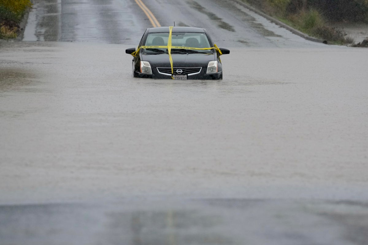
A major storm continued to drop heavy snow and record rain Friday as it moved through Northern California, closing roads and prompting evacuations in some areas, after killing two people and knocking out power to hundreds of thousands in the Pacific Northwest.
Forecasters warned the risk of flash flooding and rockslides would continue, and scores of flights were canceled at San Francisco's airport.
In Washington state, more than 185,000 people — mostly in the Seattle area — remained without power as crews worked to clear streets of electrical lines, fallen branches and debris. Utility officials said the outages, which began Tuesday, could last into Saturday. The National Weather Service warned that in addition to gusty winds, a high surf advisory was in effect Friday for large ocean waves of 20 to 24 feet (six to 7.3 meters) that may cause significant beach erosion.
Meanwhile on the East Coast, where rare wildfires have raged, New York and New Jersey welcomed much-needed rain that could ease the fire danger for the rest of the year.
The National Weather Service extended a flood watch into Saturday for areas north of San Francisco as the region was inundated by this season's strongest atmospheric river — a long plume of moisture that forms over an ocean and flows through the sky over land.
Flooding and road closures were reported in the North Bay, and the weather service warned area residents throughout the area to expect disruptions during the morning and afternoon commutes on Friday. Rain rates have increased and shifted southward along the San Francisco Peninsula to the Santa Cruz Mountains with rain gauges reporting a few tenths to 1 to 2 inches (2.5 to 5 centimeters) so far, the weather service said early Friday.
In Humboldt County, the sheriff’s office issued evacuation orders and warnings and urged residents to prepare for storm impacts throughout the week. Flooding closed Highway 1, also known as the Pacific Coast Highway, in Mendocino County north of Point Arena near the Garcia River and there was no estimate for when it would reopen, according to the California Department of Transportation.
The system roared ashore Tuesday as a “ bomb cyclone,” which occurs when a cyclone intensifies rapidly. It unleashed fierce winds that toppled trees onto roads, vehicles and homes, killing at least two people in Washington.
Communities in Washington opened warming centers offering free internet and device charging. Some medical clinics closed because of power outages.
“I’ve been here since the mid-’80s. I haven’t seen anything like this,” Trish Bloor, a city of Issaquah official, said while surveying damaged homes.
Up to 16 inches (about 41 centimeters) of rain was forecast in southwestern Oregon and California's northern counties through Friday.
Santa Rosa saw 6.5 inches (16.5 centimeters) of rain in the last 24 hours, marking the wettest day on record since 1998.
The Sonoma County Airport, in the wine country north of San Francisco, got more than 11 inches (28 centimeters) within the last 48 hours and the unincorporated town of Venado had about 12.7 inches (32.3 centimeters) in the same period.
Flash flooding, rockslides and debris flows were possible, especially where hillsides were loosened by recent wildfires, officials warned. Scott Rowe, a hydrologist with the weather service in Sacramento, said so far the ground has been able to absorb the rain in areas where the Park Fire burned this summer.
“It’s not necessarily how much rain falls; it’s how fast the rain falls,” Rowe said.
A winter storm watch was in place for the northern Sierra Nevada above 3,500 feet (1,070 meters), with 15 inches (38 centimeters) of snow possible over two days. Wind gusts could top 75 mph (121 kph) in mountain areas, forecasters said.
In California, there were reports of more than 12,000 power outages.
Authorities limited vehicle traffic on part of northbound Interstate 5 between Redding and Yreka due to snow, according to California's Department of Transportation. Officials also shut down a 2-mile (3.2-kilometer) stretch of the scenic Avenue of the Giants, named for its towering coast redwoods, due to flooding.
More than 40 flights were delayed and about 12 were canceled early Friday at San Francisco International Airport, according to tracking service FlightAware.
The Northeast, meanwhile, got a much-needed shot of precipitation, providing a bit of respite in a region plagued by wildfires and dwindling water supplies. More than 2 inches (5 centimeters) was expected by Saturday morning north of New York City, with snow mixed in at higher elevations.
Weather service meteorologist Brian Ciemnecki in New York City, which this week saw its first drought warning in 22 years, said “any rainfall is going to be significant” but the storm won't be enough to end the drought.
___
Har reported from San Francisco and Weber from Los Angeles. Associated Press writers Hallie Golden and Gene Johnson in Seattle; Martha Bellisle in Issaquah, Washington; Sarah Brumfield in Washington, D.C.; and Michael Hill in Albany, New York, contributed.


