New evidence from Mars suggests that the Red Planet may have had liquid water flowing through its surface for about a billion years longer than previously thought, which may increase the chances of its past habitability.
Using data from Mars Reconnaissance Orbiter, a team of scientists from Caltech discovered that surface water left salt minerals behind on Mars’ surface as recently as 2 billion years ago. Planetary scientists previously believed that the planet’s water had evaporated about 3 billion years ago, resulting in the barren, frigid world that it is today.
However, this latest research suggests Mars had flowing water on its surface for a significantly longer period.
The team published its findings in the journal Advancing Earth and Space Science.
WHAT’S NEW — NASA's Mars Odyssey orbiter, which has orbited Mars since 2001, found hundreds of sodium chloride (or table salt) deposits that stretch tens to hundreds of square kilometers across Mars’ surface.

The salt minerals were first discovered in 2008, and scientists have been trying to determine how and when they formed to learn more about Mars’ wet past.
“Salt is incredibly soluble, so any moisture at all would dissolve it,” Ellen Leask, a postdoctoral scholar at Johns Hopkins University’s Applied Physics Laboratory and lead author of the study, said in a statement. “As such, these deposits must have formed during the evaporation of the last large-scale water on the planet.”
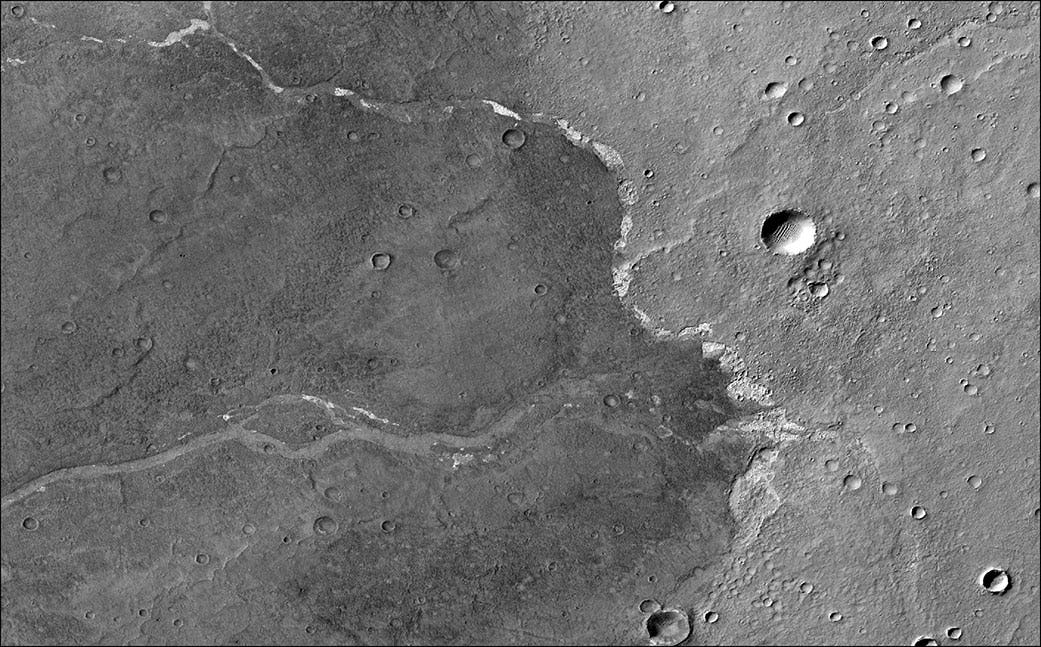
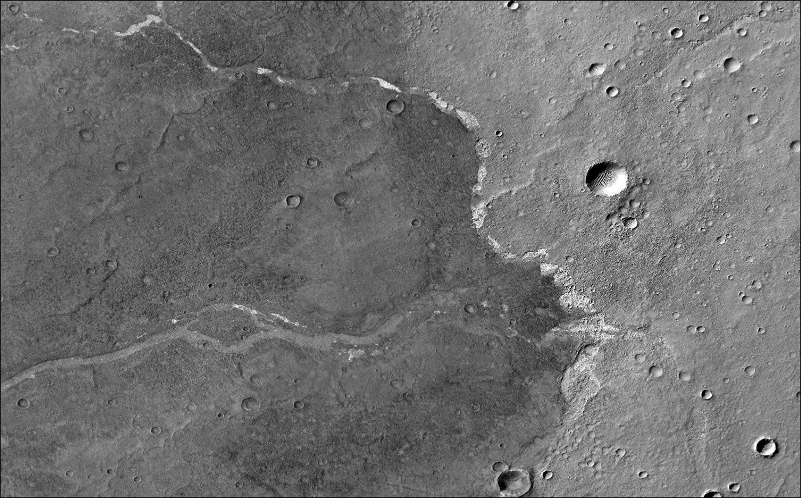
While images of Mars revealed the shapes of valleys carved out across its surface were indicative of water that flowed on the Red Planet, the discovery of the salt deposits was the first mineral evidence that confirmed the presence of liquid water.
The team behind the new study used data from the MRO’s Compact Reconnaissance Imaging Spectrometer for Mars (CRISM) instrument to map the chloride salts across Mars’ southern hemisphere.
This area has impact craters, and planetary scientists use the impact craters to date terrains. The fewer craters a terrain has, the younger it is.
They found that the salt deposits were surprisingly thin, measuring at less than 3 meters, and formed in shallow depressions on gently sloping volcanic plains that had formed as recently as 2.3 billion years ago.
“The closest analog we can find on Earth are chains of lakes that you get in Antarctica when snow melts seasonally atop permafrost,” Bethany Ehlmann, a Caltech professor of planetary science and co-author of the study, said in a statement. “It cannot penetrate deep into the frozen ground below, so when water evaporates, the salt deposit left behind is thin.”
Following their analysis, the team behind the study was able to date the salt deposits, determining that water was still present on Mars as recently as 2 to 2.5 billion years ago.
WHAT’S NEXT — As different missions work together to understand Mars’ past, each provides the groundwork for future investigations.
NASA’s Perseverance rover is currently roaming on Mars, collecting samples for a future sample return mission to Earth that could unlock the mystery of life on the Red Planet.
“This offers us new targets for future missions to Mars,” Leask said. “Some of these deposits are on terrain that’s a billion years younger than the ground the Perseverance Rover is rolling across right now, really extending our idea of when water last flowed across the Martian surface.”
Abstract: We determine the environmental setting and timing of enigmatic large-scale chloride deposits on Mars, examining all available high-resolution imagery globally, building digital elevation models, surveying targeted infrared images intersecting chloride deposits for accessory minerals (e.g., clay, carbonate, and sulfate), and performing crater counting for age-dating when possible. We find that chloride deposits are commonly draped atop underlying topography, often associated with channels, sometimes perched above deep craters in local topographic lows, and span a wide range of elevations. Where measurable, chloride deposit thicknesses are typically <3 m. The deposits range in elevation over tens of meters, inconsistent with previous hypotheses of playa-like environments, which are very flat. Chloride deposit elevations within larger basins are typically asymmetric with chloride deposits much higher on the inlet channel side, indicating that (a) surface water runoff was the most likely water source and (b) the basins were likely not filled completely with water in a deep lake setting but rather chlorides formed within a series of shallow ponds. Mass balance allows local sourcing from mobilization of cations and chlorine from dust/soil. Though prior global-scale studies report chloride deposits superimposed on Noachian terrains, crater-counting of local, stratigraphically-associated datable surfaces shows chlorides superimposed on 3.4–2.3 Ga volcanic terrain. This indicates that surface waters forming chloride deposits continued through the Hesperian and into the Amazonian, making them among the latest-formed, large-scale deposits of water-related minerals on Mars. Collectively, data suggest formation from meltwater from episodic ice/snow deposits continuing until 2.0–2.5 Ga.


