Winter has ended in Australia with weather records broken across the country – with expectations of August temperature records being broken on the final day of the month.
Amid wild winds in the country’s south, a warm run of weather was expected to continue through the weekend in central and southern Queensland, along with north-eastern New South Wales. Brisbane is expected to see multiple days of over 30C.
The Bureau of Meteorology forecast that temperatures were expected to reach 34C on Saturday and Sunday in the Queensland capital, although Brisbane city recorded a maximum temperature of 32.9C on Saturday. Monday’s maximum was forecast to be 33C, before temperatures cool through the end of next week.
Senior meteorologist Sarah Scully said some locations may have seen their warmest August day since 2009 on Saturday.
“So many, many locations are likely to see their warmest August maximum temperature since 2009 and several may set new August records today,” she said.
“These warm temperatures are expected to persist for the next few days, before cooling off a little on Tuesday as this southerly change moves through.”
Towns in the north-east of NSW, including Ballina, Grafton and Lismore, were also expected to face weekend maximums of more than 30C.
However, the Bom has also issued severe weather warnings for damaging winds across Victoria and Tasmania on Saturday, with gusts of more than 130 km/h recorded at multiple locations.
On Monday, Australia recorded its highest winter temperature on record - 41.6C at Yampi Sound, off Western Australia’s northwest coast.
Sydney hit 30C in winter for just the third time since records began in 1858, and parts of Sydney recorded their hottest winter temperature.
Sydney Airport broke its winter record of 31.1C on Friday, hitting 31.6C at 2:48pm.
On the same day, Birdsville, in Queensland’s west, recorded the state’s hottest winter temperature on record – 39.7C – about 15 degrees above average.
Alice Springs set a new winter temperature record – 36.6C – a winter day that was hotter than the average maximum in January, that city’s hottest month.
Many parts of Western Australia registered their wettest and warmest winters on record.
“Across various locations, multiple records are set to be broken, both for the season and month, for both temperature and rainfall,” Quincy Tut wrote on Weatherzone.
“Perth Airport looks set to experience its warmest winter temperature average of just over 15C in its 80 years of records, about 1.6C above the long-term average.
“The site also experienced the most winter rain days (58) since 1996, and most August rain days (12) since 1955.”
Across the country this winter, temperatures soared above long-term averages. The national mean temperature was 0.7C above the 1961-1990 baseline long-term averages for June and July.
And it appears almost certain that Australia will have its warmest August on record, given record-breaking temperatures recorded across the country, across the month.
All of Australia’s capital cities have been significantly warmer than average by day and by night throughout the month of August.
The extraordinary run of warm weather has wreaked havoc with Australia’s ski season.
Snow depth in Australia’s alpine region – as officially measured by SnowyHydro in NSW – has been the second-lowest August depth on record, at 66.2 cm on 28 August.
The figure was just over half the season peak of 124.6cm recorded in the last week of July, showing a precipitous decline caused by a combination of warm temperatures, strong wind and rain.
Victoria’s Mt Buller resort will close its ski season a month ahead of schedule on Sunday, citing wild weather and declining snow cover.
“A fortnight of gale force winds, rain and wild weather has dramatically reduced the snow cover across most of the ski area,” a statement said.
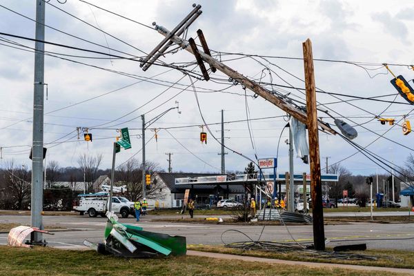
At the same time as the north of Australia sweltered, destructive gale-force winds buffeted Tasmania, South Australia and Victoria.
A 156kmh gust was recorded in the state’s northwest on Saturday morning.
On the south coast, Maatsuyker Island recorded a gust of 165kmh, about as strong as a category three tropical cyclone, the Bureau of Meteorology said.
Senior meteorologist Alex Melitsis warned strong winds were expected to return with force after a brief lull, threatening further damage.
“We’re very used to strong winds at this time of year but this is quite a rare event … and we’ll see impacts and damage tonight that we don’t usually see,” he told reporters Saturday.
Flooding also remains a danger after heavy rain in recent weeks.
“The catchments are quite saturated and we’re starting to see some pretty strong river rises and flows,” Melitsis said.
Tasmanian SES executive director Mick Lowe said volunteers had responded to 167 requests for assistance since Wednesday.
He urged the public to monitor conditions, avoid flood waters and prepare for further strong winds.
“It’s going to be a really dangerous period we’re coming up to over the next 24 hours,” he said.
Several rivers in Tasmania threaten moderate flooding that could cut off main roads and isolate or inundate nearby homes.
Residents in the north of the state have been advised to monitor conditions with flooding along the North Esk River in Launceston, as well as on the Meander River to the city’s west.
Further south, similar warnings are in place along the River Derwent, with moderate flooding likely in Meadowbank and Macquarie Plains, northwest of Hobart.
Power operator TasNetworks has reconnected about half of the 12,000 customers who experienced outages on Saturday morning but thousands remain disconnected.


