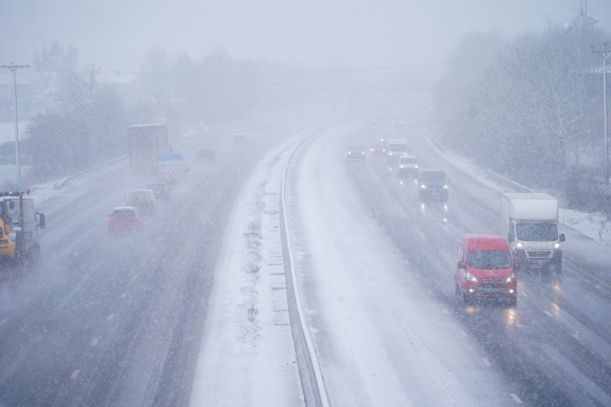
New maps have revealed where snow will fall as the UK is gripped by freezing temperatures.
As temperatures continue to plummet amidst the Arctic blast, areas across the UK have been swept by snow and ice, with the Met Office issuing weather warnings across England, Scotland, Wales and Northern Ireland.
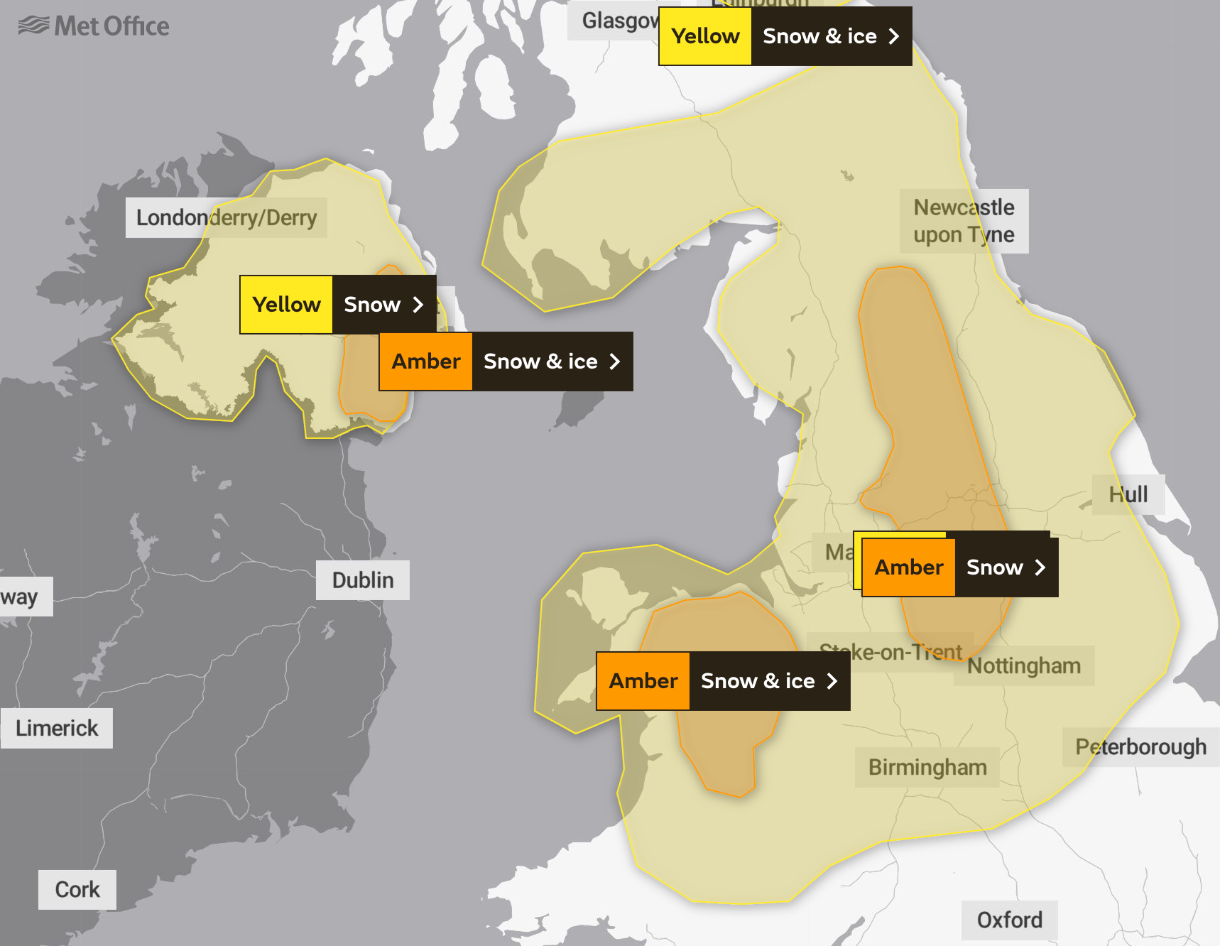
All areas north of Birmingham have been issued with a combination of yellow and amber warnings. Following snowfall across northern England on Thursday morning, snow will continue to fall throughout the afternoon and overnight into early Friday morning.
10-20cm of snow is anticipated to fall in areas with amber warnings issued, including parts of Manchester and Stoke-on-Trent. Strong, easterly winds will also accompany snowfall, facilitating blizzards which will likely drift existing snow.
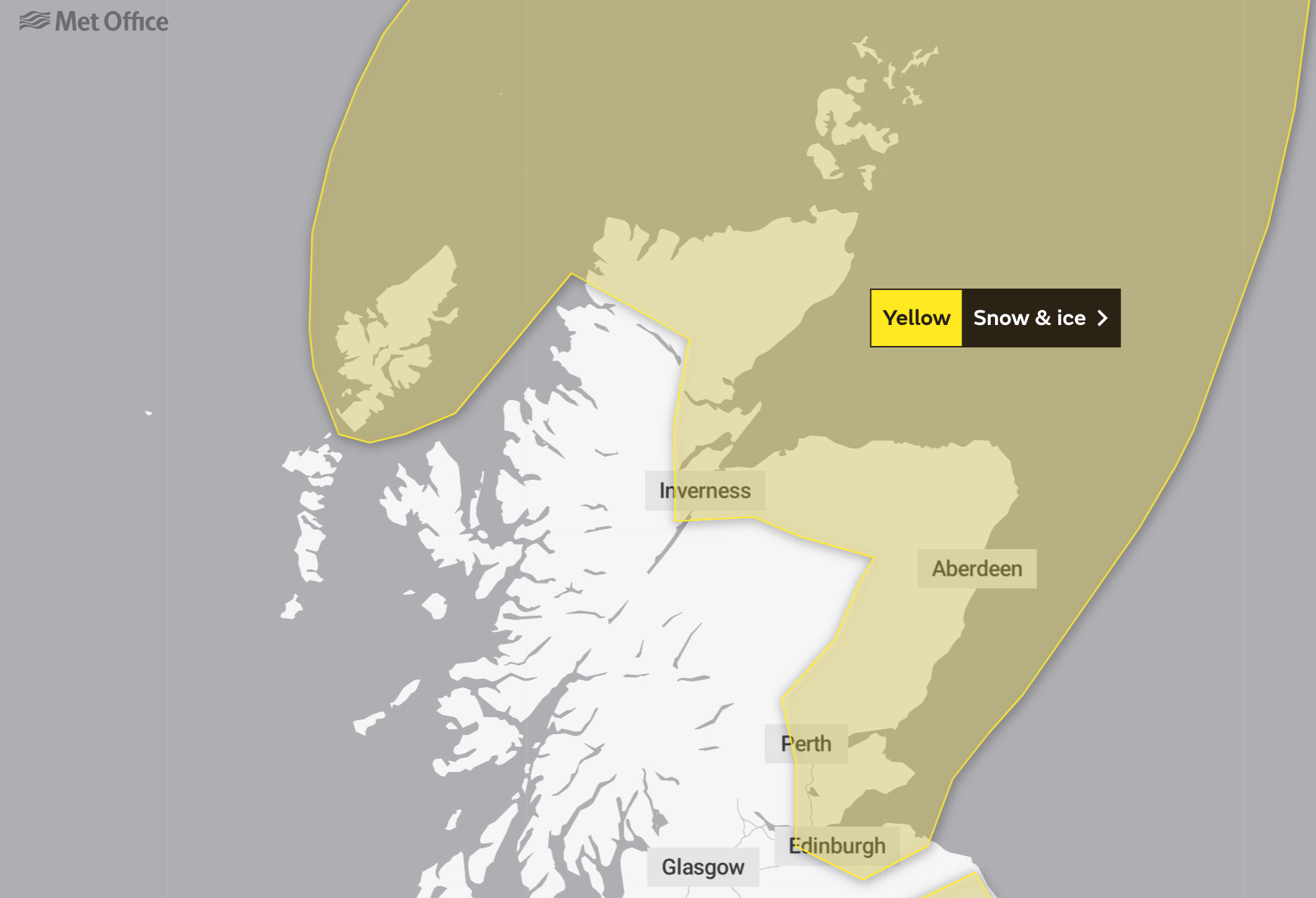
Elsewhere, yellow warnings have been issued amidst northern and eastern Scotland as snow and hail showers will continue to fall. This warning has been set between 17:00 on Thursday and 10:00 on Friday, with roads and railways likely to be impacted.
In these areas, the Met Office has predicted between two and five centimetres of snow. Icy stretches are expected on untreated roads, particularly during the evening and nighttime amidst the darkness.
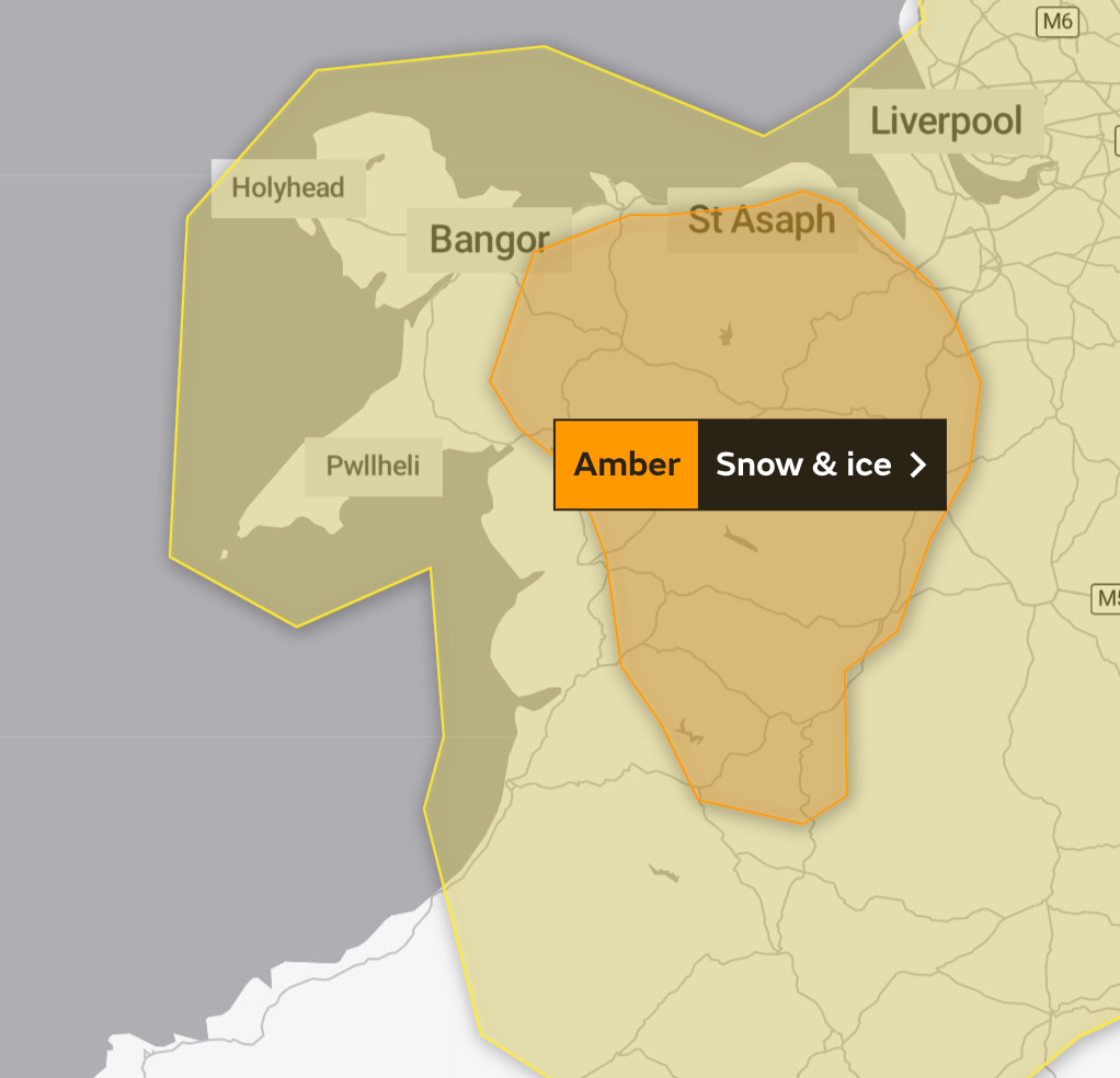
Much of north Wales has also been issued with a yellow warning, in place from 07:00 on Thursday until 14:00 on Friday. The Met Office has advised that snowfall could transition into sleet or rain, particularly in the south of the warning area and the eastern coasts.
Manchester, Liverpool and Newcastle, though covered by the yellow warning, are not expected to have heavy snowfall with between two and five centimetres.
Across northern England, “significant accumulation” – of between 10 and 15 centimetres - is anticipated across hilly areas including South and West Yorkshire, extending to Northern Ireland and southern Scotland.
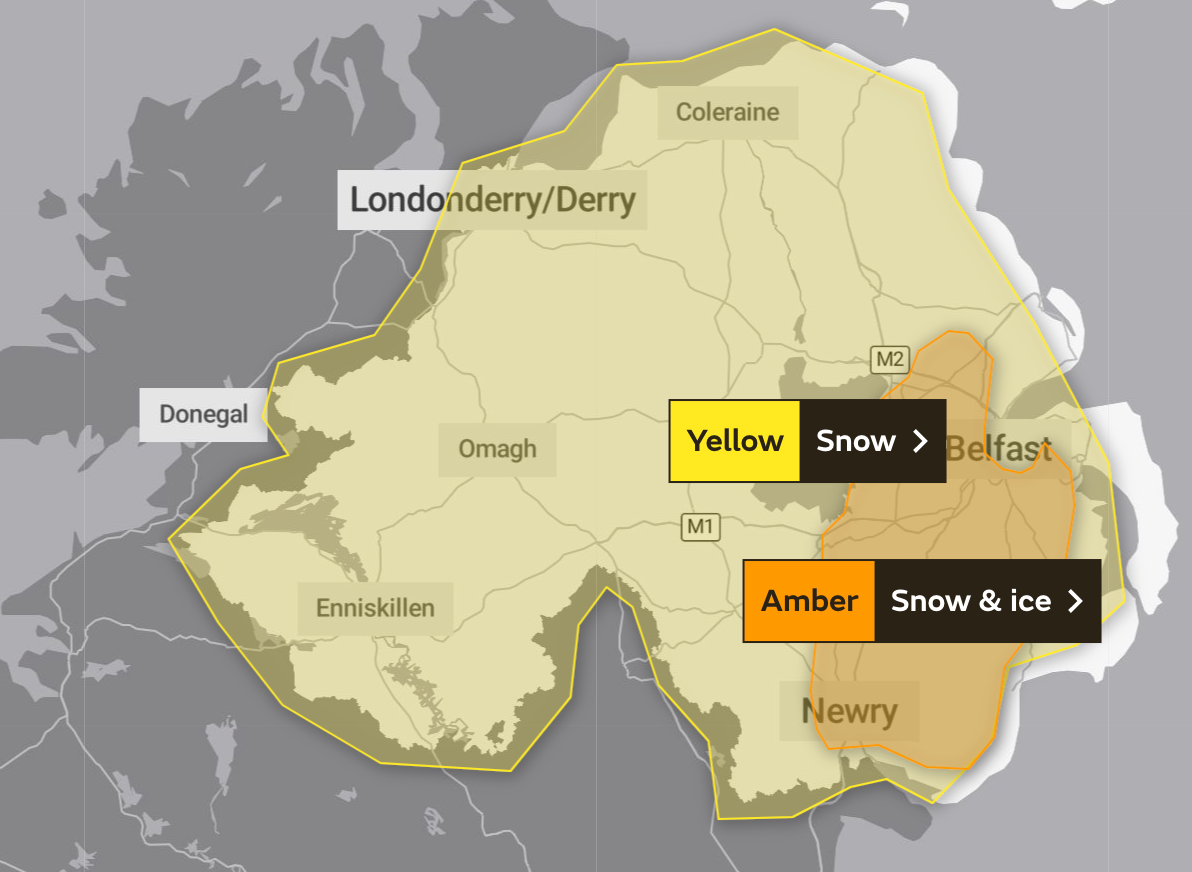
In some areas, between 25 and 40 centimetres could fall, the Met Office has further warned.
Ireland has also been impacted by the cold spat, with The Irish Meteorological Service forecasting that residual rain, sleet and snow in the east will clear into the Irish Sea on Friday morning.


