Tropical Cyclone Alfred is closing in on southeast Queensland and northern New South Wales, with authorities warning residents to “prepare now” for the “extremely rare event”.
Millions of people in Queensland and northern New South Wales (NSW) are under warnings to hunker down or evacuate with flights, trains, buses and schools suspended.
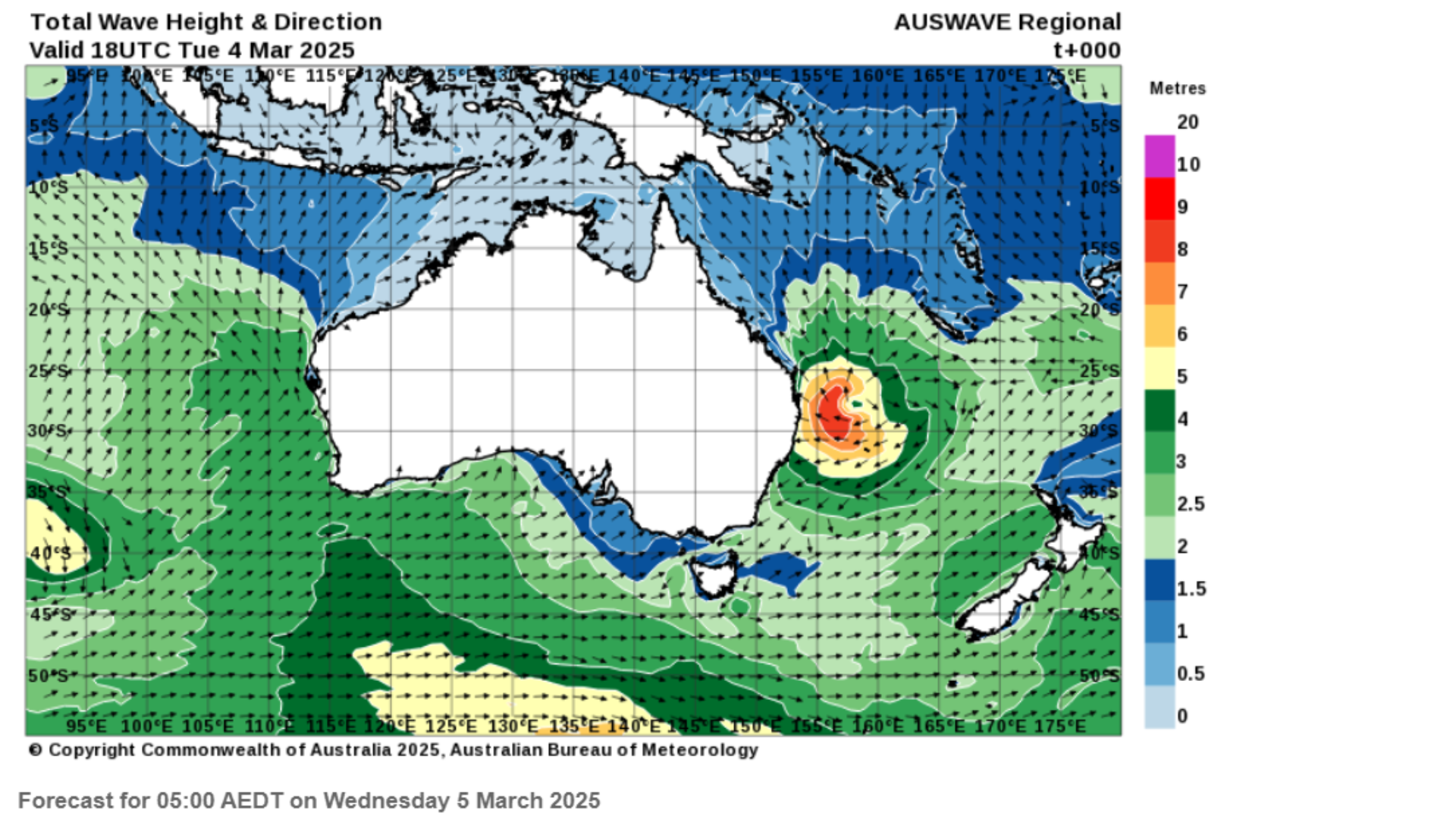
Meteorologists warn the cyclone will bring destructive winds of up to 120kmph, life-threatening flash flooding, and 8-metre waves.
Follow our live coverage of Cyclone Alfred
“The governments across the board are taking this seriously, and Queenslanders as well as those on the north coast of New South Wales need to do so as well,” Australian prime minister Anthony Albanese said.
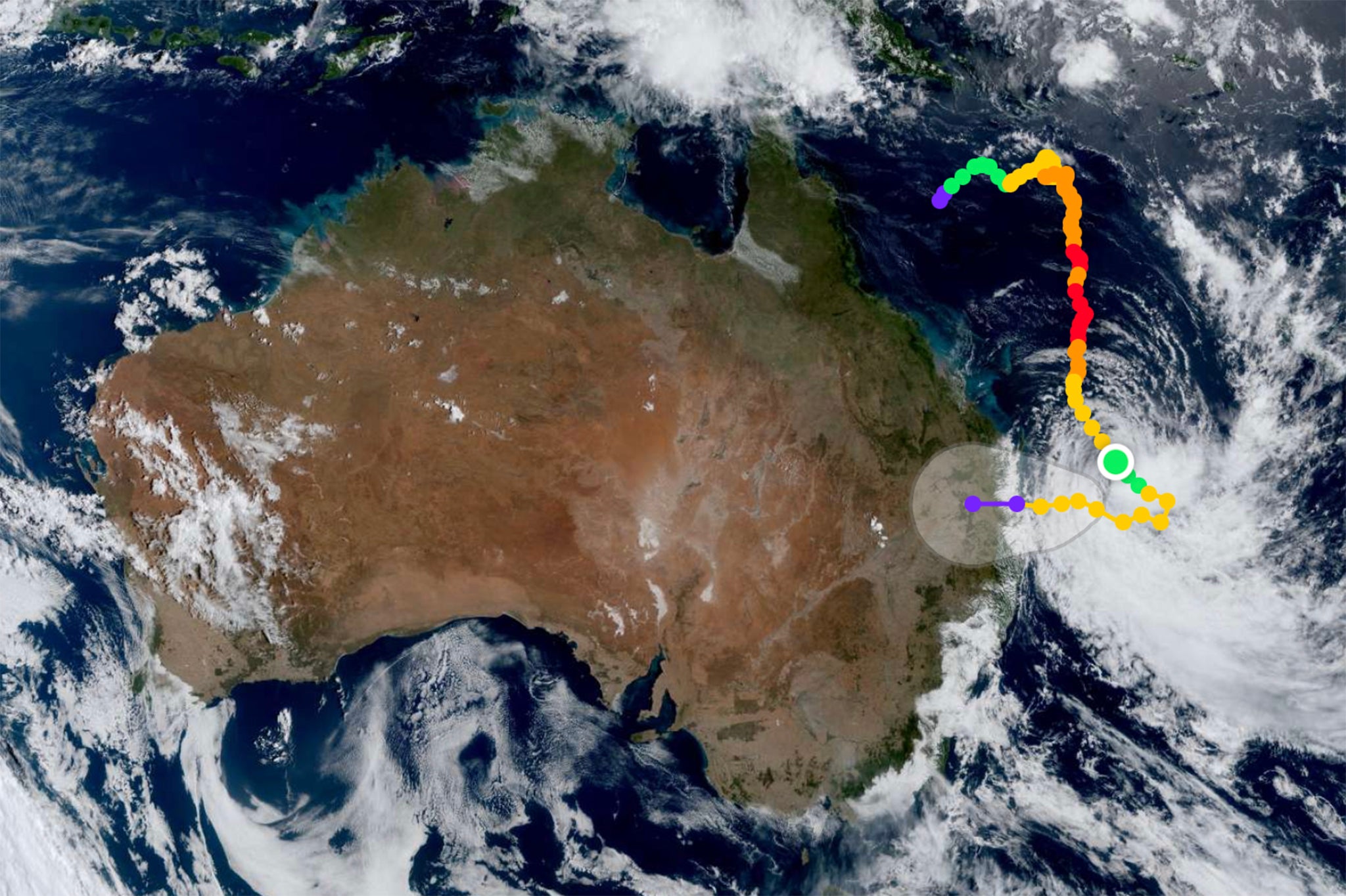
On Thursday, the storm slowed down as it moved towards the eastern coast of Australia. It is now expected to make landfall late on Friday night or early Saturday morning, between Maroochydore and Coolangatta.
The cyclone, which charted an unusual path in the Pacific, is the first to directly impact areas near Brisbane since Nancy in 1990.
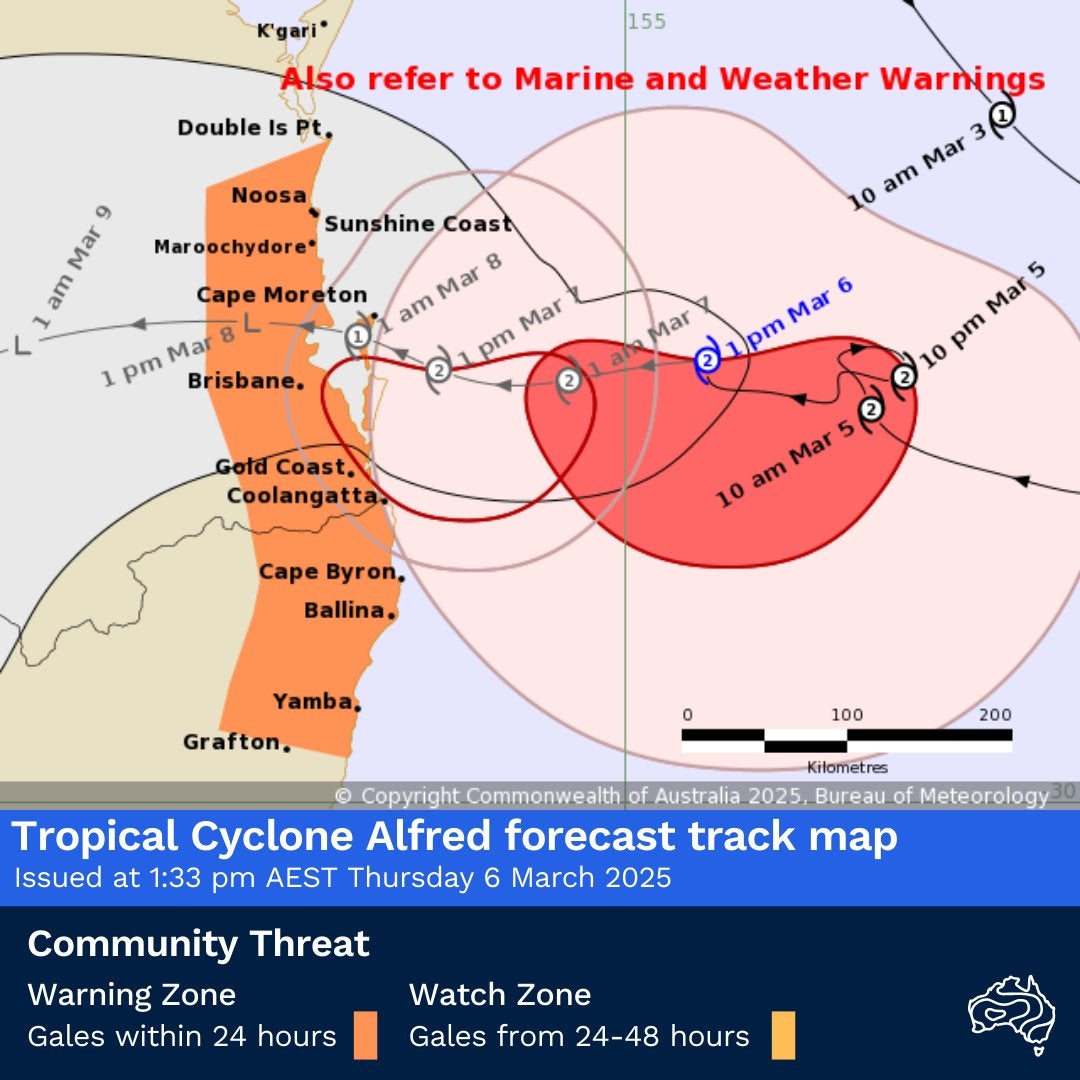
On Thursday, Alfred was 245km east of Brisbane, 230km east-northeast of the Gold Coast, moving west-northwest at just 7kmph, according to an update from the Bureau of Meteorology (BoM) at 5pm local time.
The cyclone is maintaining Category 2 strength with gusts up to 130kmph. But its slow movement means Alfred will have more time to intensify, feeding off warm ocean waters and low vertical wind shear, potentially making it stronger before it reaches the coast.
Meteorologist Thomas Hinterdorfer said that this could result in prolonged extreme weather, with some areas experiencing heavy rain, destructive winds, and storm surges for up to 12 to 14 hours.
"It’s going to have more time in the lower vertical shear. It’s going to have more time with the warm ocean waters, and all that fuel is gonna help it intensify,” Mr Hinterdorfer told The Courier Mail.
"It’s not a good scenario to have it, you know, being a bit slower, we’d much prefer it to come through faster.”
Authorities say the cyclone’s impact will extend far beyond the landfall zone, with destructive winds, extreme rainfall, and dangerous storm surges from Double Island Point (QLD) to Ballina (NSW).
BoM warns that storm surges could cause major flooding in low-lying coastal areas, particularly if Alfred’s landfall coincides with high tide early Friday.
Major warnings by region:
- Gold Coast & Tweed Coast: Extreme beach erosion, storm surges, and inundation in low-lying areas
- Brisbane, Moreton Bay, Byron Bay & Ballina: Risk of coastal flooding and dangerous tides
- Sunshine Coast to Cape Byron: Tides expected to rise well above the highest astronomical tide
"Tides are likely to rise significantly above the highest high tide mark with damaging waves and dangerous inundation of coastal low-lying areas," BoM said.
A 78-year-old woman was hospitalised with head injuries after being swept up by a large wave at Currumbin Beach on Wednesday evening.
Major flood warnings are also in place, with up to 600mm of rain forecast in some areas.
- Brisbane & Moreton Bay: 300-500mm
- Gold Coast & Sunshine Coast: 400-600mm
- Northern NSW (Byron, Ballina, Lismore, Tweed): 250-400mm
The Bellinger River and Tweed River catchments are now under major flood watches after NSW issued its first flood warning on Wednesday for Cyclone Alfred.
Queensland premier David Crisafulli urged residents to prepare for power outages lasting days, as emergency crews brace for widespread impacts.
“We have 1,000 Energex crew ready to restore power, but people should prepare for outages lasting days,” he said.
He also warned people to act before its too late as he called Cyclone Alfred an "extremely rare event".
“There is a chance this cyclone will cross in the middle of the night with a high tide. That is not the time to be making your evacuation plan, now is the time,” Mr Crisafulli warned.
With southeast Queensland residents already losing power, authorities say some areas could be left without electricity for up to three days.
“It is essential that we get power connected as quickly as we can after an event like this,” the premier said.
Mr Crisafulli reassured Queenslanders that the response and recovery efforts are already being coordinated.
“There will be no daylight between the response and the recovery. The best way to guarantee a good recovery is to do the little things now to keep yourself out of harm’s way,” he said.
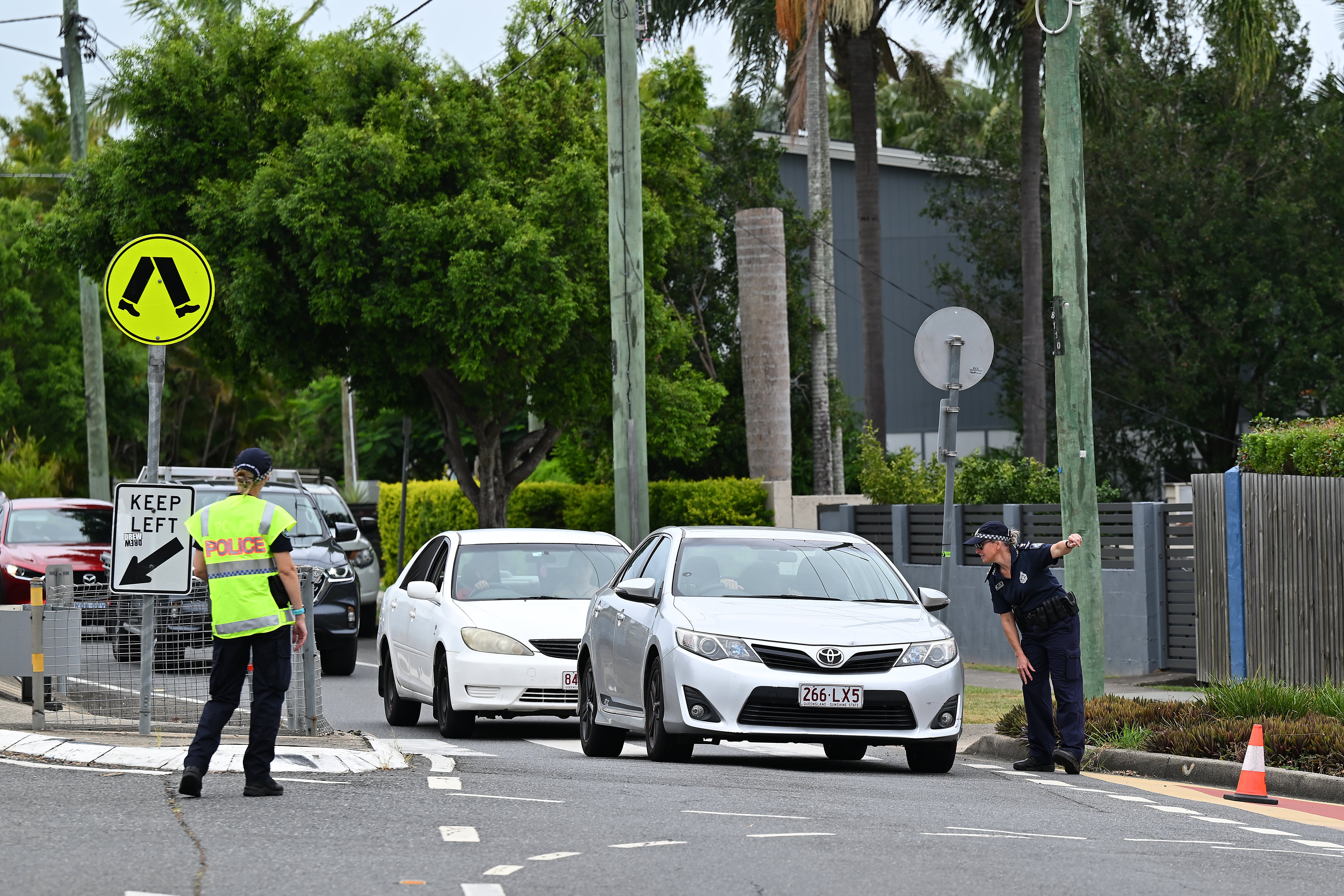
Several airports have shut down and public transport in Brisbane and nearby areas has been halted until further notice.
Gold Coast Airport was shutting services from 4PM local time on Wednesday until further notice while all flights to and from Ballina were cancelled on Wednesday and Thursday. Coffs Harbour Airport also suspended flights from midnight Wednesday
Airlines like Qantas, Virgin and Jetstar are offering free flight changes; Jetstar offering travel vouchers.
Gold Coast’s acting mayor Donna Gates warned residents to stay indoors from 6PM tonight, saying conditions will be worse than anything the city has seen in decades.
"This looks like the most significant event in our city in terms of destructive winds and heavy rain since 1954,” she said.
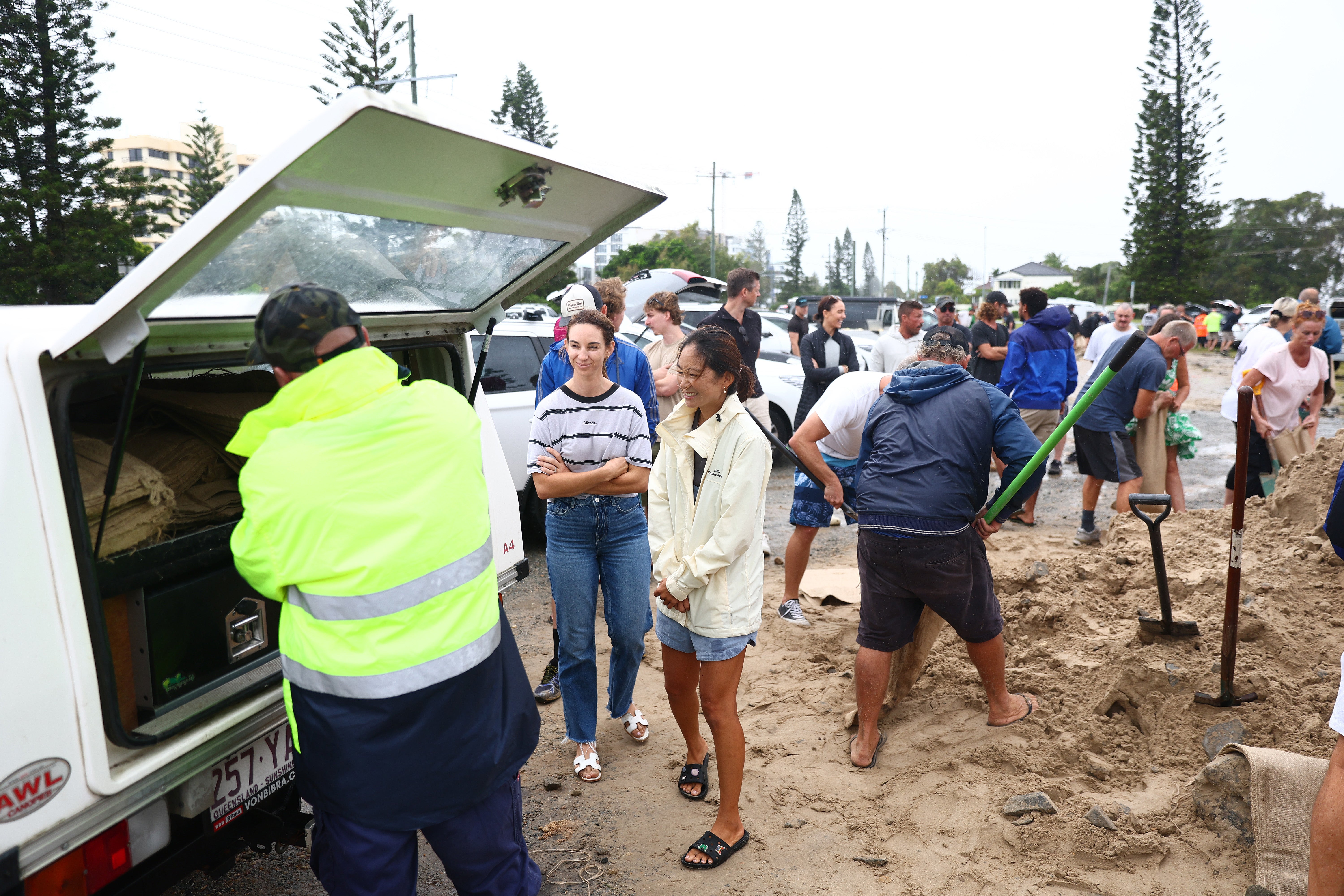
Prime Minister Anthony Albanese said Australian Defence Force is formally engaged, sending 250,000 additional sandbags to Queensland on Wednesday, after 125,000 sandbags were already delivered and 80,000 previously distributed.
It’s rare for cyclones to go further south along Australia’s eastern coast. Alfred, churning the warmer than usual waters of Pacific Ocean, took an unusual path and took a sudden turn westwards on Tuesday, intensifiying to Category 2.
“Cyclone Alfred is predicted to impact northern NSW, which is generally not an area at risk. The last cyclone warning here was more than 50 years ago. This could indicate that, due to global warming, the reach of tropical cyclones is extending further than the tropics.”
Dr Tom Mortlock from Aon notes that warmer ocean temperatures are fueling storms further south, with sea surface temperatures warm enough to sustain cyclones down to Sydney.
Residents in southeast Queensland and northern NSW are being urged to secure properties, prepare emergency kits, and follow evacuation advice as conditions deteriorate.
Authorities warn that once the cyclone hits, emergency services may not be able to reach people in danger, making early action crucial.
Cyclone Alfred: What’s making the storm unusual and why are forecasters concerned?
Cyclone Alfred already ‘packing a punch’ as 82k without power - live updates
Tropical Cyclone Alfred is slowing down – here’s why it matters
Flights cancelled as several airports shut amid Cyclone Alfred warnings
Watch live: Cyclone Alfred Australia’s central east coast braces for Cyclone Alfred
Passengers tackle teenager ‘brandishing shotgun’ on Australia flight: ‘You act’