What's the weather like in your area? Report the situation through Rappler's Agos or tweet us at @rapplerdotcom.
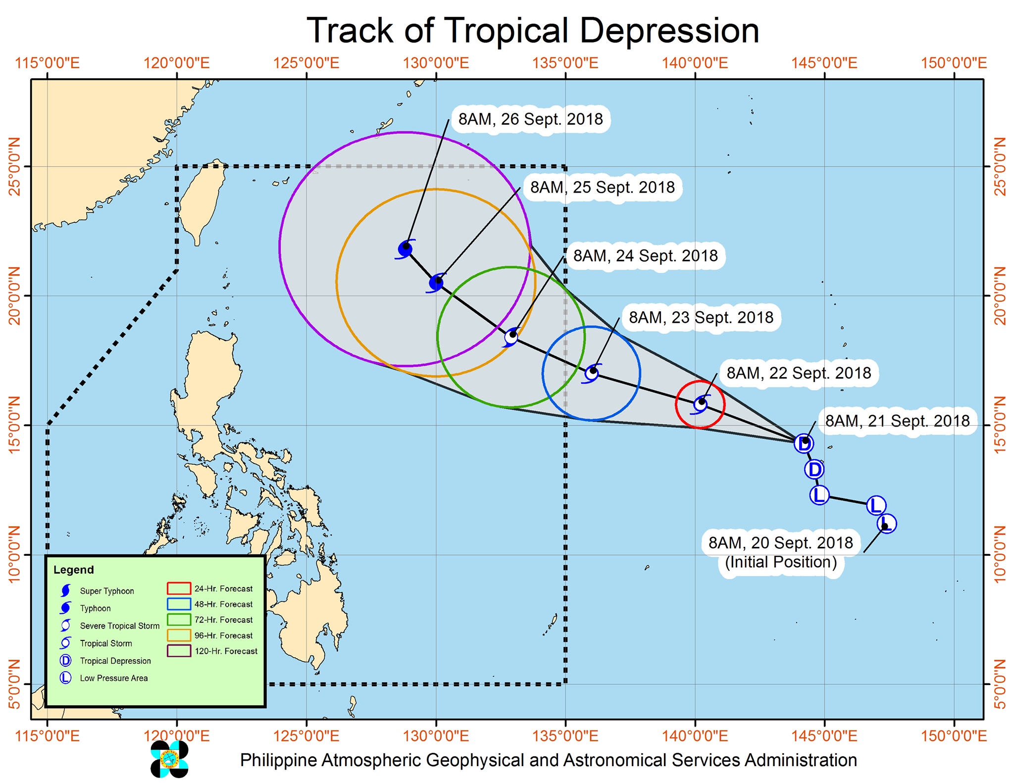
MANILA, Philippines – The low pressure area (LPA) outside the Philippine Area of Responsibility (PAR) developed into a tropical depression on Friday morning, September 21.
In bulletin released noontime on Friday, the Philippine Atmospheric, Geophysical, and Astronomical Services Administration (PAGASA) said the tropical depression is located 2,160 kilometers east of Southern Luzon, moving north northwest at 20 kilometers per hour (km/h).
At the moment, the tropical depression has maximum winds of 55 km/h and gustiness of up to 65 km/h. It could further strengthen into a tropical storm by Saturday, September 22; a severe tropical storm by Monday, September 24; and then possibly a typhoon by Tuesday, September 25.
Right now, the tropical depression is still too far to have any effect on the Philippines. It is expected to enter PAR as a tropical storm on Sunday afternoon, September 23, and will be given the local name Paeng. (READ: LIST: PAGASA's names for tropical cyclones in 2018)
The potential Paeng is unlikely to make landfall, and it is not expected to significantly enhance the southwest monsoon or hanging habagat. But it might still affect extreme Northern Luzon or the Batanes area next Friday, September 28.
PAGASA earlier noted that since the weather disturbance is still too far away, the forecast could still change. The public should continue monitoring updates.
So far, the Philippines has had 15 tropical cyclones in 2018. The country usually gets an average of 20 tropical cyclones per year.
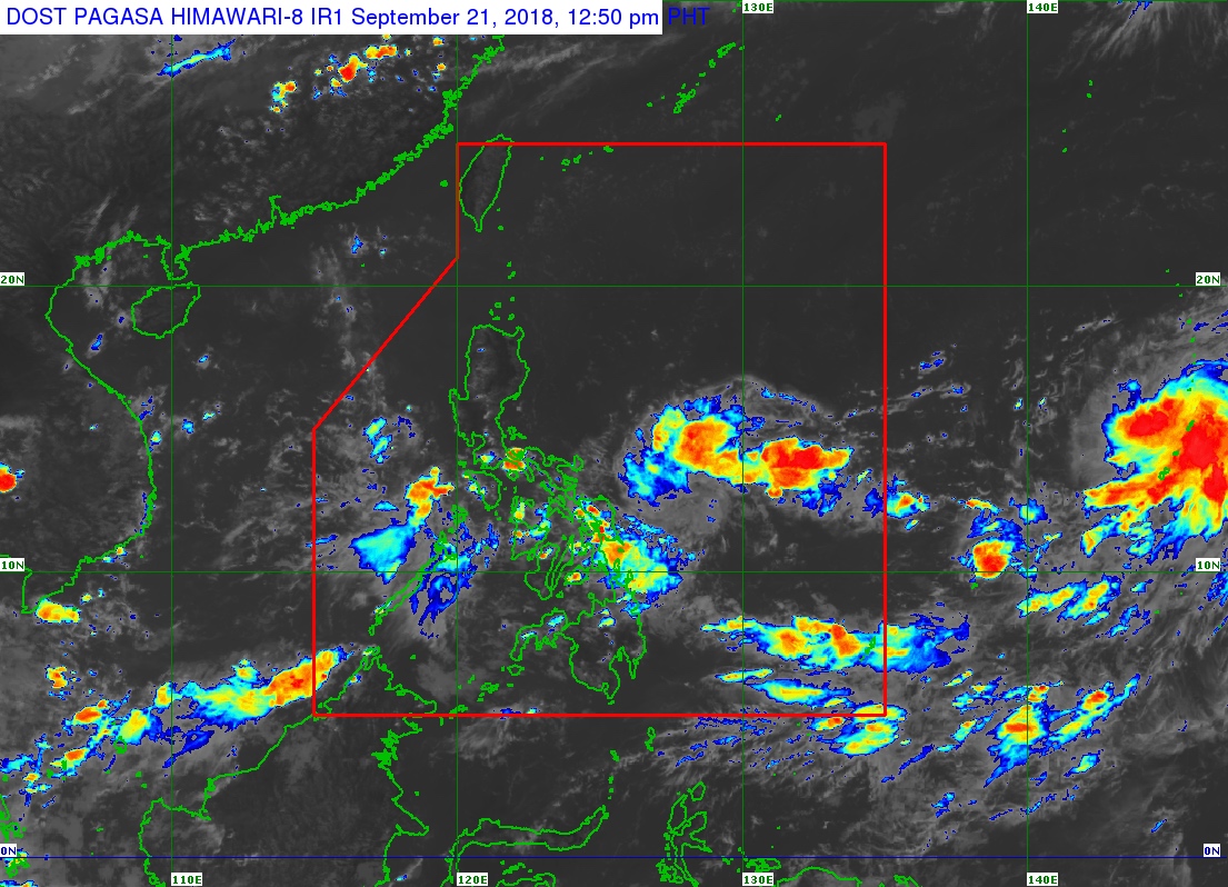
Meanwhile, the intertropical convergence zone (ITCZ) continues to affect Southern Luzon, the Visayas, and Mindanao on Friday.
The ITCZ is a belt near the equator where the trade winds of the Northern Hemisphere and Southern Hemisphere meet, usually causing LPAs or thunderstorms. (READ: FAST FACTS: Tropical cyclones, rainfall advisories)
In a bulletin issued 4 am on Friday, PAGASA warned there would be light to heavy rain in Mimaropa, Western Visayas, Central Visayas, and the Zamboanga Peninsula due to the ITCZ. Residents of these areas should be on alert for possible flash floods and landslides.
The rest of the country will only have localized thunderstorms on Friday, mostly in the afternoon or evening. But flash floods and landslides are also possible if the thunderstorms bring heavy rain.
Parts of Luzon are still reeling from the impact of Typhoon Ompong (Mangkhut), which left at least 95 people dead and caused destruction in provinces up north. (READ: Areas under state of calamity due to Typhoon Ompong)
PAGASA declared the start of the rainy season last June 8. – Rappler.com