La Niña, the natural cooling flip side of the better-known and warmer El Niño climate phenomenon, has dwindled away after just three months.
The La Niña that appeared in January, months later than forecast, was a weak one, the National Oceanic and Atmospheric Administration (NOAA) said on Thursday.
Earth is now in a neutral stage of the El Niño Southern Oscillation cycle, which is generally the most benign of the three states that influence hurricane formation, droughts, floods and global temperatures.
What does the end of La Niña mean for this year’s weather?
NOAA forecasts the current neutral setting to last most, if not all, of 2025.
That makes longer-term weather forecasts a bit trickier because one of the major factors used to determine global patterns is not pushing one way or the other.
La Niña is an irregular rising of unusually cold water in a key part of the central equatorial Pacific that changes weather patterns worldwide.
It typically brings more Atlantic hurricanes in the summer, but it won't be a factor this year.
In the United States, La Niñas tend to cause drier weather in the south and west and often make it wetter in parts of Indonesia, northern Australia and southern Africa.
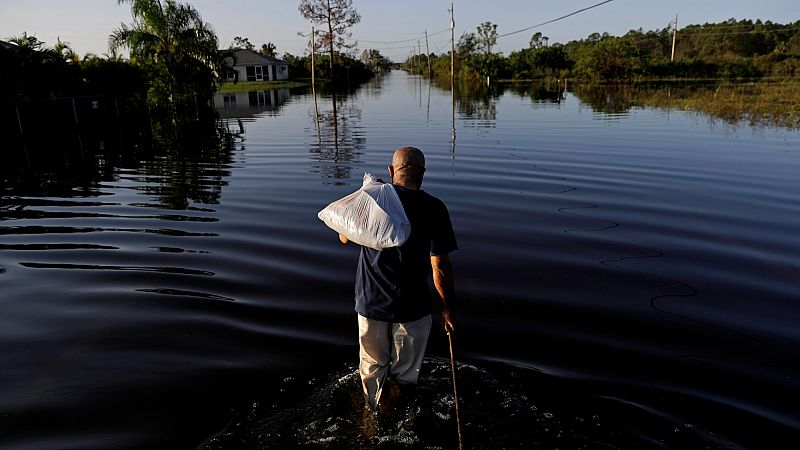
Studies have found that La Niñas tend to be costlier than El Niños and neutral conditions. Last year, this phase of the cycle brought drought, food shortages and deadly heat in some parts of the world.
What does La Niña do to Europe’s weather?
The biggest sign of La Niña in Europe can be found during winter. This is because of something called a teleconnection mechanism - large-scale weather patterns in other parts of the world that interact with those closer to home.
Two different areas in the Pacific are being monitored: the Central Pacific (CP) and the Eastern Pacific (EP). It is important to differentiate between the two because what is happening in these two basins has different impacts on our weather.
“If the strongest cold anomaly during La Niña is in the EP region, the North Atlantic and western European region tends to weaker storms or low-pressure systems and more blocking highs which often leads to drier and sometimes colder conditions,” Lars Lowinski, a meteorologist at Weather & Radar, told Euronews Green earlier this year.
“However, a cold anomaly in the CP region tends to result in a pattern that resembles a so-called positive North Atlantic Oscillation (NAO) pattern, with a stronger jet stream and more storm activity across the near Atlantic and western Europe, resulting in milder, wetter and windier conditions.”
That’s what happens in theory, Lowinski clarified, but other major players can affect our European weather like the NAO, winds in the stratosphere near the equator and even tropical convection over the Indian Ocean.
However, with the current return to neutral conditions before summer 2025, there likely won’t be any strong tendencies either way this time.
Despite this, 2025 is still likely to be among the three hottest years on record, according to the UK’s weather and climate agency, the Met Office. And, with this March the hottest on record in Europe, there could be harsher heat waves and wildfires to come this summer.

.png?w=600)