Could a nor’easter storm be heading for the East Coast this week?
Following cold weather and life-threatening flooding over the weekend, a low-pressure system will affect more than 110 million Americans in the Plains, Northeast, and Mid-Atlantic regions this week.
It may end up being the largest snowstorm of the season for parts of the Mid-Atlantic, bringing over a foot of powder, according to forecasting company AccuWeather.
“This February Frenzy pattern of relentless winter storms will bring yet another round of snow and ice to the Plains, Midwest, and mid-Atlantic. Slippery and hazardous conditions could shut down highways, delay or cancel thousands of flights, close schools, and disrupt business and supply chain operations,” AccuWeather Chief Meteorologist Jonathan Porter said Monday.
Parts of the Midwest and Appalachians could see between six inches and a foot of snow, with three to six inches forecast across the Dakotas, Kansas, Oklahoma, Arkansas, and to parts of Illinois, Indiana, and Kentucky by Tuesday night.
AccuWeather also said a zone in those states and Missouri could get up to a foot before the storm advances eastward.
As the system shifted on Tuesday, 16 inches fell over Wyoming’s Grand Targhee resort. Roads were made “treacherous” on Monday in Colorado as a band of heavy snow produced close to four inches an hour.
The storm is tracking to the Mid-Mississippi Valley through this evening.

“With the support of a jet stream in the upper levels, the snow will become more focused across eastern Oklahoma into Arkansas and southern Missouri by this afternoon and into the evening,” the National Weather Service said.
Local forecasters warned of sleet and freezing rain and ice accumulations, as well as periods of reduced visibility due to snow.
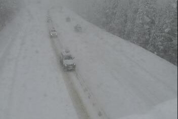
Major travel disruptions are a concern, including along the busy I-95 corridor from Virginia to Washington, D.C.
There were already dozens of cancellations and delays reported Colorado, Washington, Chicago, New York, and Boston on Tuesday, according to tracker FlightAware.
“People should be prepared for significant snowstorm impacts across much of Virginia into the suburbs south of Washington D.C.,” Porter said.
Winter weather alerts have been posted across the country, according to FOX Weather. Snow was already falling in upstate New York.
The network said Monday that whether or not the storm has the potential to become a nor’easter depends on its track and moisture. If it moves over the Atlantic, there might not be major impacts in cities like Boston and Washington, D.C.

By Wednesday and Thursday, potential major impacts will be felt along the eastern U.S., including at least a quarter of an inch of ice in Virginia and North Carolina. Up to a foot of snow may fall from Richmond to the nation’s capital.
"Snowfall accumulations in the Northeast, especially in New England, will be heavily dependent on the track of the storm," said AccuWeather Senior Meteorologist Kerry Schwindenhammer. "A sharper turn up the coast on Thursday could lead to noticeably higher amounts for places as far north as Boston, Providence, Rhode Island, and even Portland, Maine."