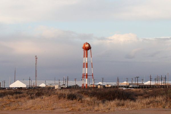
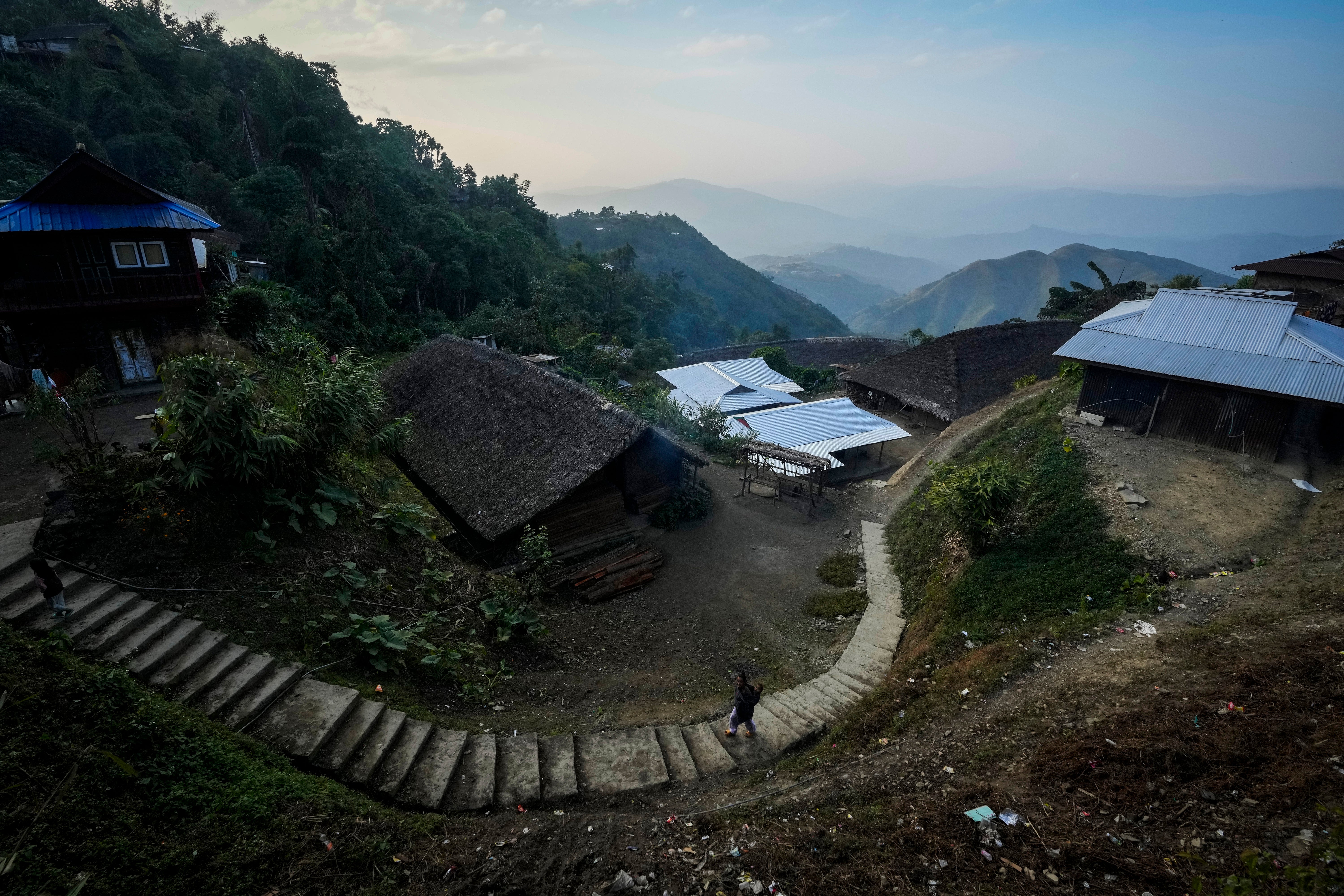
In the remote hilltop village of Longwa, the most prominent structure is the corrugated tin roof of the hut belonging to the Angh, a symbol of traditional authority for the Konyak tribe.
But a less visible landmark, the India-Myanmar border slicing through the village, has become a source of growing anxiety for residents.
For generations, the border held little significance for the Konyak people, whose lives have seamlessly straddled both nations.
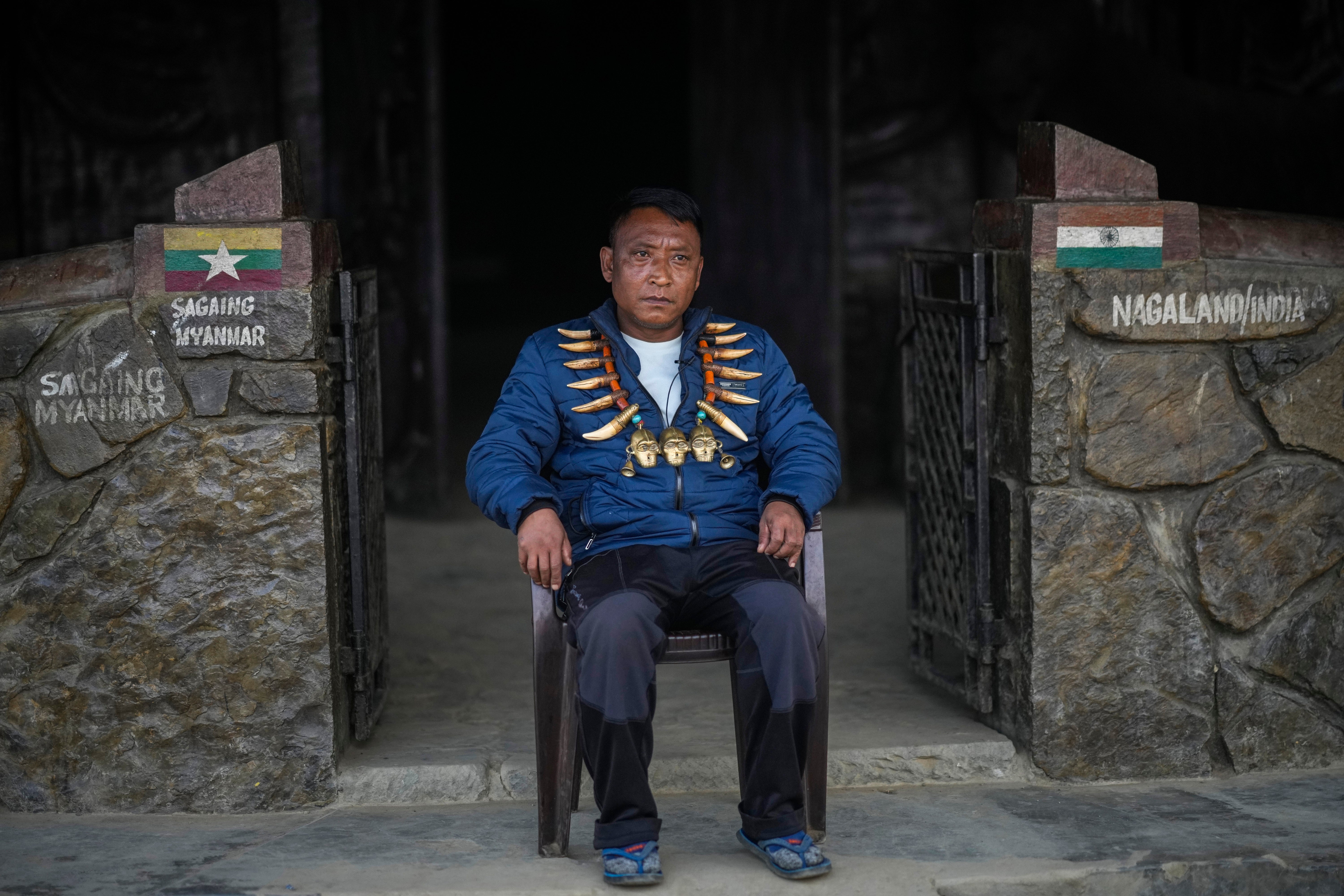
“I eat in Myanmar and sleep in India,” explains Tonyei Phawang, the Angh, whose house sits directly on the dividing line.
This long-held tradition of free movement, however, is now under threat.
The Indian government is moving to restrict border crossings for the first time, revoking a system that permitted Indigenous people to traverse the boundary freely.
The proposed construction of a border fence raises the alarming prospect of dividing villages like Longwa, disrupting the lives and traditions of the Konyak community.
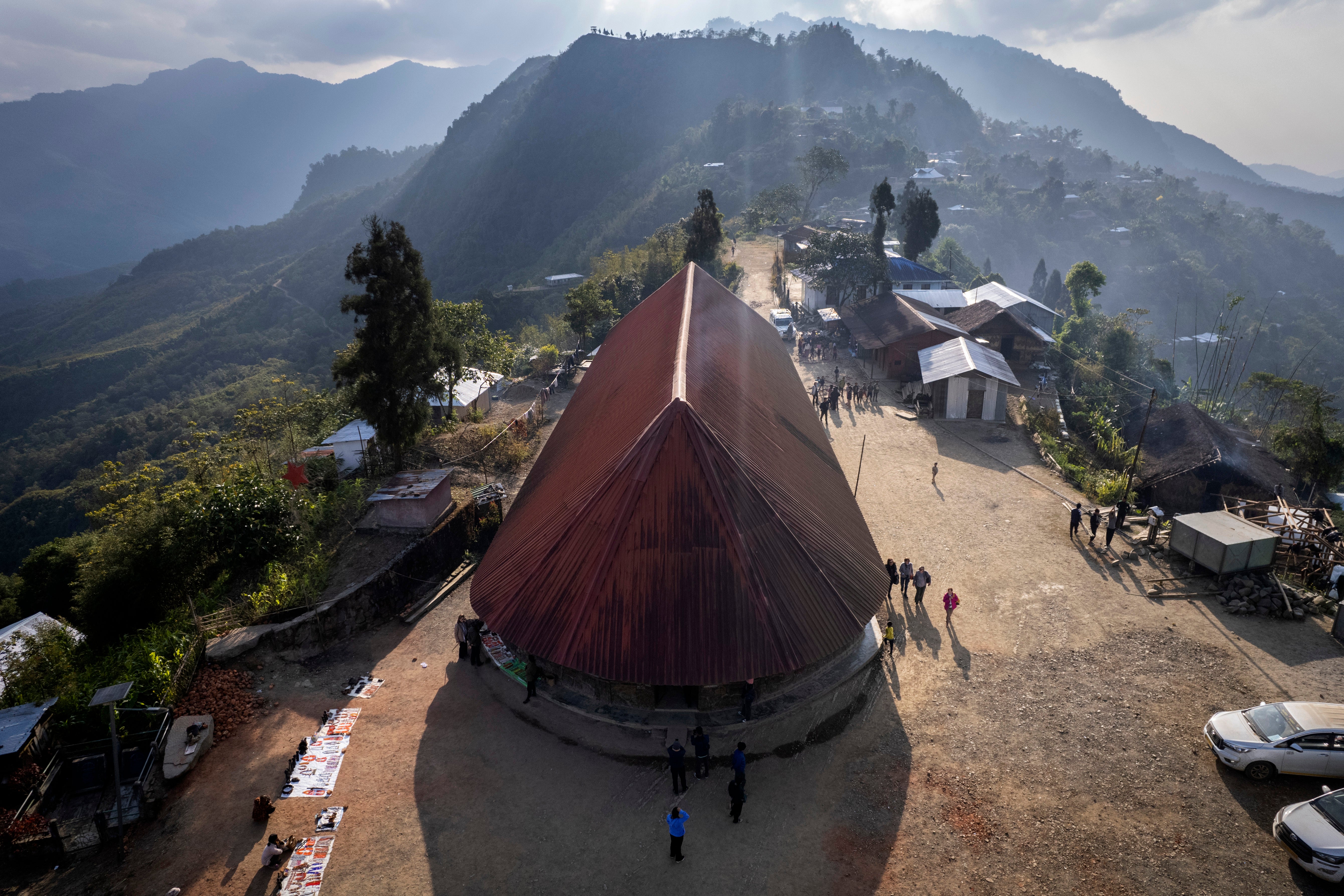
Two countries, one community
On a Thursday in December, Longwa's marketplace was bustling with shoppers from the Myanmar side.
Motorbikes were loaded with as many groceries as they could carry, including clothes, tea and soap. The nearest town with a market on the other side of the border is Lahe, a full day’s drive away.
Locals have long come and gone from Longwa to shop, study or seek medical care, with no sign that they're crossing an international border except a border marker sitting on a hilltop.
The Angh and village council members say their ancestors had no idea that the concrete pillar was meant to divide them when it was built in the early 1970s.
“At that time we had no idea this is India or Myanmar. It was a free land. There was nobody who understood English or Hindi. They understood nothing,” Phawang says.
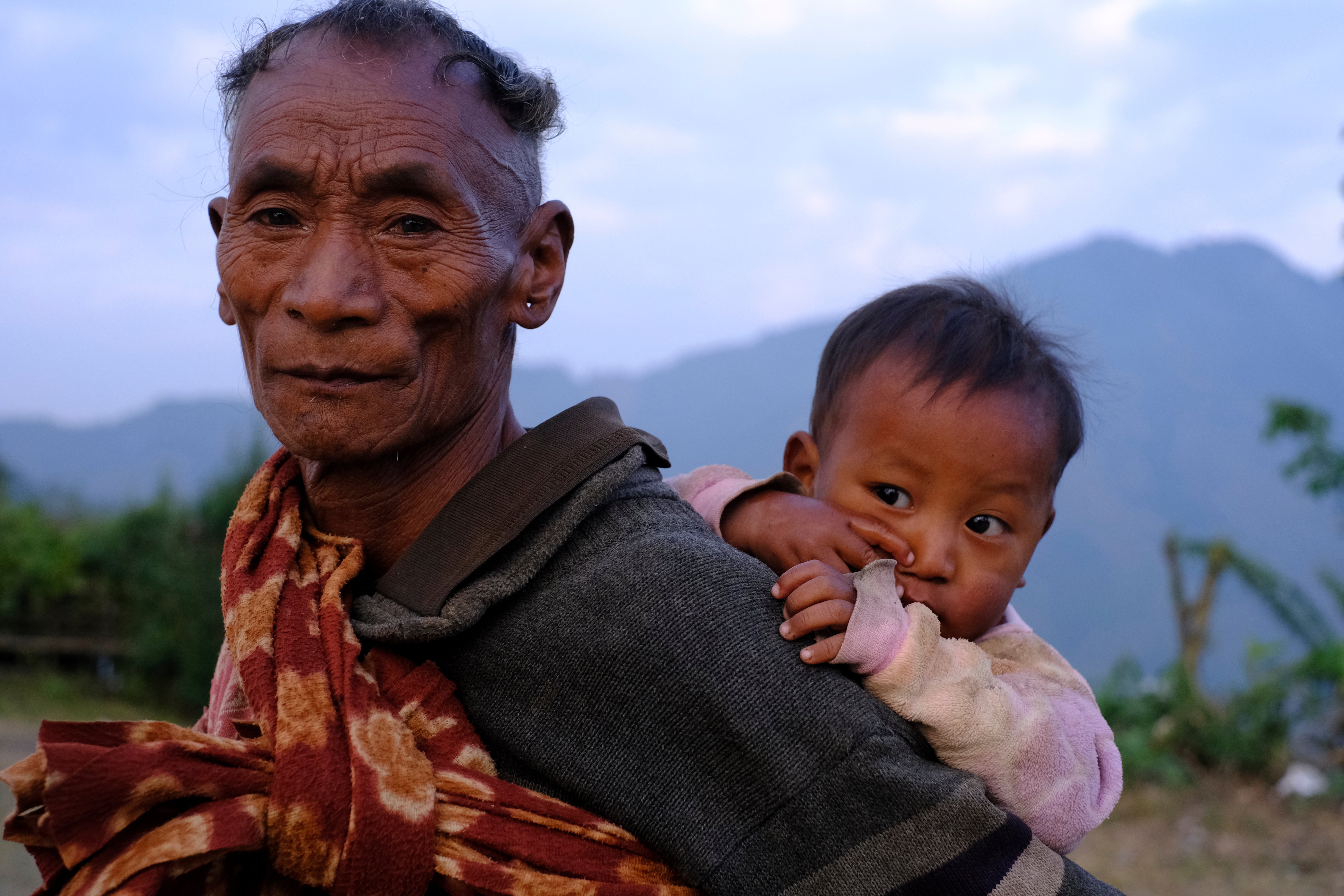
Like dozens of other Indigenous Naga tribes, the Konyak’s land straddles the mountains that divide India and Myanmar.
Naga villages are usually built on hilltops for security, something that wasn't considered when the British East India Company drew the border in an agreement with the then-Kingdom of Burma.
The Constitution of India does not allow dual citizenship. However, people in Longwa see themselves as belonging to both countries.
“I am from both India and Burma,” Phawang said, using another name for the country officially known as Myanmar. “I vote in the Burmese election. And when the Indian election comes I vote there too.”
Phawang is the chief of six Konyak villages in India and more than 30 in Myanmar, whose residents pay allegiance with a yearly feast as they have for some 10 generations.
The reach of the Indian state was very limited in these borderlands until recently.
People here often have documents from both governments, said Khriezo Yhome, a senior fellow and editor at Asian Confluence, a think tank working to create an understanding of eastern South Asia.
“However, there was practically no way for the state to do anything to check it.”
Border guards and fences could cut the village
Until recently, residents from both sides could travel legally within 9.9 miles of the border, but that started to change in February 2024, when the government revoked the Free Movement Regime “to ensure the internal security of the country and to maintain the demographic structure of India’s North Eastern states bordering Myanmar”.
Change has come slowly in Longwa: it took almost a year before soldiers stationed in the village began checking documents, and Longwa residents still move freely after their shifts end in the early afternoon.
But people from other villages in Myanmar are afraid to travel beyond Longwa to reach schools or medical care, said B. Phohi Konyak, a former local leader of an organisation representing Konyak women.
Indian Home Minister Amit Shah said the government has decided to construct a fence along the entire 1,021 mile-long Indo-Myanmar border.
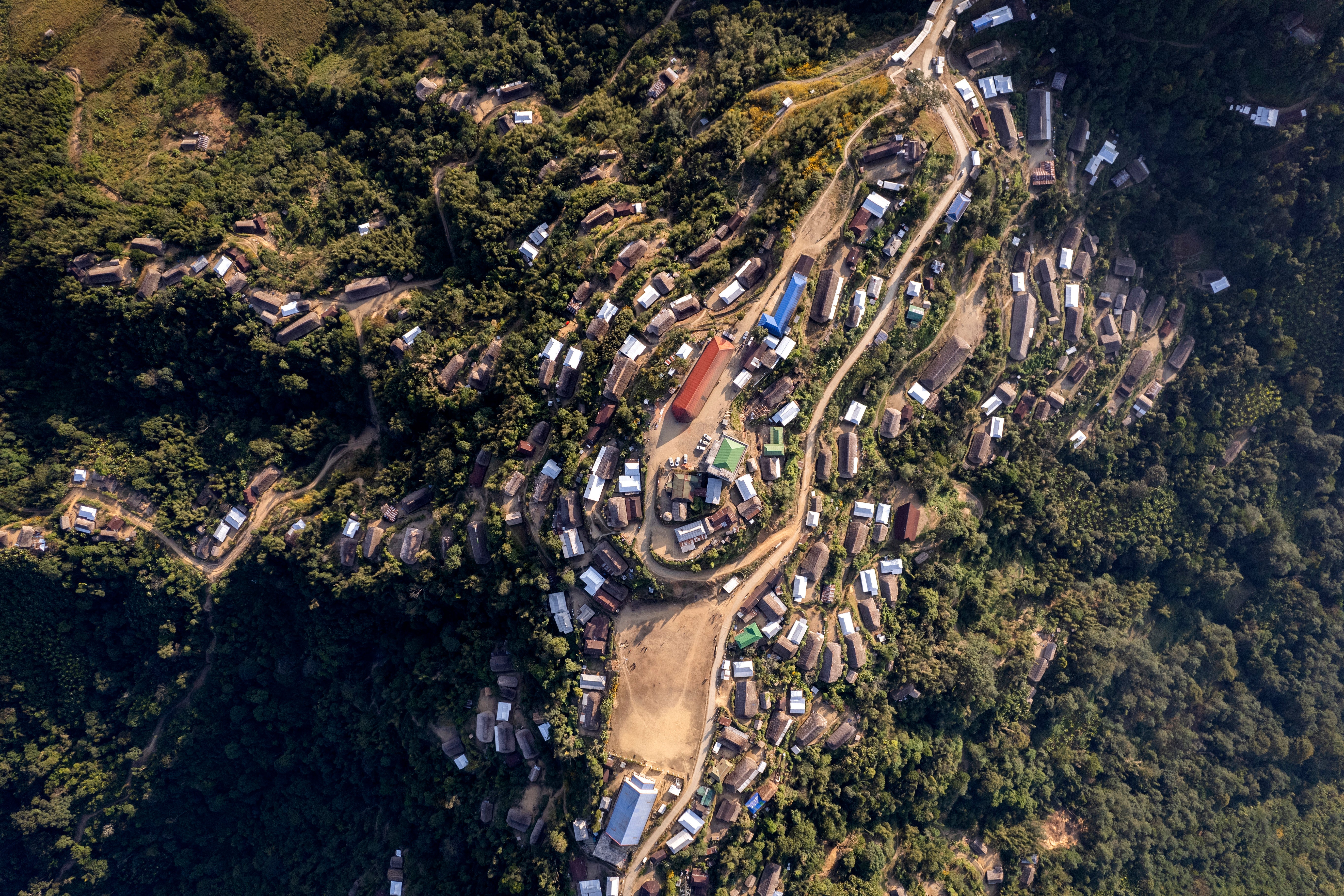
If it follows the legal border, it would have to cut through dozens of houses.
Of the 990 buildings in the village, 170 lie on the boundary line, including a government school, the church and an army camp.
Locals say a fence won't help
Wangron Konyak, 23, drove five hours on his motorcycle from the village of Momkho to pick up his sister as school closed for vacation.
“If we are not allowed to come this side then we will suffer a lot. For those studying in Myanmar school it will be alright, but people like my sister who study in India will be very affected.”
Residents and state officials are rejecting the changes.
The Nagaland state government passed a resolution opposing the end of the Free Movement Regime and plans for border fencing.
On February 3, Longwa residents staged a protest carrying placards with slogans like “Respect Indigenous rights, not colonial legacy!”
Yhome, the expert, said that an effort to stop locals from crossing the border could violate the UN Declaration of the Rights of Indigenous People, which seeks to protect the integrity of border-straddling communities.
“For us there is no Burma Longwa or India Longwa," Yanlang, a 45-year-old village council member, said.
"How can one village and one family be divided?”