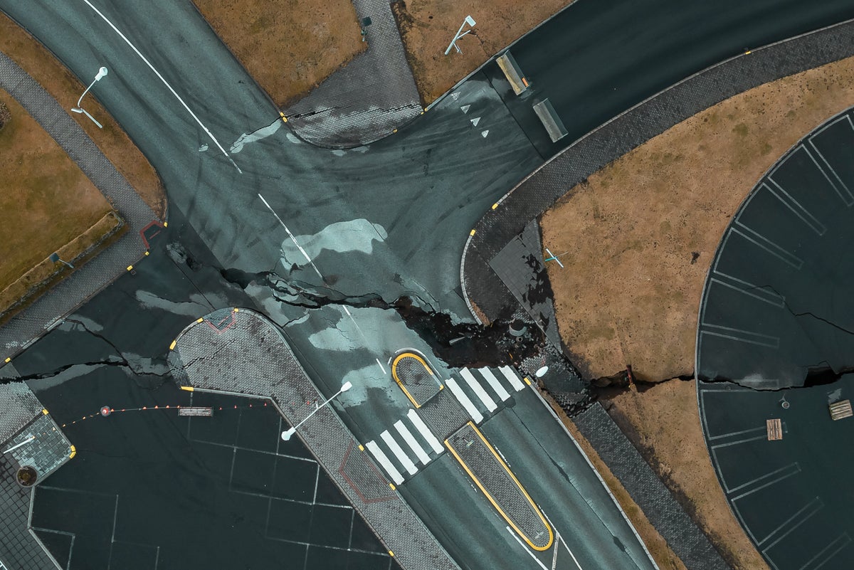
Huge cracks appear on roads in Icelandic town at risk of volcanic eruption
Around 120 earthquakes have rocked the areas surrounding the town of Grindavik as they await a likely eruption, report the Icelandic Met Office.
It comes as the exact location for an eruption has been revealed by the Icelandic Met Office, which says it “is still considered likely”.
Experts at the Icelandic Met Office have issued a key update after a study of data from GPS stations and satellite images showed an “uplift” continues in the area of Svartsengi, north of Grindavík.
The Met Office stated that the eruption is “still considered likely as the magma inflow continues”, adding that “the highest likelihood for an eruption is in the middle part of the dike between Hagafell and Sýlingarfell”.
Earthquake activity has also led to the deepening of the port at Grindavik, according to RUV.
The change in depth is because of the earthquakes’ impact, said the port manager Sigurður Arnar Kristmundsson.
He told RUV: “The docks seem to have sunk by 20-30 centimeters when we measured about 10 days ago and then there is a chance that, yes, the bottom has sunk accordingly.”
A fortnight ago, Grindavik was evacuated after magma-induced seismic activity tore vast chasms through the streets.


