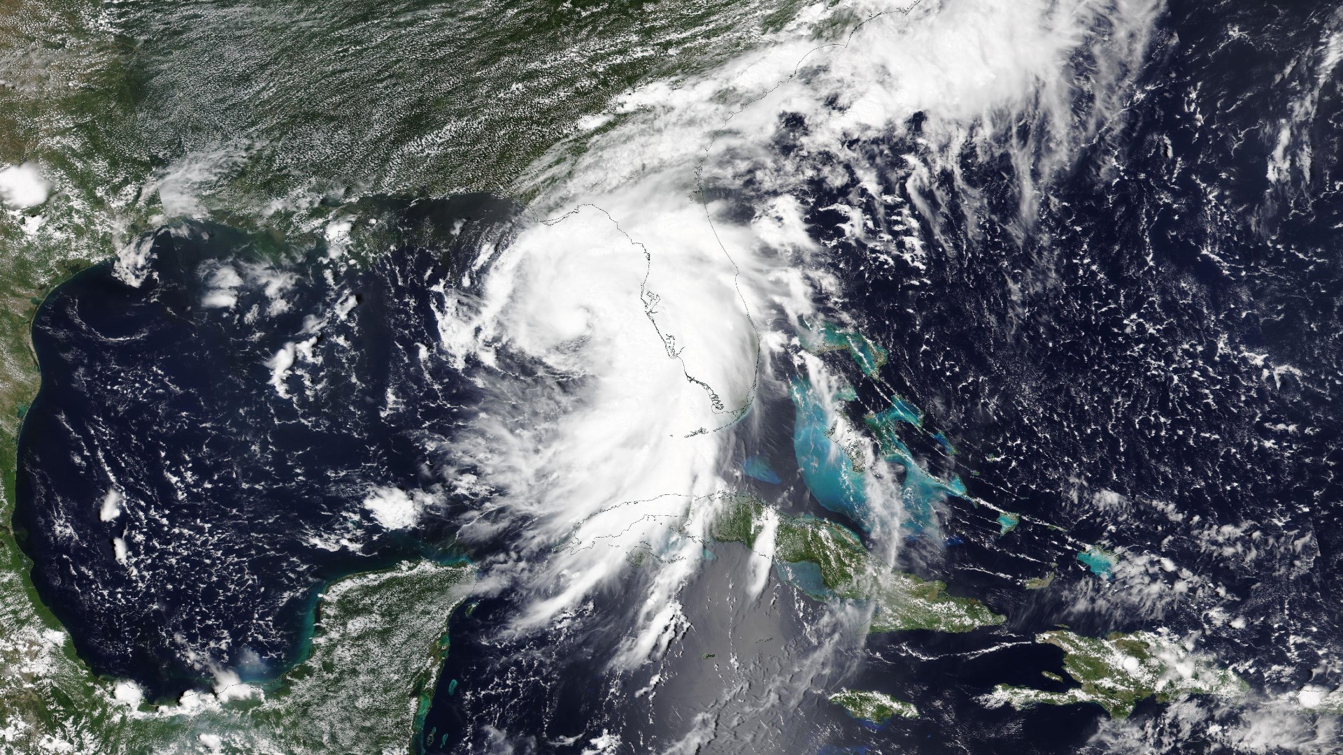
Satellites in space watched Hurricane Debby roar across Florida on Monday, bringing with it potentially record-setting rainfall and dangerous 80 mph (129 km/h) winds.
NOAA's GOES-East satellite recorded real-time views of Debby as it watched the hurricane unleash its force across the southeastern U.S. The footage, gathered from the satellite's position about 22,236 miles (35,785 kilometers) above Earth's equator, shows Debby strengthening in the Gulf of Mexico on Sunday, swirling dangerously close to Florida.
Debby made landfall at Steinhatchee, Florida around 7 a.m. ET (1100 GMT) on Aug. 5 as a Category 1 hurricane, drenching the state's Big Bend coast in over 10 inches (25 cm) of rain. By 11 a.m. ET (1500 GMT), it weakened into a tropical storm and was traveling north, carrying with it the potential for record-setting rain and dangerous flooding, the National Hurricane Center (NHC) reported. At least four deaths have been reported so far in Florida, and over 300,000 people remain without power across the state, NBC reported.
The hurricane's outer bands can be seen in the satellite footage sweeping across the state, where it delivered at least two isolated tornadoes and intense thunderstorms, including a few that overturned several campers in an RV park. The satellite continued to capture imagery the storm as it barreled toward the state in the early hours of Monday and as it came ashore in the morning.
Such satellite imagery helps scientists determine the strength, size, shape and direction of the storms. The day-time views of the hurricane seen in the video are approximately the way they would appear to human eyes from space, according to NOAA. The city lights shining in the night-time views are not real-time depictions, but are sourced from a static database of nighttime mosaics gathered by another NOAA satellite.
Hurricane Hunters of the U.S. Air Force Reserve, who flew into Debby on Sunday, provided data useful for NHC weather forecasting.
Debby is the fourth named storm of this year's Atlantic hurricane season, after Hurricane Beryl and tropical storms Alberto and Chris, all of which formed in June. Forecasters have warned that the season, which runs from June 1 to Nov. 30, will be a busy one.
Debby, now a tropical storm ferrying "potentially historic" amounts of rain and winds of 70 miles per hour (110 kilometers per hour), is moving north along the southeastern coast, the NHC said. In the coming days the storm is expected to dump up to four feet of rain in both Georgia and South Carolina. Governors in both states have declared emergencies.