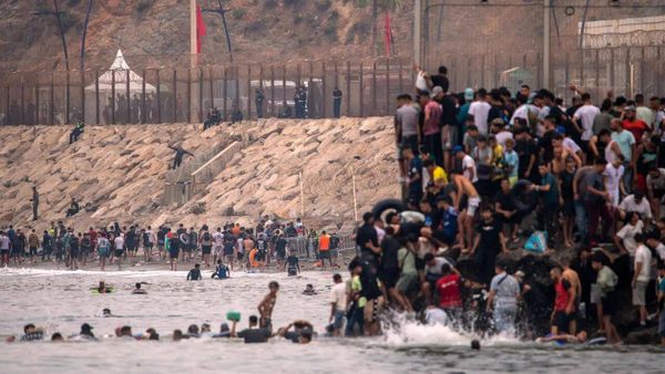
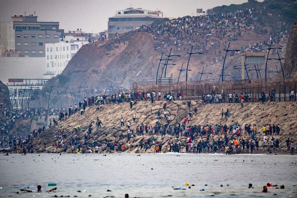
Heavy rains have brought the Kanniyakumari district to its knees. In three days starting from November 11, various parts of the district recorded copious amounts of rainfall, submerging several villages.
Due to incessant rains, the water levels of major rivers running through the district - Kodaiyar, Paralayar, Pazhayar and Thamirabharani - surged. In some cases, the levels crossed the Highest Flood Level ever recorded.
A rugged terrain
The Kanniyakumari district has varied topography from mountainous terrain to plains and valleys. The elevation of the surface ranges from 0 meters to as high as 1,800 meters above sea level in some places. The terrain is rugged in many places.
The map visualises the topography of the district.
Rainfall recorded in different places is overlayed in the map (coloured cylinders). The higher and deeper the red colour of the cylinders, the higher the rainfall recorded in a place. The cylinders depict rainfall recorded on Nov 13 and 14.
Kodayar
Kodayar river surpassed the High Flood Mark by many meters at around 6 p.m. on November 13 and continued flow above the danger level on November 14 and November 15. The HFL mark was just below 15 meters, while the actual water level reached 16 meters on November 13.
Paraliyar
The Paraliyar river reached just below the HFL mark of around 13 meters at around 9.30 p.m. on November 13. It continued to flow well above the danger mark on November 14 and November 15.
Pazhayar
Pazhayar, a major river flowing in the Kanniyakumari district, crossed the Highest Flood Level (over 7 meters). The water level crossed the danger mark of 6 meters at 1.30 a.m. on Nov. 13. Around 5.30 p.m. on Nov. 14, it crossed the HFL mark. However, since then the level has been on a decreasing trend.
The water level in the Pazhaiyar river is being measured downstream at Asharam. Although major floods were recorded in the upstream, the quantum could not be measured as there were no flood monitoring stations.
Thamirabharani
The Thamirabharani river reached just below the HFL mark of 9 meters at around 1.30 p.m. on November 13. It continued to flow well above the danger mark on November 14 and November 15.
Intense rainfall over many days
The table lists the rainfall recorded in various places of the Kanniyakumari district in the 24 hours ending at 8.30 a.m. on November 12, 13, 14 and 15. During the November 14 period, Puthan and Perunchani dams recorded 22 cm of rainfall each. Heavy rainfall reaching 10 cm were recorded on multiple days in Kalial, Suralacode, Kannimar and Mylaudy.
*Blank space in the table indicates the rainfall was less than 5cm
Map rendered by Raj Bhaghat Palanichamy, WRI India