A niche piece of technology used by public sector scientists and researchers to rapidly work out the dangers and effects of natural hazard events is winning acclaim and international interest | Content Partnership
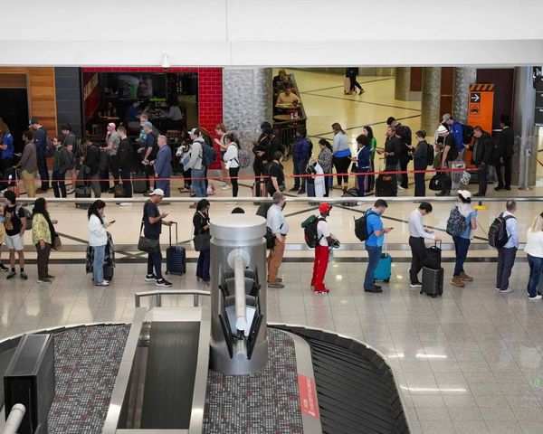
As the kingdom of Tonga lay all-but cut off from the world under the cloud of ash from the massive volcanic eruption in January, thousands of kilometres away New Zealand scientists were using a high tech and locally developed system to quickly determine how much damage was expected and how much aid would be needed.
By inputting local and international seismograph data, satellite imagery and measurements for the sonic boom, researchers at GNS were able to start modelling in real time how much infrastructure might have been wiped out by the impact of the Hunga Tonga - Hunga Ha'apai eruption and tsunami.
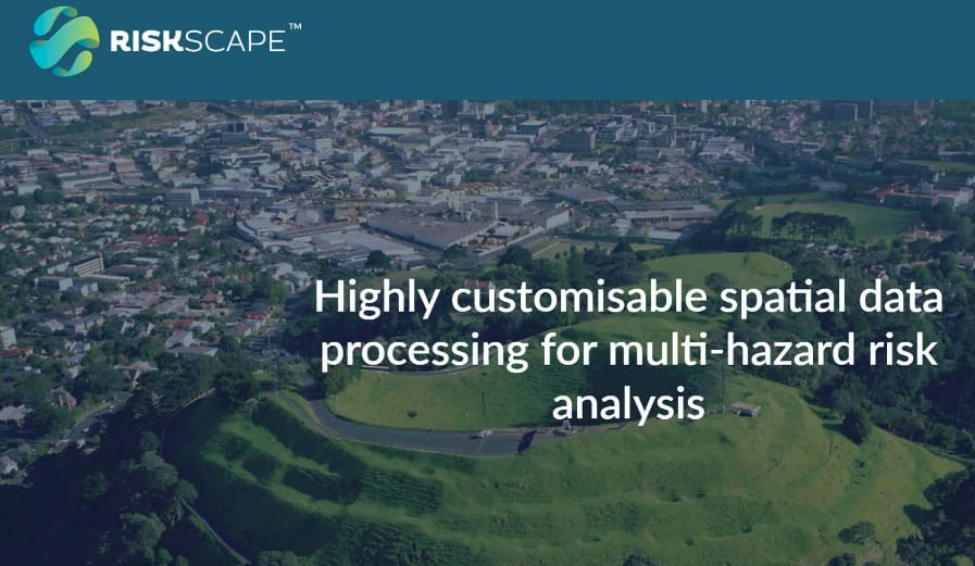
Using an open source tool called RiskScape, which GNS Science and the National Institute of Water and Atmospheric Research (Niwa) developed with Kiwi IT firm Catalyst and is also now backed by EQC, the scientists could do within minutes what might in the past have taken days to calculate.
When the eruption occurred, GNS and the University of Canterbury used RiskScape to estimate the impacts from volcanic ash and the tsunami. This information was provided to emergency response agencies to help estimate the impact, even as communications were still be restored to the island kingdom.
RiskScape allows scientists to rapidly swap in and out data for various scenarios for natural hazard events, estimating damage and effects for everything from floods and debris flows, rockfalls, earthquakes and storms. It is not just during the events that high speed estimates can be developed, but also before and after communities are hit.
Catalyst's Russel Garlick says the RiskScape tool developed by his firm with GNS and Niwa took an existing software product and opened it to a world of possibilities.
"The way I think about it is we have created a really fancy scientific calculator. With the old basic calculator, with big keys, you can only go so far. We now have one of those big scientific calculators, and if you know how to use it..."
What that's meant is, simply, the researchers and scientists have been provided "a whole lot of shortcuts with spatial data, so they can spend more time on the science of how we should be looking at this."
"Everything we can do with RiskScape, scientists can do long-hand, and get the same result, but it would be a one-off, and requires a bunch of work."
RiskScape's value has now been recognised by technology leaders.
At this month (August's) NZ Hi-Tech Awards, before a crowd of 1100 including Prime Minister Jacinda Ardern, GNS Science and Niwa won a major award for Best Hi-Tech Solution for the Public Good.
Judges were impressed with its ability "to harvest data to benefit so many communities on a national and global scale.
"The team has a commitment to language diversity, including te Reo," the citation read. "RiskScape is used to make better decisions driving impact from research and science with a sophisticated platform designed to be customised and flexible."
The two Crown agencies were joined by a third public sector organisation, Toka Tū Ake EQC (the Earthquake Commission) in funding and developing RiskScape and EQC has adopted it as its loss modelling platform to provide near-real-time estimates of the number of claims and potential losses expected from an event.
RiskScape can also provide an estimate for the organisation's level of risk for its reinsurance programme and for modelling possible disaster scenarios for response planning.
RiskScape can be used to look well into the future.
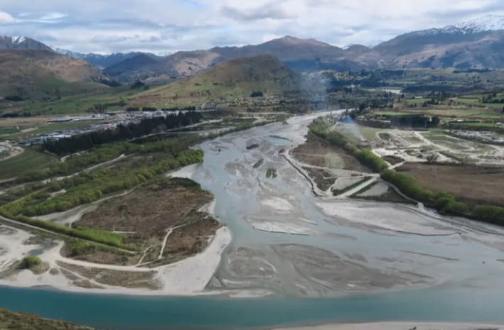
Nick Horspool, a senior risk scientist with GNS who is project lead for RiskScape, told Newsroom the tool had been used to estimate potential damage and losses for buildings in Queenstown, for the Reavers Lane and Brewery Creek alluvial fans from several debris flow and rockfall scenarios.
"RiskScape then modelled four different land use planning policy options, to quantify the impact of each if the hazard events were to occur in 2120. The data has been presented to the community for consultation on a preferred option."

A preferred option was approved by Queenstown Lake District Councillors at the end of June and more work will be done over the next 18 months to prepare for what the model has outlined.
Horspool says RiskScape's advantages include a "wizard which helps scientists build customised workflows, replacing in a matter of minutes a process that would usually take days of coding" and the fact it can be run on laptops, workstations, the cloud or high performance computing environments, depending on the size of the problem.
"RiskScape is one of the very few risk models globally that are open-source for transparency. Many similar models are developed for the insurance and reinsurance sector but are very expensive to license and have 'black box' systems. In developing RiskScape, it was very important to us that it be readily available for users."
Horspool's counterpart at Niwa, natural hazard risk researcher Ryan Paulik, says RiskScape is applicable for use anywhere in the world, for any natural or non-natural hazard risk context.
"In RiskScape, models can take numerous forms, from a simple 'what-if' analysis, that reports the number of buildings in a floodplain - to complex 'probabilistic' analysis, where the damage and monetary loss for buildings in any one year is determined from a simulation of a million earthquake shaking events."

Paulik says the tool can produce risk information as soon as a model is run. He gives two examples of RiskScape in action:
GNS and EQC linked RiskScape to the US Geological Survey (USGS) ShakeMap to provide near-real-time estimates of residential building damage and financial loss from major earthquakes in New Zealand.
And Niwa and the Samoan Ministry of Natural Resources and the Environment developed a system to support decisions for the Vaisigano River on the island of Upolu, that flows through the capital, Apia. RiskScape delivered information on buildings and roads where human safety is compromised in an impending flood event.
Paulik says the purpose-built framework of RiskScape makes setting up risk models more efficient and researchers can get more accurate estimates of risk from having more time themselves to develop information about the hazards and elements of risk.
At Catalyst, Garlick says RiskScape's success has attracted interest internationally. "Right now, it is being used by scientists in France and Spain. Some of our people and from Niwa are up in Fiji training the secretariat of the South Pacific Forum to do risk modelling for the South Pacific."
Development work goes on, with the software being refined and a web-based version now being a focus, so RiskScape can be fired up in the Cloud, making it more accessible to Civil Defence and territorial local authorities.
Garlick says the open source nature of the tool, and its transparency, set it apart. "Everything is transparent. The user has complete control over it. For example, say I'm a researcher who knows how firestorms impact pine forest plantations and I've written out a formula or model. Now I want to apply that in practice to all forests in New Zealand and then all different scenarios of wind from the north, trees being very dry. That's what we would use RiskScape for."
He says Catalyst's role was to identify ways to make the risk modelling more efficient and come up with solutions.
"Because we don't get bogged down in the science, we focus on working with the scientists to understand how they are trying to transform the spatial data, and what we do is wherever we see them doing something that takes time, or unnecessary constraints on what they want to manipulate (e.g other tools only work with point data), we come up with a way to make that easier for them to use.
"They could do everything RiskScape does long hand, like we can all do long division for large numbers, but if you change the number by one, you have to start again. We have built them a fancy calculator that gives them are very powerful divide button.
"This allows them to spend more time thinking about whether they should be dividing, or multiplying, or performing a quadratic analysis, rather than doing it by hand."
Horspool, of GNS, says: "The process of building a risk model workflow used to take days if a scientist was writing their own code. But now, using the RiskScape platform can reduce that to just a matter of minutes."
* Catalyst is a content partner of Newsroom