A “generational flooding” event could pound parts of the central U.S., dumping four months of rain over the course of just a week.
More than 46 million Americans will be affected by repeated rounds of intense rainfall over the region, including at least 13 million people within a high-to-extreme risk zone.
"Should the amount of rain occur that we anticipate over the middle of the nation, it would exceed the 500- to 1,000-year average," warned AccuWeather Senior Storm Warning Meteorologist William Clark. "Truly, the potential is there for a historic flash-flooding event."
Forecasters warned some areas of Tennessee could expereience as many as 15 inches of rain between Wednesday afternoon and Sunday morning. Video Wednesday showed hail pelting the state’s roads. Transportation crews were working to clear gutters of debris in preparation for the rain.
“This isn’t routine. This is a rare, high-impact, and potentially devastating event,” the Memphis National Weather Service office wrote on social media. “Heavy rainfall will likely lead to widespread river, flash, and area flooding that could cause severe disruptions, especially along and north of Interstate 40.”
Tennessee Governor Bill Lee and state emergency managers told residents to heed local guidance, and make a plan to stay safe.
“Make sure you’re paying attention. Make sure you have a plan if you have to leave of where you would go and how you communicate that with folks,” Tennessee Emergency Management Agency Chief of Staff Alex Pellom advised at a press conference.
The multi-day “catastrophic” and possibly historic heavy rainfall event may also produce life-threatening flooding from the Ozarks into the Ohio River Valley.
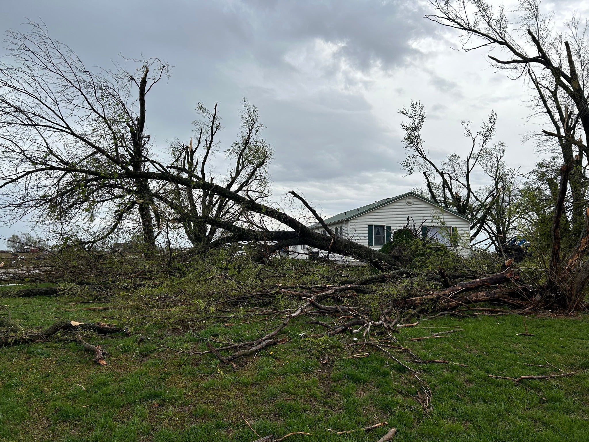
The powerful storm system will also bring a “barrage” of other life-threatening weather hazards, including strong tornadoes throughout the Lower Ohio Valley and mid-South on Wednesday.
Tornado damage was already reported in Oklahoma and Missouri, where trees were knocked down, structures were destroyed, and power poles were knocked askew. Tornado warnings were issued through the mid-afternoon in Missouri and Tennessee.
Several school districts had canceled classes there, in Indiana, Arkansas, and other states. More than 9,500 Arkansans were left without power, according to the outage tracker PowerOutage.US.
The severe weather outbreak is also bringing damaging winds and the risk of very large hail to the region.
“Unfortunately, this severe threat will be compounded by the beginning of a life-threatening flash flood event,” the National Weather Service said.
After the first round of rainfall and flash flooding, it said the system will become “nearly stationary” on Thursday.
It will remain stalled into the weekend, bringing the “possibility of long duration and severe disruptions to daily life,” it added. Severe thunderstorms are also anticipated on Thursday and Friday.
“The repeated rounds of rainfall will lead to increasingly saturated soils, with possible additional rainfall over areas already experiencing flooding,” forecasters said.
Climate change is making rainstorms more intense, according to a new analysis from the nonprofit group Climate Central.
It said that more than 125 cities have experienced an increase in hourly rainfall intensity since 1970, and that hourly rainfall intensity has increased in every U.S. region.
Watch: Trump brings out big chart to list tariffs during ‘Liberation Day’ speech
More Black babies are dying than white infants. Scientists blame inequality
Teens arrested after South Carolina’s Table Rock fire torches more than 13,000 acres
Wild weather expected Wednesday gets a rare 'high-risk' designation -- the most severe category
No escape for UK as Trump targets ‘foreign cheaters’ in new global trade war
Seven tigers seized from Nevada residence of exotic animal dealer