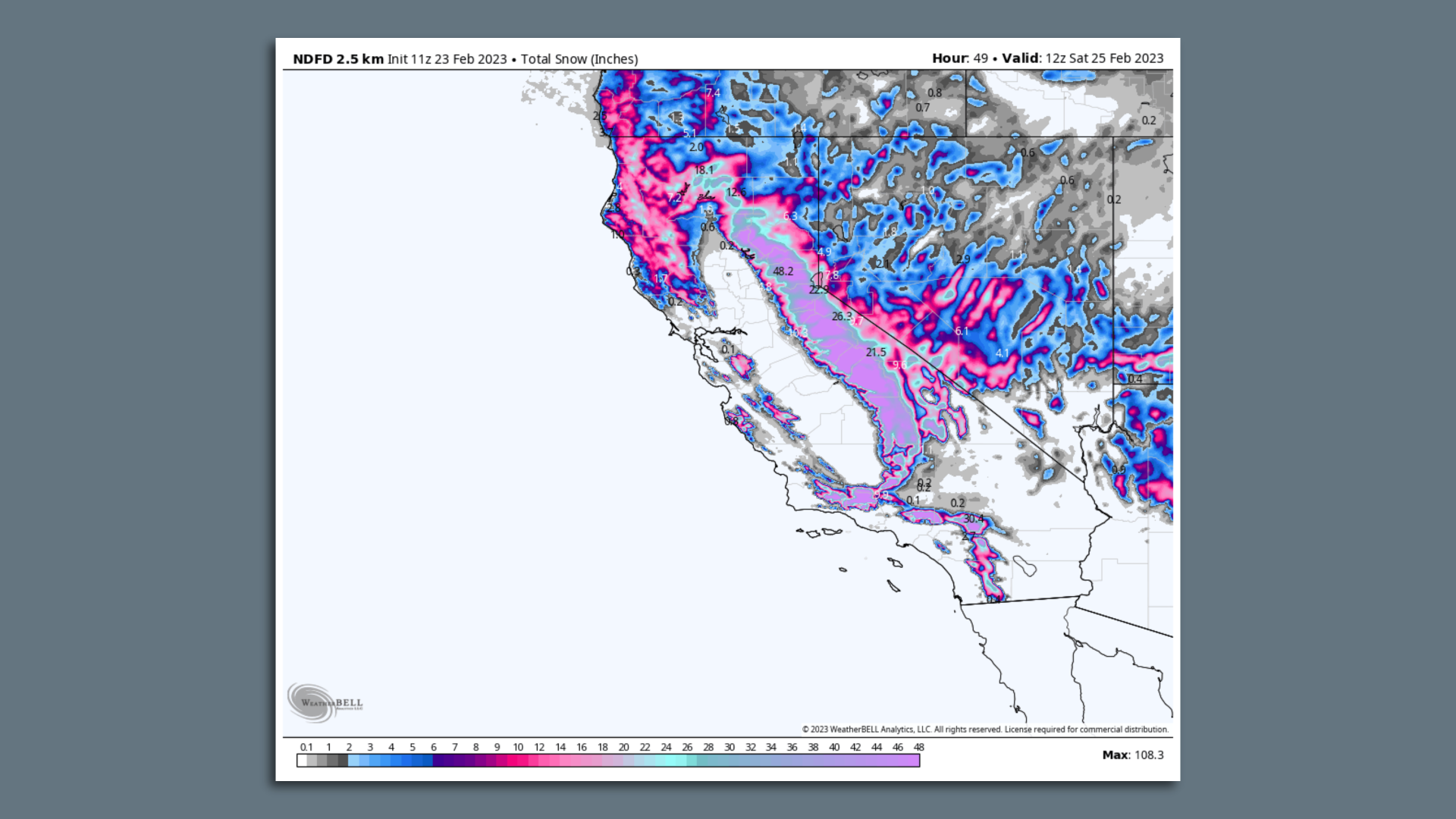
A sprawling, high-impact winter storm continues to affect the Lower 48 states, with the worst effects felt in the Upper Midwest, Northeast and West Coast Thursday.
The big picture: As rare blizzard warnings were issued for the Southern California mountains, combined outages due to ice, high winds and heavy snow across the U.S. left more than 800,000 customers without power as of early Friday.
- These included over 725,000 customers in Michigan — where ice began taking down trees and powerlines over Wednesday night. Van Buren County officials have confirmed the death of a firefighter who came into contact with a downed powerline.
- In the Northeast, the expected tail end of this storm was crossing overnight, bringing with it one more round of snow and some freezing rain on Friday.
- Heavy snow ended Thursday in the Twin Cities, with amounts so far coming in at 13 inches officially, but reaching 16 inches in some spots since Tuesday.
Winter storm warnings
Threat level: Winter storm alerts, including winter storm and blizzard warnings, stretched from Oregon south to California's border with Mexico.
- Arctic air has invaded the region, bringing snow to unusually low elevations, including coastal areas of Northern California.
- Portland, Oregon, was heavily affected by snow, with hundreds of cars abandoned around the city due to treacherous roadways.
- The National Weather Service (NWS) reported 10.8 inches of snow fell in Portland on Wednesday — the 2nd largest calendar day snowfall in city history. More snow fell into Thursday morning there before tapering off.
Rare California blizzard warnings
Zoom in: The storm that caused the Portland snow was pinwheeling south, parallel to the West Coast, and taking direct aim at California.
- The culprit behind the storm is a deep dip in the jet stream, also known as a trough, which has been carved out across the state, steering storms that way.
- Traveling along that trough is a pocket of cold air at the upper levels of the atmosphere, along with a potent package of energy in the form of atmospheric spin.
- These elements will combine to yield heavy precipitation in California, as winds howl from sea toward shore, transporting copious amounts of moisture.

Between the lines: The storm, which will reach its maximum intensity in Southern California on Friday through Saturday, will encounter an unusually cold airmass, even for late February.
- The NWS issued winter storm warnings for the hills of San Francisco Bay.
- With snow levels down to about 1,000 feet, it's likely that snow will pile up in the North Bay mountains, Santa Cruz Mountains and other higher elevations in the Bay Area.
- Southern California was expecting severe impacts from this event, with up to 6 inches of rainfall at lower elevations — which could cause flooding and mudslides.
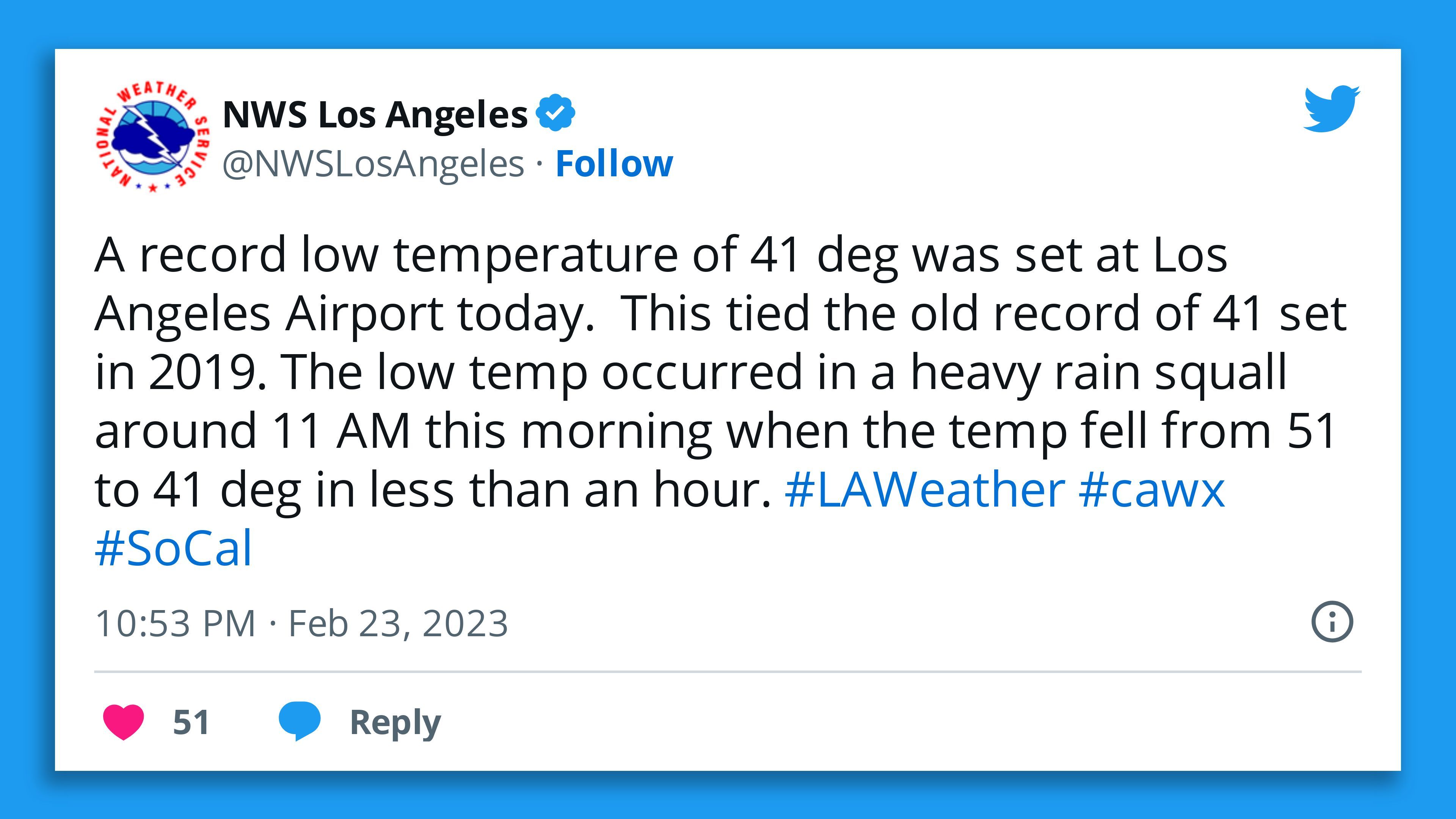
- "Scattered showers and thunderstorms are affecting portions of LA County, with potential for strong gusty and erratic winds, hail and/or graupel and heavy downpours," NWS Los Angeles tweeted.
- At higher elevations, though, blizzard warnings were in effect for the hills and mountains of L.A. and Ventura counties, as well as northward into Yosemite and Sequoia National Park.
Of note: This is the first blizzard warning issued by the NWS' L.A. forecast office since 1989.
- The NWS office in San Diego also issued a blizzard warning for the San Bernardino County Mountains for early Friday through Saturday.
- It is the first time that office has ever issued such an alert, per the agency.
- "Travel will be VERY DIFFICULT TO IMPOSSIBLE," due to the mix of strong winds and heavy snow, the NWS tweeted.

Avalanche dangers, power outages and tree and structural damage could occur due to the heavy snow and strong winds.
- The NWS warned of up to 7 feet of snow at the highest elevations, but even areas down to 1,500 feet could see several inches of snow.
- "Significant blowing and drifting of snow combined with the whiteout conditions will make driving very difficult to impossible, including for rescue crews," the NWS L.A. office wrote in a forecast discussion.
Record heat in the Mid-Atlantic, Southeast
At the same time that heavy snow and ice was falling across much of the country, southerly winds were drawing record warm air up the East Coast as well as into the Ohio Valley and Southeast.
- Temperatures reached 81°F Thursday afternoon in Washington, D.C., and dozens of daily and even monthly records are likely to fall across several states.
- The warmth is likely to solidify this winter's standing as one of the top 5 warmest such seasons on record for several cities, from Miami north to New York City.
- Many spots are vying for their warmest February on record.
Editor's note: This story has been updated with additional developments.


