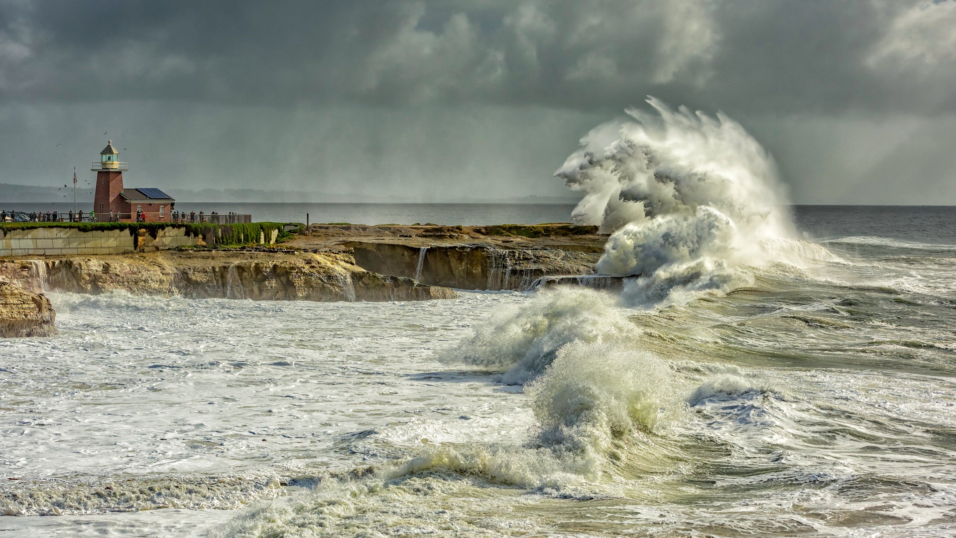
A strong El Niño could cause more floods across cities along the western coasts of the Americas this year, swamping roads and inundating buildings, a NASA analysis warns.
This year's El Niño — a warming of surface temperatures from the Central to East Pacific Ocean — could unleash up to five "10-year flood events" this winter in cities such as Seattle and San Diego.
Ten-year floods (those that have a 1-in-10 chance of occurring in any given year) lead to moderate flooding, according to the National Oceanic and Atmospheric Administration, causing exposed roads and buildings to be partially inundated and prompting limited evacuations. There is a 55% chance of El Niño being at least “strong” and a 35% chance of it being "historically strong" this November-to-January season, the U.S. Climate Prediction Center (CPC) said.
Related: Florida waters now 'bona fide bathtub conditions' as heat dome engulfs state
And by the 2030s, climate change and rising sea levels could cause similar floods along the West Coast each year without El Niño, the researchers said.
"I'm a little surprised that the analysis found these 10-year events could become commonplace so quickly," Phil Thompson, an oceanographer at the University of Hawaii at Mānoa and a scientist on NASA's sea-level-change science team, said in a statement.
The El Niño Southern Oscillation occurs every two to seven years and is a natural shift in sea surface temperatures that causes equatorial trade winds, which tend to blow water east to west, to weaken or reverse, causing warm water to flow eastward. This causes global temperatures to increase by about 0.36 degrees Fahrenheit (0.2 degrees Celsius), according to the World Meteorological Organization.
The effects of an El Niño event, which typically last' nine months to two years, are global. The current El Niño, which began in June 2023 and is expected to last until at least April 2024, has already paired with climate change to make 2023 the hottest year on record, causing record droughts across East Africa, Indonesia, Australia and the Americas.
And the biggest effects are likely still to come, given that the strongest effects tend to happen between January and March.
To investigate how the oscillation is affecting this year's sea levels, NASA used the Surface Water and Ocean Topography (SWOT) and Sentinel-6 Michael Freilich satellites to gauge the height of the ocean before and after this year's El Niño.
The coming flooding is a harbinger of the effects of rising sea levels.
"As climate change accelerates, some cities will see flooding five to 10 times more often," said Nadya Vinogradova Shiffer, a SWOT program scientist and the director of the ocean physics program at NASA.
By monitoring sea surface temperatures, programs like SWOT can help planners prepare ocean defenses and evacuation plans, the researchers said.