Where is it? The Sulaiman Mountains, in Pakistan [31.42234772, 69.99196811]
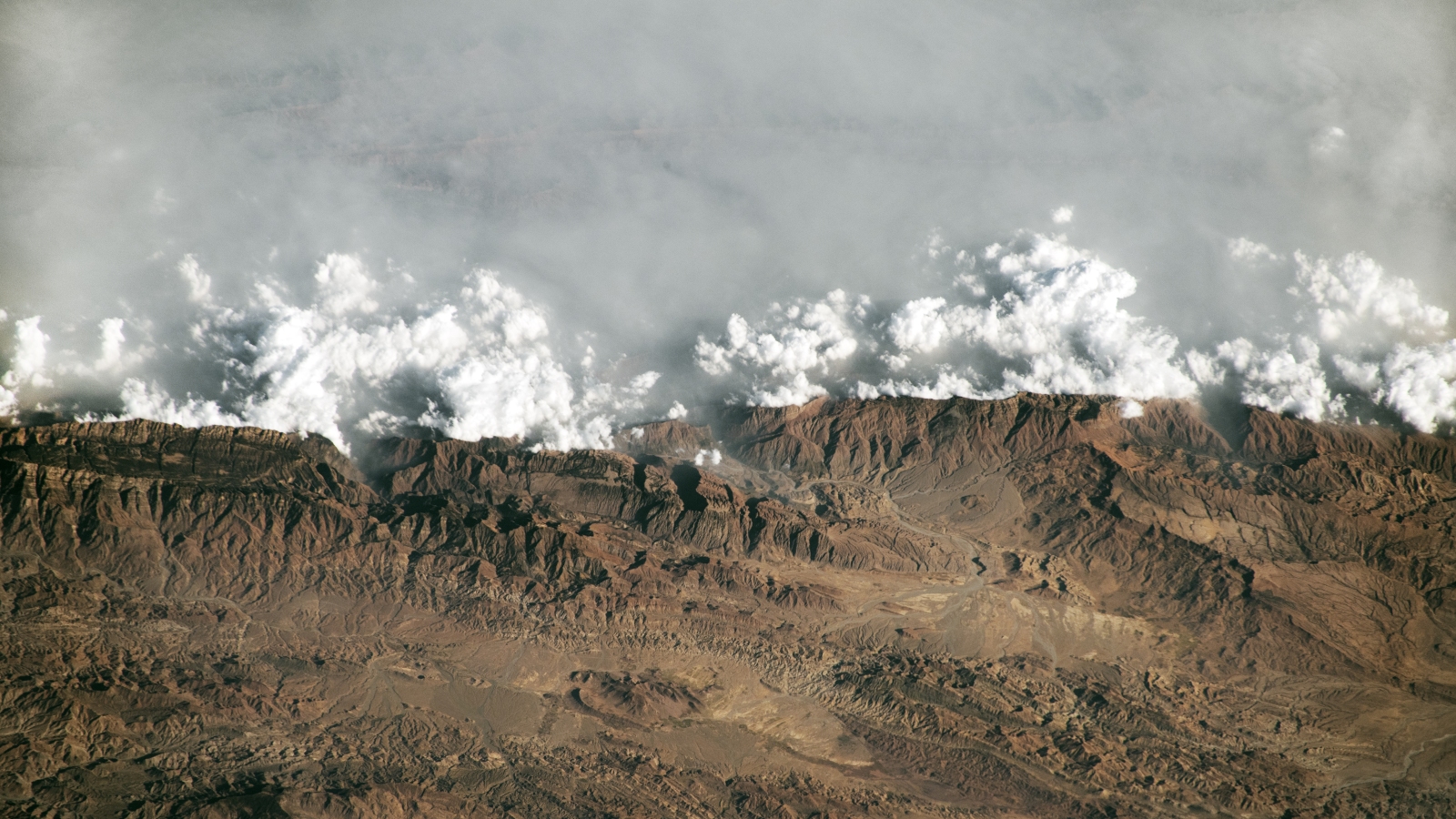
What's in the photo? A wall of haze trapped behind a massive, mountainous ridge
Who took the photo? An unnamed astronaut on board the International Space Station
When was it taken? Dec. 17, 2023
This astronaut photo, captured in 2023, shows a wall of haze trapped by a mountain range in Pakistan. The low angle of the photo provides a unique perspective of the clouds pressed up against the peaks.
Pictured in the image is a section of the Sulaiman Mountains, which cover around 2,500 square miles (6,500 square kilometers) of Afghanistan and Pakistan. The name "Sulaiman" means "of Solomon" in Balochi — a reference to the biblical figure King Solomon, who ruled ancient Israel around 3,000 years ago.
The mountains form a natural barrier around 9,800 feet (3,000 meters) above sea level. Elevated plateaus sit to their west, and the Indus River Valley lies to their east, where moisture from the Indian Ocean frequently accumulates, creating a mix of haze, mist and clouds. The various forms of water vapor are too low to pass above the mountains and are instead forced around the peaks via a process known as terrain-forced flow, according to NASA's Earth Observatory.
However, some small clouds can still force their way in between the peaks in a few places. One of these spots, located in the center of the image, is right above a small Pakistani town named Dhana Sar, where a gorge cuts through the mountains.
Related: 12 amazing images of Earth from space
The Sulaiman Mountains are an extension of the southern Hindu Kush mountain system, which formed around 60 million years ago by a "slow-motion collision of the Indian and Eurasian tectonic plates," according to NASA's Earth Observatory.
The mountains' best-known peak is Takht-e-Sulaiman, also known as the "Throne of Solomon," where its namesake supposedly climbed up to gaze over Hindustan — the ancient term used to describe the northern parts of the Indian subcontinent, according to the writings of 14th-century explorer Ibn Battuta. This mountain, which is 11,440 feet (3,487 m) tall, is located just out of shot (to the left of the image), around 20 miles (32 km) north of Dhana Sar.
Despite being captured from space, the photo looks like it has been taken from the air because it is "oblique," meaning it has been taken side-on from an angle of around 45 degrees. This effect can be achieved only from the International Space Station because astronauts can take photos out of the station's side windows. Most satellites, by contrast, are restricted to the traditional straight-down, or "nadir," perspective.