Potentially record-breaking heat is projected over the coming days across the Southwest and Great Basin regions.
An early-season heat dome is anticipated to bring triple-digit temperatures, with more hot weather conditions expected into next week.
“Phoenix experienced its first 100-degree reading of the year on Thursday,” said AccuWeather senior meteorologist Heather Zehr in a statement. “Friday and Saturday may also top 100.”
The forecasting company notes that the average date for the first 100-degree day in Arizona’s capital city is May 2. The earliest date was March 26 in 1988. Last spring, the city jump-started a record-breaking 113 consecutive days of 100-degree temperatures, ending on September 16.
“All three climate sites reached the century mark for the first time this year,” the city’s National Weather Service office wrote on Thursday. “Yuma and El Centro both set new record highs, and Phoenix tied its record high. Temperatures are forecasted to be a couple of degrees warmer tomorrow, so make sure to keep practicing smart heat safety.”
In neighboring Texas, the highs on Friday would still be in the 90s — although a few degrees colder than Thursday.
“Dry and warm weather continues into next week,” said San Antonio and Austin forecasters.
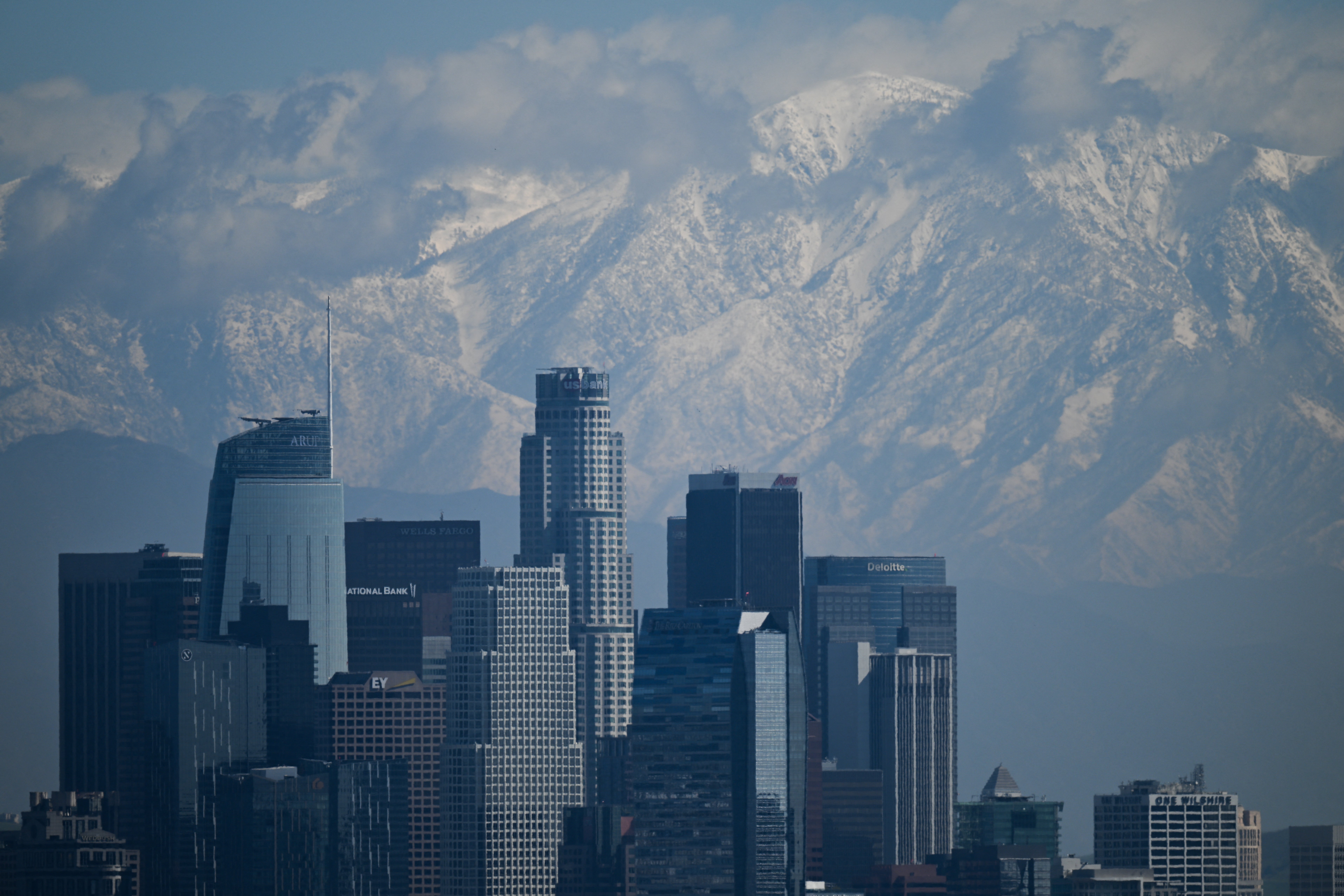
Further west, southern California’s Los Angeles area saw temperatures 20 degrees above normal on Thursday.
Another warm day was expected there with highs in the 80s before a cooling trend over the weekend.
Across the interior Southwest, higher temperatures are leading to wildfire danger and possible flooding risks.
Snowmelt in mountainous areas will raise river water levels in Oregon and Idaho.
In nearby Colorado, warmer weather and wind gusts up to 45 miles per hour are creating critical fire danger around Boulder.
“Critical fire danger will develop on Saturday across South Park, Foothills, Palmer Divide, and portions of the plains. Wind gusts from 35 to 45mph will be possible with humidity levels from 8 to 13 percent,” forecasters there said.
AccuWeather urged residents to be extremely cautious, as any fire sparked by human activity could be intensified by gusty winds.
Unfortunately, it could be weeks before rainfall and the North American monsoon is widespread over the Southwest.
Drought conditions are forecast to continue to worsen before that. More than 30 percent of the West is in moderate drought, and approximately 14 percent is in severe drought, according to the U.S. Drought Monitor.
Western drought is driven by human-caused climate change, which is also turning up the heat earlier in the year. Over the years, that’s resulted in dangerous conditions for places without air conditioning, and more heat-related deaths. It’s also led to more intense and frequent wildfires.
More heat is coming for the West next week after a brief lull, according to Ian Livingston, a forecaster for the Capital Weather Gang.
“There’s a risk of another round of record warmth, originating on the West Coast then drifting eastward, by the middle to latter portion of next week. On the opposite side of the country, chillier-than-typical conditions should continue in the Northeast,” he said.
Tariffs live: White House insists countries need US markets to survive
Global warming isn't funny. But more comedians are using humor to bring awareness to it
Moment US ballerina Ksenia Karelina embraces fiancé as she returns from Russian jail
‘Extreme’ wildfire warnings continue amid warm weather in UK
Three people killed and one injured in Florida plane crash
Pig kidney removed from Alabama woman a record 130 days after transplant