The killer app for hurricane prediction? It could be lightweight drones that explore some of the fiercest parts of a hurricane and send back real-time data — or new satellite tech that gives forecasters a better look at storms from above.
Why it matters: Seesawing forecasts and delayed evacuations for Hurricane Ian may have contributed to deaths in Florida — and have spurred soul-searching about how to do better.
- Better forecasts will be increasingly vital as climate change makes for more intense and wetter hurricanes, which undergo rapid intensification — like Ian did shortly before its devastating landfall.
Where it stands: Today's monitoring systems are good at predicting a storm's track but struggle to anticipate intensity changes.
- To improve predictions — particularly about intensity — scientists need more information about hurricanes' relatively small core.
- Right now, those are mainly sampled by human-flown Hurricane Hunter aircraft.
What's happening: In recent firsts, uncrewed airborne and seaborne drones have transmitted live data and video from inside these violent storms, including areas off limits to Hurricane Hunters.
- The drones complement advanced satellites (including a planned private-sector network) and a new hurricane forecasting model the National Oceanic and Atmospheric Administration (NOAA) aims to adopt next year.
Driving the news: After enduring an especially rough ride into Hurricane Ian, NOAA scientists deployed a 27-pound drone called Altius into the storm's eye and eyewall, where it spent two hours "acquiring critical measurements to understand these complex storm systems," the agency says.
- The 8-foot drone was released from "Kermit," one of NOAA's three Hurricane Hunter aircraft.
- It was able to communicate from an impressive range of 100 miles — keeping Kermit's human pilots out of harm's way.
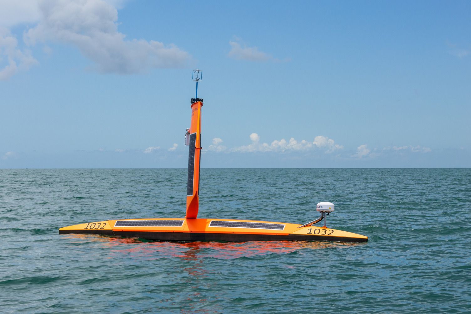
- Last year, NOAA first used "Saildrones" — surface vessels that troll the ocean to assess storm intensity.
A Saildrone that plunged into Hurricane Sam last year marked "the first time we ever had video coming back in real time from the eye of the hurricane," said Matt Womble, director of ocean data at Saildrone, a NOAA contractor based in Alameda, California.
- The second time was last month, when a 23-foot Saildrone braved 50-foot waves and 100-mph winds in Hurricane Fiona, a Category 4 storm.
- The goal of these encounters is to gather data at the air-sea interface, in order to learn more about how a storm is drawing heat and moisture from the ocean.
- "The heat and momentum fluxes are the way the ocean and the atmosphere talk to each other," said Johna Rudzin, an assistant professor of meteorology and physical oceanography at Mississippi State University.

NOAA has been testing drones for years, but the latest generation is more sophisticated, providing real-time views of a hurricane's shifting track and intensity.
- They're meant to be used in concert with NOAA's Hurricane Hunter research aircraft.
- "They're so new," Frank Marks, director of NOAA's Hurricane Research Division, said of the drones. "We haven't really taken advantage of them beyond seeing things we've never seen before."
- Going forward, the "kind of technology combination we're looking for is the manned aircraft flying the safer part of the storm a little higher" while drones dive into the eye.
- Rudzin said the drone platforms are still being evaluated to determine their data's reliability.
The big picture: For storm intensity forecasts in particular, NOAA has been developing a new system known as HAFS — the Hurricane Analysis and Forecast System — and hopes to implement it next spring.
- HAFS will "provide an operational analysis and forecast out to seven days" and allow scientists "to see multiple storms at once to understand how they interact," NOAA says.
- Marks says he was "blown away" with how HAFS performed during real-time experiments on Hurricanes Ian and Fiona: "It predicted the eyewall replacement cycles; it predicted the rapid intensification," he said.
Meanwhile: Boston-based weather and climate intelligence firm Tomorrow.io is building a constellation of 12 satellite-mounted radars meant to scan developing tropical storms and hurricanes hour by hour.
- Currently, NASA operates one space-based radar satellite, known as the Global Precipitation Measurement mission, designed to look inside tropical cyclones — but it only passes over a hurricane about every three days, said Rei Goffer, co-founder and chief strategy officer at Tomorrow.io.
- These scans are like storm X-rays. Natasha McGrady of Tomorrow.io, who like Goffer is a former fighter pilot, says the new satellites are designed to peer into a storm's inner structure. The resulting data can greatly improve computer model simulations, she said.
The bottom line: Not only can these new technologies pump out data that improves forecasting models, the drones can also beam video that conveys the ferocity of the storm to the general public — potentially persuading people to evacuate.


