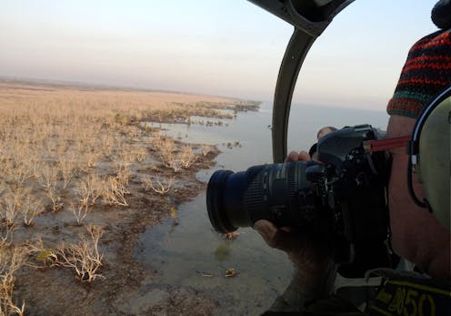
Environmental scientists see flora, fauna and phenomena the rest of us rarely do. In this series, we’ve invited them to share their unique photos from the field.
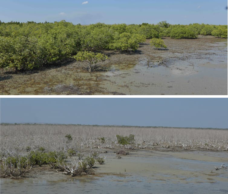
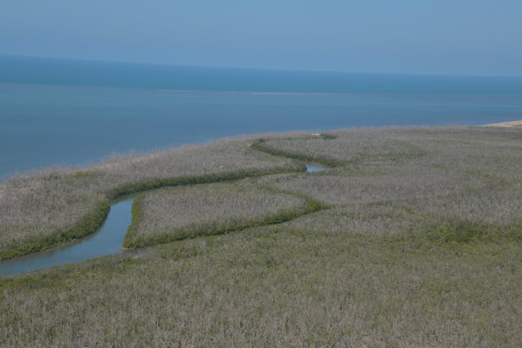
In the summer of 2015-2016, some 40 million mangroves shrivelled up and died across the wild Gulf of Carpentaria in northern Australia, after extremely dry weather from a severe El Niño event saw coastal water plunge 40 centimetres.
The low water level lasted about six months, and the mangroves died of thirst. Seven years later, they have yet to recover. My new research, published today, is the first to realise the full scale of this catastrophe, and understand why it occurred.
This event, I discovered, is the world’s worst incidence of climate-related mangrove tree deaths in recorded history. Over 76 square kilometres of mangroves were killed, releasing nearly one million tonnes of carbon into the atmosphere.
But this event, while unprecedented in scale, is not unique. My research also discovered evidence of another mass die-back of mangroves in the region in 1982 – the same year the Great Barrier Reef suffered its first mass bleaching event.
The mangroves took 15 years to recover. This time, we won’t be so lucky.
Mangroves are immensely important
In Samoa, El Niño-driven sea level drops are called “Taimasa” because of the putrid smell of decaying marine life from long-exposed corals, when sea levels remained low for months on end.
In northern Australia, Taimasa conditions in 2015 left mangroves at higher elevations exposed for at least six months. Without regular flushing and wetting of tides, shoreline mangroves don’t stand a chance.
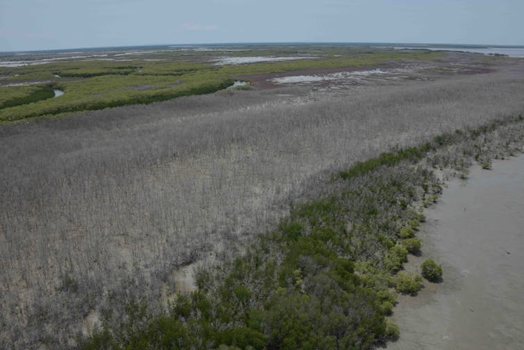
Mangroves are enormously valuable coastal ecosystems. Healthy mangrove ecosystems not only buffer shorelines against rising sea levels, but they also provide valuable protection against erosion, abundant carbon sinks, shelter for animals, nursery habitat, and food for marine life.
These benefits have cultural and economic value, with widespread significance to local communities.
The mass die-back event of 2015 was widely reported in national and international news, with shocking images emerging from the remote region.
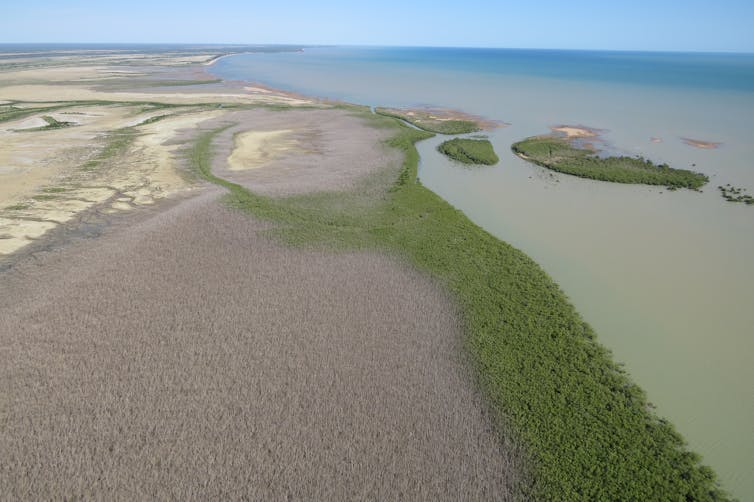
Although the cause was unknown at the time, the implications of such catastrophic damage were immense for local and regional communities, natural coastal ecosystems and the fisheries that depend on them.
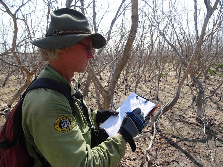
Access was difficult and expensive, and environmental records for the region were scarce. But after four years of research , we uncovered evidence this event was indeed a dramatic consequence of climate change.
Why the mangroves probably won’t recover this time
Our research reveals the presence of a previously unrecognised “collapse-recovery cycle” of mangroves along Gulf shorelines. The mangroves, damaged in 1982, are now attempting to recover again after the mass-death event in 2015.
But, at least three factors have changed since 1982, leaving recovery less likely.
For one, sea levels have risen dramatically due to climate change, causing erosion. This places escalating pressure on tide-fed wetlands to retreat towards higher land.
Younger trees are essential for future mangrove habitat. But upland, environmental conditions for newly established seedlings can be deadly. Landward pressures of bushfires, feral pigs and weed infestations are made far worse by the catastrophic sudden drops in sea level associated with severe El Niño events.
Two, localised storms, such as tropical cyclones, have become increasingly severe. At least two particularly severe cyclones struck the Gulf of Carpentaria coast: Owen in 2018, and Trevor in 2019. A severe flood event also hit the region in 2019.
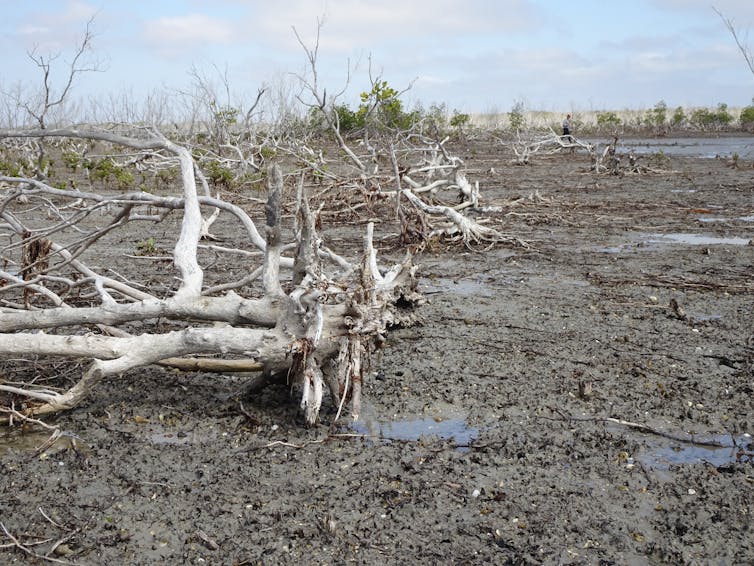
The cyclone impacts were notable and extreme. Piles of dead mangrove timber were swept up and driven across tidal areas, bulldozing any newly established trees, as well as sprouting survivors.
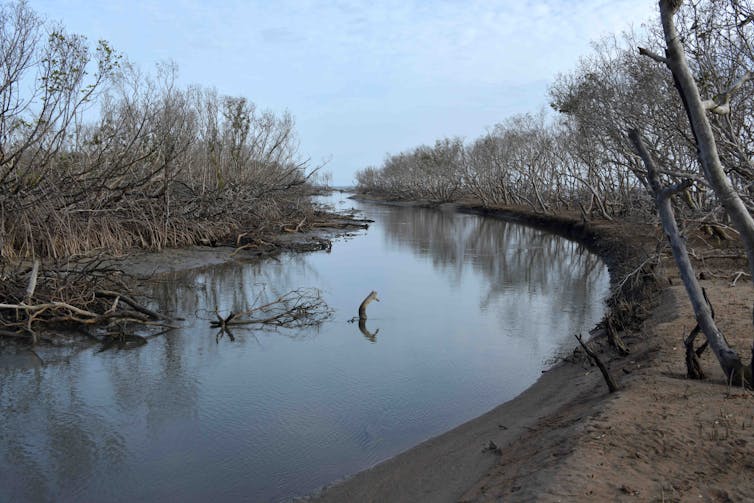
And three, the threat of future Taimasa low sea level events appear imminent, as evidence points to a link between climate change and severe El Niño and La Niña events. Indeed, El Niños and La Niñas have become more deadly over the last 50 years, and the long-term damage they inflict are expected to escalate.
Under these circumstances, the potential for the mangroves to recover are understandably low.
Protecting these vital ecosystems
These new findings make us more aware of the vulnerability of shoreline ecosystems, and the benefits we’re losing.
A $30 million fishing industry relies on these mangroves, including for redleg banana prawns, mudcrabs and fin fish. When the El Niño of 2015-2016 struck, redleg banana prawn fishers reported their lowest-ever catches.
Read more: An El Niño hit this banana prawn fishery hard. Here’s what we can learn from their experience
Mangroves also help stabilise shorelines by buffering otherwise exposed areas from erosion. Such shoreline protection is crucial as sea levels continue to rise rapidly, coupled with increasingly severe storm waves and winds.
Healthy living mangroves are among the world’s most carbon-rich forests, binding and holding considerable carbon reserves both in their woody structure and below ground in peaty sediments.
Losing mangroves in the Gulf released more than 850,000 tonnes of carbon into the atmosphere, across both mass dieback events. That’s similar to 1,000 jumbo jets flying return from Sydney to Paris.
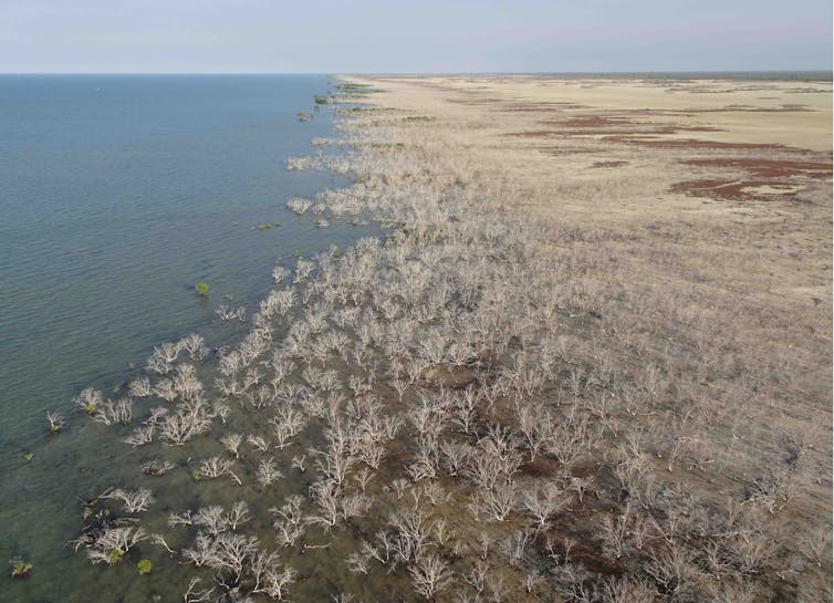
It’s critical these buried carbon reserves remain intact, but this will occur only if living vegetation on the surface remains healthy and protected.
Mangroves are also like the kidneys of the coast. Losing them will amplify pollutants in runoff, with excess nutrients, sediments and agricultural chemicals travelling unmitigated into the sea.
They need greater monitoring
Tropical mangroves – as well as saltmarsh-saltpans, the other part of tidal wetlands – need much greater protection, and more effective maintenance with regular health checks from dedicated national shoreline monitoring.
Our aerial surveys of more than 10,000 kilometres of north Australian coastlines have made a start. We’ve recorded environmental conditions and drivers of shoreline change for north-western Australia, eastern Cape York Peninsula, Torres Strait islands and, of course, the Gulf of Carpentaria.
As the climate continues to change, it’s vital to keep a close eye on our changing shoreline wetlands and to ensure we’re better prepared next time another El Niño disaster strikes.
Norman Duke received funding from the Australian Government’s National Environmental Science Program (NESP) and administered and managed by their Tropical Water Quality Hub and the Northern Australia Environmental Resources Hub. Supplemental funding was also received indirectly from CSIRO Oceans & Atmosphere, the Northern Territory Government’s Department of Environment, Parks and Water Security, and World Animal Protection.
This article was originally published on The Conversation. Read the original article.


