'Black Marble' satellite images of Earth unveiled - in pictures
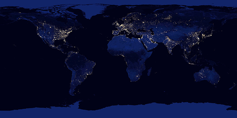
This image of the Earth at night is a composite assembled from data acquired by the Suomi National Polar-orbiting Partnership satellite over nine days in April 2012 and thirteen days in October 2012. It took 312 orbits and 2.5 terabytes of data to get a clear shot of every parcel of Earth's land surface and islandsPhotograph: NASA Earth Observatory/ReutersBritain, Ireland and part of western Europe on the night of 27 March 2012Photograph: NASA Earth Observatory/ReutersA composite image of Europe, Africa, and the Middle East at nightPhotograph: NASA Earth Observatory/Reuters
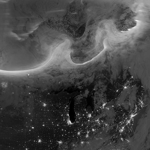
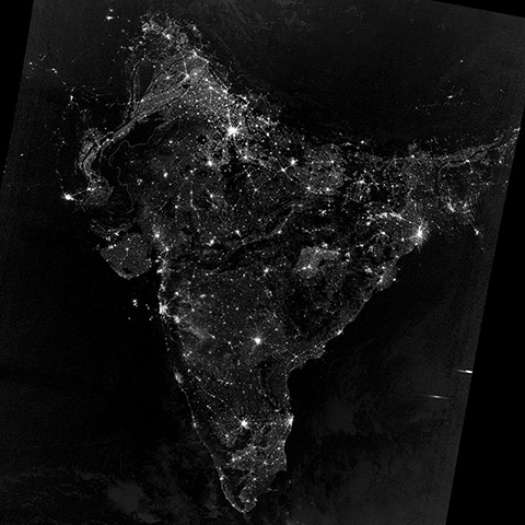
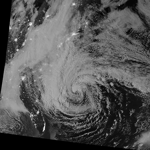
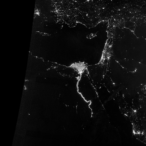
A composite image of Asia and Australia at nightPhotograph: NASA Earth Observatory/ReutersThe United States at night. The image was made possible by the satellite's 'day-night band' of the Visible Infrared Imaging Radiometer Suite (VIIRS), which detects light in a range of wavelengths from green to near-infrared and uses filtering techniques to observe dim signals such as city lights, gas flares, auroras, wildfires and reflected moonlightPhotograph: NASA Earth Observatory/ReutersNight time view of Auroras over Canada, 8 October 2012 Photograph: NASA Earth Observatory/ReutersSouth Asia during Diwali celebrations on the night of 12 November 2012Photograph: NASA Earth Observatory/ReutersHurricane Sandy off the eastern coast of the United States on 28 October 2012 Photograph: NASA Earth Observatory/ReutersNight time view of a blackout in New York and New Jersey following Hurricane Sandy, 1 November 2012 Photograph: NASA Earth Observatory/ReutersThe area near the Nile river valley and delta on the night of 13 October 2012Photograph: NASA Earth Observatory/Reuters
Sign up to read this article
Read news from 100’s of titles, curated specifically for you.