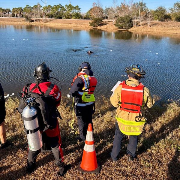
As global warming intensifies droughts, floods and wildfires around the world, scientists in western United States are turning to beavers to help reverse some of the damage.
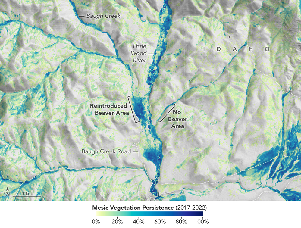
Scientists at Utah's Boise State University and Utah State University are using satellite data to identify streams where once-eradicated beavers can be re-introduced to boost vegetation. They're also recording how water abundance and vegetation bordering those streams changes once beavers return — metrics of environmental health.
"The real value of using satellite data for monitoring is that there are people on the ground working hard and implementing things like increasing water availability, increasing fish and species habitat," Jodi Brandt, an associate professor at Boise State University who leads a team using satellite data to quantify the impact of beavers on local ecosystems, said in a previous NASA statement. "The more support we can give them, the more broadly these practices can proliferate."
Related: Researchers study how rocket noise affects endangered wildlife
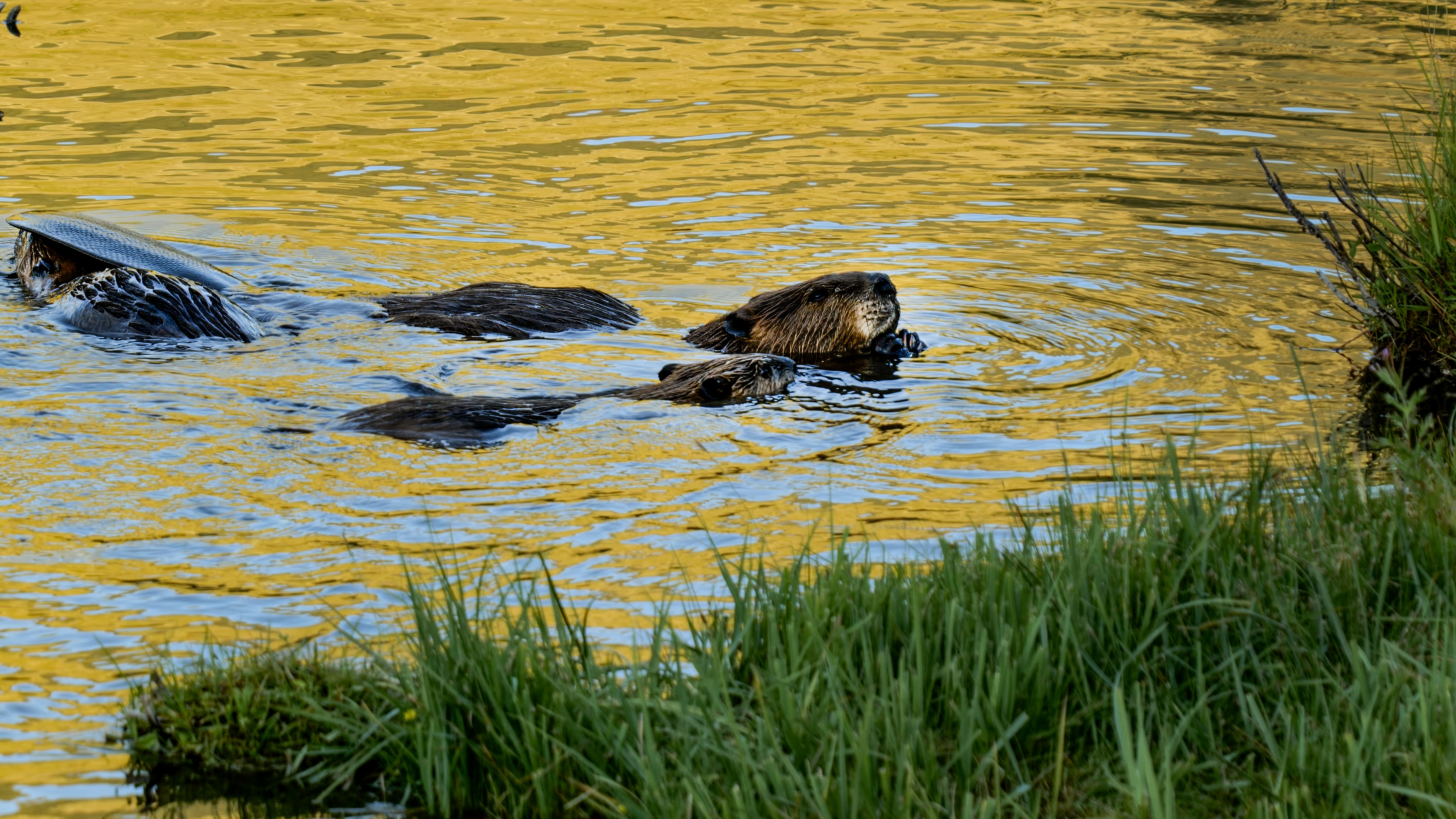
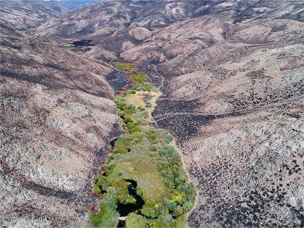
Beavers are "furry weapons of climate resilience," according to one New York Times article. They are innately wired to build dams on rivers and streams, a measure of protection from predators like bears, cougars and wolves. These dams, composed of materials sourced from trees, branches, twigs, stones and grasses cut by beavers' teeth, slow the flow of water that would otherwise gush through the region, according to the National Park Service. The pools subsequently created by the dams then offer a safe haven for the beaver to build their oven-shaped dens while also boosting green vegetation — in turn, this reduces the risk of forest fires and mitigating the effects of droughts and floods that have become increasingly frequent and severe in recent years due to human-induced global warming.
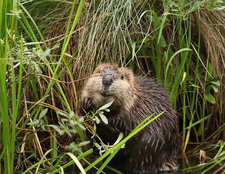
Until the late 1800s, beavers had been common in lakes, streams and marshes throughout North America. However, unregulated trapping driven by a new demand for beaver fur reduced the animal's population from as many as 400 million beavers in the 1600s to just 10 million to 15 million today, according to the California Department of Fish and Wildlife.
In response to the decline, California, Idaho and Utah are among a handful of U.S. states that have recently launched major beaver restoration programs. Sure enough, data from a NASA satellite shows denser patches of green vegetation where beavers have been reintroduced when compared to areas where their population is limited. For instance, a stream near Preston, Idaho, is now flowing 40 days longer into the year thanks to over 200 beaver dams that appeared after ranchers began beaver rewilding, according to a previous NASA statement.
"Prior to beaver trapping, beaver dams were just about everywhere in the west. So what we're attempting to do is to bring beaver dam densities back to historic levels where possible," he said. "In doing so, we're building important drought resiliency and restoring stream areas."
The online Beaver Restoration Assessment Tool, or BRAT, uses data from NASA's Landsat and European Sentinel satellites to spot restoration sites that would benefit the most from beaver-led reintroduction. The tool takes into account available trees that beavers could use for building dams, thereby increasing water flow, vegetation and supporting in-place human infrastructure. Once the researchers choose a site, they attract beavers by constructing temporary beaver-dam-like structures that make the area more hospitable for beaver families.
Using satellite data allows researchers to not only kickstart these decades-long restoration efforts but also monitor the results over time, for which there are often insufficient funds available, Brandt said in a recent NASA statement. She noted satellite data can also provide empirical evidence of the restoration efforts which can be used to boost funding and support from federal agencies, conservation groups, land trusts and other businesses.
"That's what applied science is all about – getting the users whatever is needed for environmental decision making," Cindy Schmidt, an associate program manager for NASA Ecological Conservation effort, said in the statement. "The future of our planet relies on these commercial partners working with us to do things more sustainably."