Hurricane Ida jumped from a 105-mph Category 2 hurricane on Saturday to a high-end Category 4 monster by Sunday morning, in a feat enabled by climate change, seasonal timing and a dose of bad luck.
Why it matters: Understanding how Mother Nature's most powerful storms are changing is key to learning how to better protect coastal communities around the world — everywhere from the mega-cities of Southeast Asia to the small towns of the Louisiana Bayou.
Driving the news: The explosive intensification of Hurricane Ida shortly before landfall was a nightmare situation. Social media was inundated with expressions of anxiety and dread, as it was too late for anyone in harm's way to flee from what they may have thought was going to be a weaker storm.
- That the storm rapidly intensified was not a surprise to hurricane forecasters, who had been predicting this since the storm moved off the coast of Cuba on Friday.
- But even the most bullish forecast did not call for the rate or peak of intensification that ended up occurring.
By the numbers: One key measure of storm intensity is the minimum central air pressure. In this case, the pressure dropped by a whopping 41 millibars in just 14 hours, between 5pm ET Saturday and 7am ET Sunday — and 52 millibars in 24 hours, starting from 8am ET Saturday.
- During the 24-hour period, winds shot upwards by 65 mph, exceeding the National Hurricane Center's definition of rapid intensification, which is when a storm's maximum sustained winds increase by 35 mph in 24 hours.
- In keeping with another suspicious trend, Ida also intensified all the way to the coast in the northern Gulf of Mexico, something that was virtually unheard of before 2018, yet has seemingly become routine.
The intrigue ... Hurricane Ida's explosive intensification was due to three main factors, with climate change mainly affecting the first two — and most decisive — of these three:
- An ample supply of bathtub-like warm water, with the warmth extending deep into the water column. This was heightened by the storm's timing: Gulf temperatures tend to be at their hottest at this time of year. This year, though, the waters have been even hotter than average.
- Abundant moisture in the atmosphere, since dry air can get entrained into storms and disrupt their intensification process.
- A lack of wind shear or any other atmospheric factor that could stifle the storm's towering thunderstorms from organizing and forming a concentric ring around the eye.
How it works: Hurricanes are heat engines, feasting off warm, tropical waters.
- The vast majority of extra heat going into the climate system from burning fossil fuels is being absorbed by the oceans, and the seas are warming as a result.
- So, too, are air temperatures. Physics, specifically the Clausius-Clapeyron relationship, tells us that for every 1°C (1.8°F) of temperature increase, there is about a 7% increase in the water holding capacity of the atmosphere.
- A recent scientific assessment found that the planet's oceans have warmed faster during the past 100 years than at any point in the past 11,000 years.
- These two trends are causing hurricanes and tropical storms to dump more water, on average, than they used to, and for there to be a greater proportion of high-end Category 3, 4 and 5 hurricanes in some ocean basins.
Context: Sufficient studies have been published on these trends in peer-reviewed journals that the recent UN Intergovernmental Panel on Climate Change report included some changes to the role of climate change in tropical cyclones as an area of increased scientific confidence.
- For example, a 2019 study in the journal Nature found there had been a trend in the Atlantic Ocean toward more rapidly intensifying storms between 1982 and 2009, and computer modeling showed that such a trend would not have been likely without human-induced climate change.
- A 2020 study published in the Proceedings of the National Academy of Sciences found that tropical cyclones are more likely to reach higher categories across much of the globe, including the Atlantic.
- And an especially ominous 2017 study published in the Bulletin of the American Meteorological Society found that a storm that intensifies by 70 mph in the 24 hours before landfall, which occurs about once every century today, could occur as frequently as every five to 10 years by the end of this century.
The bottom line: In the end, the fact that this storm hit Port Fourchon, Louisiana, also comes with a dose of bad luck and bitter irony.
- Bad luck, since the direct hit makes the state the first to ever see back-to-back years with hurricanes that made landfall with sustained winds of 150 mph or greater, according to meteorologist Steve Bowen, head of catastrophe insight at Aon.
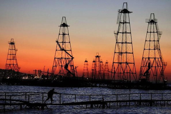
- And irony, because the landfall location, Port Fourchon, is home to critical facilities for operating deepwater oil and gas drilling rigs in the Gulf of Mexico. More than 1.5 million barrels of crude oil per day are transported via pipelines and through the port. Yet it's the burning of fossil fuels that helped make this storm so strong, and so badly damaged the port.
Go deeper ... In photos: Hurricane Ida pummels Louisiana