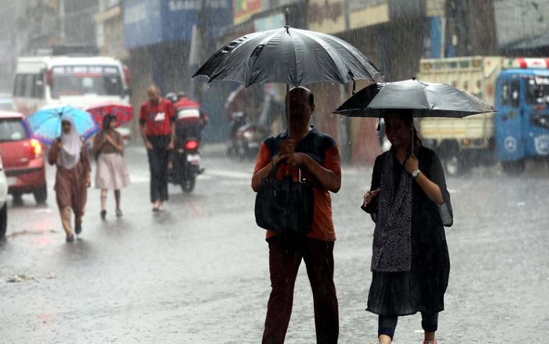
Srinagar: Rainy weather continued on Sunday in the Kashmir Valley as some of the higher reaches received light snowfall amid a fresh forecast by the Meteorological Department Srinagar of widespread moderate precipitation during the next 48 hours till Tuesday.
Srinagar and other parts of the valley received widespread moderate rainfall inundating several low lying areas besides bringing down the temperatures and disrupting normal life.
The MeT data showed Srinagar received 30 mm of rainfall, Qazigund 23mm, Pahalgam 18.6mm, Kupwara 30.8mm, Kokernag 16.4mm and Gulmarg 20.6mm during the past 24 hours.
Some upper reaches including Kongdori in Gulmarg, Sinthan pass, Mughal Road and Razdan pass received light snowfall during the period.
The MeT office forecast generally cloudy weather on Sunday with light to moderate rain, snow (light snow over higher reaches) at most places with thunder, lightning. Hailstorm and gusty winds at few places with possibility of heavy rain over isolated places of Jammu & Kashmir division particularly during the next two days was forecast.
There is a possibility of light rain with thunder at many places on April 30. The weather will generally remain dry from May 1 to 5, it said.
Kashmir weather, an independent forecaster said that “due to the impact of back-to-back active Western Disturbances as cyclonic circulations, Jammu and Kashmir is going to receive moderate to heavy rainfall during the next 48 hrs”.
“The main intensity of this weather system will be from April 29 and will continue till late night of April 30,” it said.
Farmers have been advised to suspend farm operations till April 30. There is also possibility of disruption of traffic over higher reaches of Zojila, Sinthan Pass, Mughal Road and Razdan pass.
The inclement weather may cause water logging in low lying areas besides there is a possibility of landslides and shooting stones on upper reaches. Due to rainfall there is also possibility of temporary increases in water level in river Jehlum and tributaries and other local streams and nallas.
The maximum temperatures dropped by 5-13 degrees in Kashmir valley on the previous day. Srinagar had a maximum of 11.5 degree Celsius and it was 11.3 degrees below normal on Saturday forcing people and tourists to wear warm clothes.
The MeT office said the minimum temperature recorded during the intervening night of Saturday and Sunday in Srinagar at 8.5 degree Celsius and it was 0.8 degree below normal for the summer capital of Jammu and Kashmir during this period of the season.
Pahalgam had a low of 6.4 degrees Celsius and Gulmarg 1.5 degrees Celsius recorded on Sunday, the MeT office said.